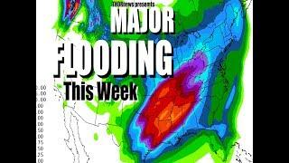
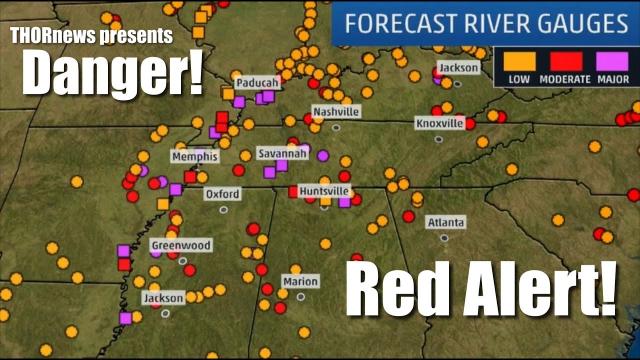
Danger! More Tornadoes, Rain & MAJOR RECORD MIDWEST RIVER FLOODING! & 2 Cal dams 98%
Description
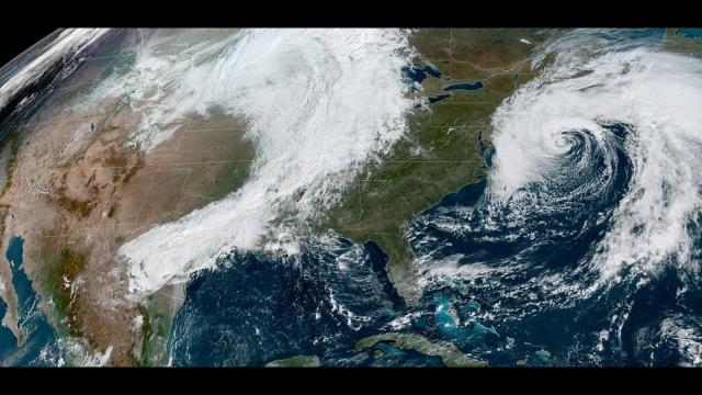
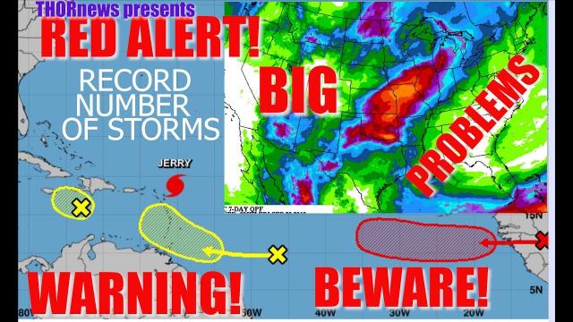
We've got record cool in the west, record heat in the southeast and a surefire chance of nasty weather in between. It's getting extremely ugly out there. AND Hurricane Season is almost here.
God Bless everyone,
T
you can mail me cool stuff at
T Lewison
5430 Birdwood Rd. #416
Houston, Texas 77096
the crankywxguy blog
http://www.stormhamster.com/entry2/e052919.htm
video on storms
https://weather.com/storms/severe/news/2019-05-23-severe-thunderstorms-tornadoes-flash-flooding-plains-midwest
Severe Thunderstorms and Flash Flooding to Threaten From Southern Plains to the Mid-Atlantic Wednesday
Thunderstorms capable of producing damaging winds, large hail, tornadoes and flash flooding will once again flourish from the southern Plains to portions of the Midwest and mid-Atlantic on Wednesday. The overall weather pattern will then become less favorable for widespread severe weather as the week comes to a close.
- A severe thunderstorm watch is valid until 5 p.m. CDT for portions of northwestern Arkansas, far southeastern Kansas, southern Missouri, eastern Oklahoma and a small part of northern Texas. This watch area includes Fort Smith, Arkansas and Springfield, Missouri.
- A severe thunderstorm watch is in effect until 1 p.m. CDT for parts of north-central Texas. The watch area includes Denton and Stephenville.
Severe thunderstorms packing a few tornadoes, large hail and damaging winds are possible from central and northern Texas to the mid-Mississippi Valley. More flash flooding is likely across this same general corridor.
Scattered severe storms are also possible in broad swath from the Ohio Valley into the mid-Atlantic region. Damaging winds and large hail are the primary concerns, but an isolated tornado threat cannot be rule out.
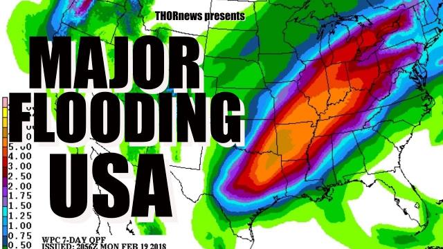
The potential for heavy rain through Wednesday night has prompted the National Weather Service to issue numerous flood watches from north Texas to southern and eastern Oklahoma, western Arkansas and southern Missouri. Another 2 to 5 inches of rain is possible across this region through Wednesday night, potentially triggering more flash flooding.
Flash flood watches have also been issued in parts of the East, from east-central Ohio into much of Pennsylvania, New Jersey and northern Delaware.
Heavy rainfall over the past few weeks is threatening all-time May records and swelling rivers to record levels in parts of Arkansas and Oklahoma. For more on that story, click here.
Thursday-Friday
A shift in the large-scale jet stream pattern should significantly decrease the amount of severe weather in the central and eastern states Thursday into Friday.
There could be a few severe storms on Thursday in the Ohio Valley, mid-Atlantic and southwest Texas.
Severe thunderstorms are unlikely across much of the central and eastern states on Friday, but a few can't be ruled out in the southern mid-Atlantic.
Tuesday, May 28
Early Tuesday evening, tornado emergencies were issued for the southern side of Lawrence, Kansas, and the western side of Kansas City. A confirmed large tornado, estimated to be 1 to 1.5 miles wide by storm spotters, was seen on the ground. Doppler radar detected debris being lifted some 20,000 feet into the air.
Images posted to social media showed houses damaged or destroyed just south of Lawrence. Dozens of houses were also damaged or destroyed near Linwood, Kansas, by this destructive tornado.
The National Weather Service office in Kansas City said debris from that tornado was falling from the sky along Interstate 70 north-northeast of Edwardsville, Kansas. The Kansas City International Airport airfield had to be closed until around midnight because it was covered in storm debris.