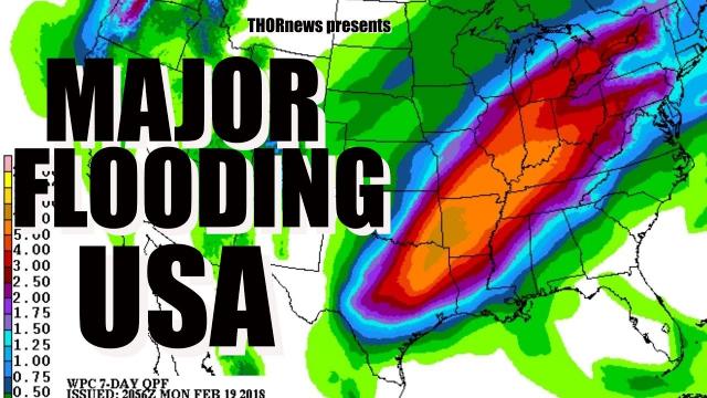
MAJOR FLOODING & River Flooding for Texas & USA this Week
Description
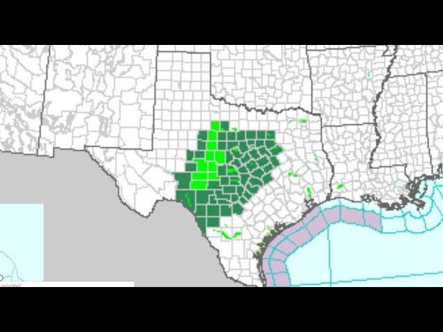
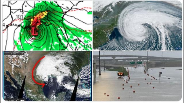
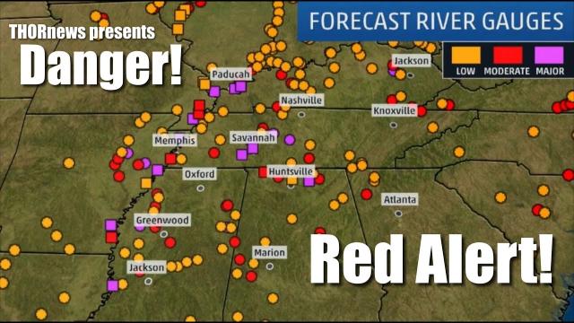
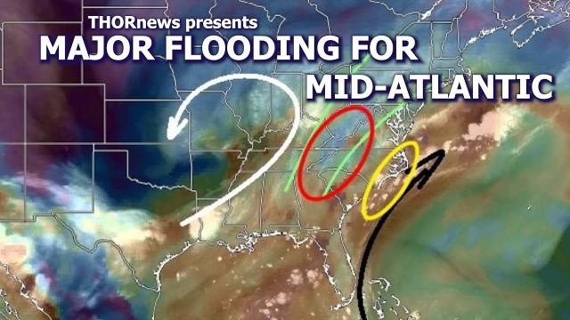
We've got a long duration storm that is slowly going to drop scary amounts of rain over flooded rivers for a week or more. Be Aware & Prepared.
God bless everyone,
T
https://www.paypal.me/THORnews
https://www.patreon.com/thornews
@newTHOR on twitter
https://www.facebook.com/THORnewsthornews
THORNEWS PO BOX 35946
HOUSTON TEXAS
articles on situation
https://www.accuweather.com/en/weather-news/easter-weekend-outlook-storms-may-hinder-travel-outdoor-plans-in-central-and-eastern-us/70004502
Easter weekend outlook: Storms may hinder travel, outdoor plans in central and eastern US
Those in the central and eastern United States may face disruptions to travel plans and outdoor activities for part of Easter weekend.
Meanwhile, people in the northern Plains and Upper Midwest will be left shivering amid unseasonably cold and possibly snowy conditions.
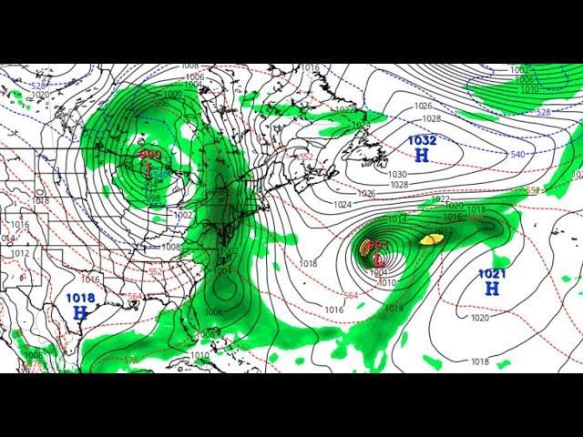
Storm may unleash disruptive rain, snow in northeastern US
A storm that will first bring severe weather and flooding to the South Central states will take aim at the Eastern Seaboard during a portion of the holiday weekend.
“It will be unsettled in the Great Lakes and Northeast, but none of the three days spanning Friday to Easter Sunday will be a complete washout,” said AccuWeather Senior Meteorologist Mike Doll.
While the exact timing of the storm is not set in stone, those planning road trips and flights into and out of the Northeast may need to allot extra time to reach their holiday destinations due to clouds and wet weather. This includes the major hubs from Washington, D.C, to Boston.
Interior areas could even face snowy and slick travel, depending on how much cold air meets up with the back edge of the storm.
Winterlike chill could set stage for snow across northern Plains, Upper Midwest
Across the northern tier of the country, people heading to Easter egg hunts, sunrise church services or hoping to break out spring attire will not be able to do so without layering up.
“The northern Plains and Upper Midwest will remain entrenched in a winterlike air mass [over Easter weekend],” said AccuWeather Long-Range Meteorologist Max Vido.
A large portion of this corridor may be chilled by temperatures more typical of February, about 10-20 degrees Fahrenheit below normal, on Easter Sunday.
Average high temperatures during the end of March and beginning of April range from the low 40s in Grand Forks, North Dakota, to near 50 in Minneapolis and Madison, Wisconsin.
Bismarck, North Dakota; Rapid City, South Dakota; Minneapolis; and Madison are some of the cities where residents may not be able to head outdoors this weekend without hats, gloves and thick jackets.
Depending on the exact speed of the cold push, extra layers may also be needed as far south as Omaha, Nebraska; and Chicago.
At least one storm is poised to clash with the cold air over the northern tier this weekend, setting the stage for snow to whiten part of the region and possibly trigger slick travel conditions.
"There will be a snow risk from the northern Rockies to the Upper Midwest," Doll said.
West Coast to remain largely free of weather-related disruptions
One or two weak storms are forecast to track from the Pacific Northwest to the northern Rockies late this week and into the weekend.
Seattle will be one of the few places where an umbrella may be needed and Easter egg hunts may be dampened on Saturday and/or Sunday.
The northern storm track will promote great weather for travel and outdoor gatherings from San Francisco to Los Angeles, Las Vegas and Phoenix.
“Temperatures will largely be above normal for this time of year from the Southwest to Texas,” Doll said.
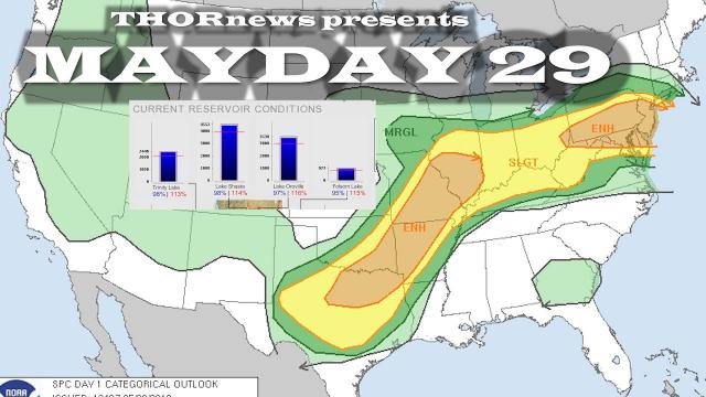
Oklahoma City, Norman and Lawton, Oklahoma, and Wichita Falls, Fort Worth, Abilene and San Angelo, Texas, may be rocked by the violent weather.
A secondary area of heavy, gusty thunderstorms that may produce small hail are likely in parts of Missouri and Illinois into Monday night.
The risk of severe thunderstorms will shift farther to the east and south on Tuesday.O
This day the potential for damaging storms will extend from the Rio Grande River in Texas to the Red River Valley in southwestern Arkansas.
It will be vital for residents who are commuting home, busy with after work and school activities or heading to sleep to have a way of receiving severe weather alerts.


Comments