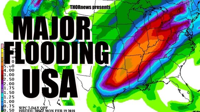
200 Million people in Danger - Stationary Nor'Easter & River Flooding & Atmospheric River
Description
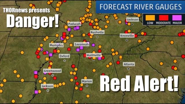
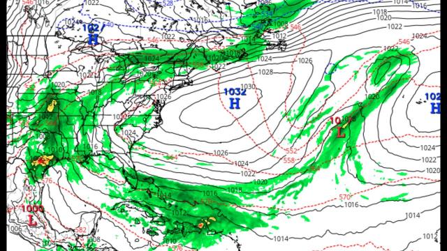
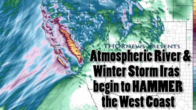
Our major freak frankenstein storm has fired up and is already dropping heavy rain over the areas where 223 Rivers are at flood stage & 171 rivers are near flood stage. The storm will then undergo bombogenesis and rapidly intensify of the coast while churning up 85 mph wind gusts and 15-35 foot waves all along the East Coast from Florida to Nova Scotia in Canada. And the NEXT storm is already hitting the West Pacific Coast and will bring heavy rain and snow to Washington Oregon and California.
Stay aware, be prepared and have a plan.
God bless everyone,
T
https://www.paypal.me/THORnews
https://www.patreon.com/thornews
@newTHOR on twitter
https://www.facebook.com/THORnewsthornews
THORNEWS PO BOX 35946
HOUSTON TEXAS
77235-5946
article on storm
https://weather.com/forecast/regional/news/2018-02-27-noreaster-strong-winds-coastal-flooding-early-march
Nor'easter to Bring Strong Winds, Coastal Flooding, Beach Erosion
March in the Northeast will begin with an intense nor'easter that is expected to develop late this week. High winds, coastal flooding and beach erosion, along with some rain and snow, will all be concerns along the Northeast coast.
Wind-driven rain is expected from southern New England into the mid-Atlantic Thursday night into at least Friday.
Damaging wind gusts over 60 mph are possible from coastal New England to eastern Long Island on Friday, which could lead to power outages.
Gusty winds may persist into Saturday along the Northeast and mid-Atlantic coasts.
Accumulating snowfall will likely remain in the interior Northeast Friday into early Saturday, with moderate to heavy snow possible in the higher elevations from Maine to West Virginia.
Mainly rain is currently anticipated near the I-95 corridor, with rainfall totals of 1 to 2 inches expected.
https://www.accuweather.com/en/weather-news/storm-to-renew-severe-weather-flooding-risk-in-central-us-by-midweek/70004265
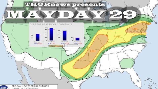
a new storm will spring up and begin producing downpours and locally gusty thunderstorms from central Texas to central Arkansas and southern Tennessee as early as Tuesday night.
On Wednesday the threat of severe weather is likely to ramp up significantly from northeastern Texas to much of Arkansas, northern Louisiana, northern Mississippi, western and middle Tennessee and northern Alabama.
Little Rock, Arkansas; Shreveport, Louisiana; Huntsville, Alabama; Tupelo, Mississippi; Dallas; and Memphis and Nashville, Tennessee, are among the cities that may be in the path of the storms or may have severe weather in their metro areas.
there is the potential for 3-6 inches of rain to fall from the northeastern corner of Texas to eastern Tennessee and southeastern Kentucky. Much of that rain may fall in 36 hours.
Farther north, a separate area of heavy rain is possible from eastern Iowa and northeastern Missouri to southern Michigan, central and northern Ohio to western Pennsylvania.
The storm is likely to prove disruptive to motorists across the state as well as airline passengers in San Francisco, Los Angeles and other major hubs.


Comments