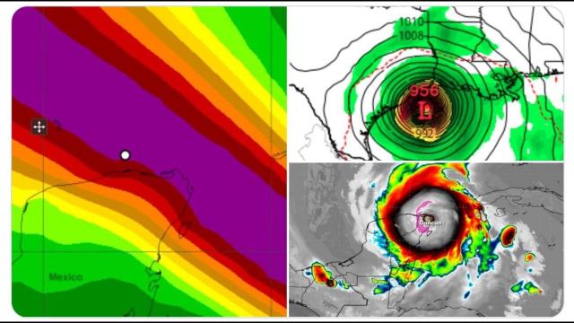
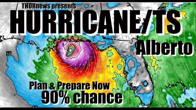
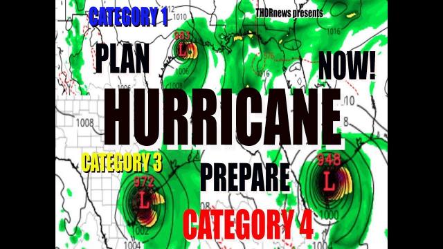
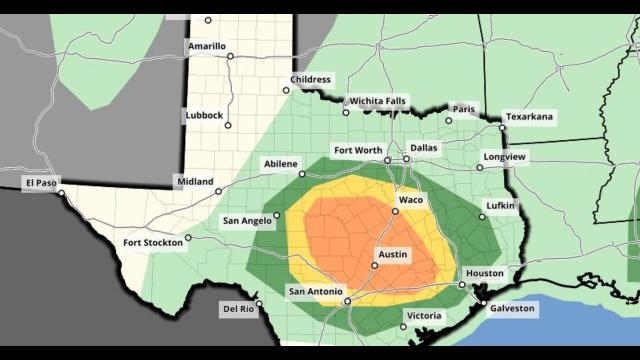
RED ALERT! Texas & Gulf States prepare for a Category 2 Hurricane landfall around the 7th* of June
Description
This storm is going to be a monster size, that drops a monster amount of rain and i am worried that it could eject from CAG sooner than estimated.
God bless everyone,
T LEWISON
5430 BIRDWOOD RD. #416
HOUSTON TEXAS 77096
https://www.paypal.me/THORnews
https://venmo.com/TEric-Lewison
$THORnews on CashApp
https://www.patreon.com/thornews
video
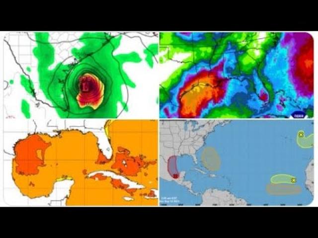
https://weather.com/storms/hurricane/news/2020-06-01-tropical-depression-three-tropical-storm-cristobal-gulf-of-mexico
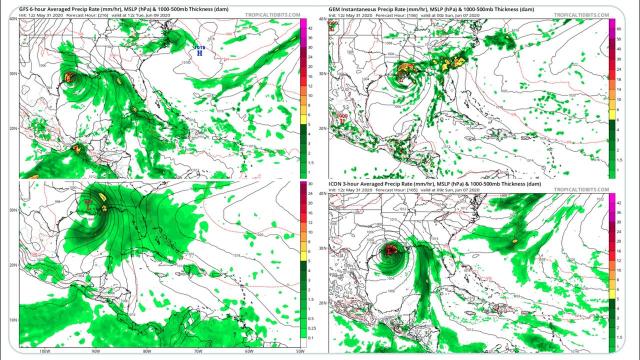
Tropical Depression Three Forms in the Southwestern Gulf of Mexico; Tropical Storm Warning Issued in Mexico
Tropical Depression Three formed in the southwestern Gulf of Mexico Monday afternoon.
A tropical storm warning has been posted along the Mexican coast.
This system is likely to linger in the vicinity of the southwestern Gulf of Mexico for several days this week.
Beyond that, it's uncertain where this system might track.
The U.S. Gulf Coast and Mexico should follow this system's progress closely.
This was spawned by a large system called a Central American Gyre and the remnants of a former Eastern Pacific tropical storm.
The gyre and tropical storm remnants have already produced major flooding in parts of Central America.
Tropical Depression Three formed Monday afternoon in the southwestern Gulf of Mexico on the first official day of the 2020 Atlantic hurricane season.
This new tropical depression is located about 95 miles west-southwest of Campeche, Mexico, and is moving westward at 5 to 10 mph. Its maximum sustained winds are currently 30 mph.
The National Hurricane Center is predicting the depression will strengthen into a tropical storm on Tuesday. Once it does so, it will earn the name Cristobal.
A tropical storm warning has been posted along the Mexican coast from Campeche westward to Puerto de Veracruz. This means tropical-storm-force winds (39-plus mph) are expected somewhere within the warning area within 36 hours.
The latest forecast from the National Hurricane Center shows that this system is likely to linger in the vicinity of the southwestern Gulf of Mexico for several days this week, perhaps even into the start of the weekend.
After that time, there is the possibility it could eventually move northward through the Gulf of Mexico toward the Gulf Coast of the United States later this weekend, as suggested in the latest National Hurricane Center five-day forecast.
It's also possible this system could remain stuck in the southwestern Gulf of Mexico and move inland over southern Mexico.
ADVERTISING
Since there remains a high degree of uncertainty in the forecast, interests along the Gulf coasts of the U.S. and Mexico should monitor the tropical depression's progress closely this week. Check back to weather.com for updates over the next several days. If anything, this is a reminder to refresh or develop your hurricane plan now.
Incidentally, we could be flirting with the record-earliest third named Atlantic storm, which is currently held by Tropical Storm Colin on June 5, 2016.
Serious Flood Threat in Mexico, Central America
One thing we know for certain is that there is a serious threat of flooding rainfall and mudslides in Central America and southern Mexico this week.
The National Hurricane Center said rounds of additional heavy rainfall could impact southern Mexico, Guatemala, El Salvador, Belize and western Honduras over the next few days.
(MORE: Central America, Mexico Tropical Cyclones Have a Deadly History)
In addition to Tropical Depression Three, this rainfall is also being fueled by what's called a Central American Gyre, or CAG. This "gyre" is a large, broad area of low pressure that often forms in late spring and early fall over Central America and the western Caribbean Sea.
This CAG will park itself over far southeastern Mexico and Central America through the week.
Flooding from former Eastern Pacific Tropical Storm Amanda and its remnants caused damage and killed several people in El Salvador over the weekend.
Amanda's leftover energy and spin played a role in triggering the development of Tropical Depression Three in the southwestern Gulf of Mexico Monday afternoon.
Most of these are either tropical depressions or tropical storms because they often don't have as much time to intensify before striking land, and they may be affected by wind shear early in the hurricane season.
Only a dozen of those June developing storms became hurricanes.
The last June hurricane in the Gulf of Mexico was Alex, which made landfall in northeastern Mexico on June 30, 2010, and brought flooding rain to Monterey, Mexico, and the lower Rio Grande Valley of Texas.
Warm water is another factor that boosts tropical development.
While not as warm as midsummer and somewhat lacking deep heat content, Gulf of Mexico water temperatures are currently warmer than average for this time of year and warm enough to support tropical development. NOAA reported Gulf water temperatures shattered April records dating to 1910.