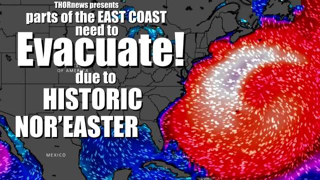
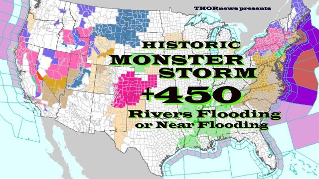
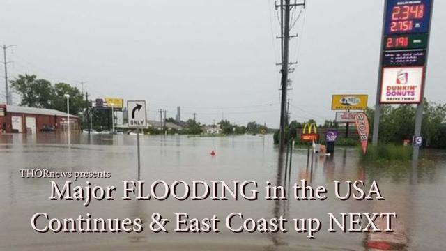
Major Deadly Flooding Nor'Easter for East Coast & Blizzards for Europe
Description
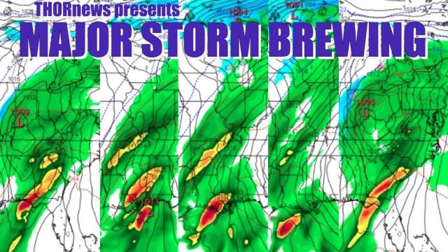
We get a 48 hour break from the River Flooding and then the storms pick back up again with a Wild & Weird storm hitting the East Coast USA to bring March in like a Lion. Stay Aware & Be Prepared.
God Bless everyone,
T
https://www.paypal.me/THORnews
https://www.patreon.com/thornews
@newTHOR on twitter
https://www.facebook.com/THORnewsthornews
THORNEWS PO BOX 35946
HOUSTON TEXAS
77235-5946
article on storm
https://weather.com/storms/winter/news/2018-02-25-wintry-system-snow-west-midwest-northeast-polar-vortex-split
Next Wintry System To Spread Snow from West to Midwest and Could Become a Northeast Coastal Storm Threat
The next weather system could bring snow to the West, Midwest and Northeast in the week ahead.
Snowfall amounts should remain rather modest in the West and Midwest.
Late in the week, a coastal storm may bring snow, rain, wind and coastal flooding to the Northeast, but much uncertainty remains.
That coastal storm would be an indirect result of a recent polar vortex split.
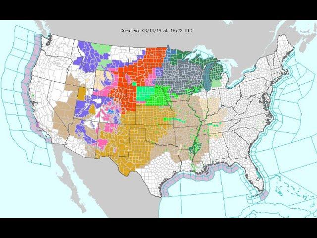
An active winter weather pattern remains in place this week, as the next storm system could spread snow from the West early this week into the Midwest by midweek, followed by a possible Northeast coastal storm late in the week.
Key details of this forecast will likely change in the days ahead, but here is what we know right now about this next cross-country storm system.
Welcome Rockies Snow
A sharp, southward dip in the jet stream is carving itself out over the West early this week, and an area of low pressure is expected to form in the Great Basin by late Monday. That low-pressure system will then track across the Southwest and the southern Rockies into Wednesday.
Winter storm warnings and winter weather advisories have been posted by the National Weather Service from the northern Rockies into the Sierra Nevada and even the mountains of Southern California.
This system will produce mainly mountain snow in the West while rain is likely in the lower elevations. Below is a general look at the timing through Wednesday.
Monday: Snow will spread from the northern Rockies southward into the Great Basin and Sierra.
Monday Night-Tuesday: Snow continues in the Great Basin, extending into parts of the Southern California mountains. Snow levels will be quite low so travel could be affected on Interstate 5 through the Grapevine in Southern California.
Wednesday: Snow showers may linger in the southern Rockies before ending late in the day.
The southward dip in the jet stream will translate eastward into the Plains and Midwest Wednesday and Thursday, steering the area of low pressure across those regions. That low may gain some strength in the Great Lakes region.
Cold air will be limited, but some wintry precipitation is possible on the northern flank of the low-pressure system. The exact track of the system, however, remains uncertain at this time.
Wednesday Night: Snow is possible from eastern Nebraska and western and northern Iowa into southern Minnesota and Wisconsin.
Thursday-Thursday night: Snow or rain changing to snow and increasing winds may spread southward across Wisconsin and adjacent portions of southeastern Minnesota, Iowa and northern Illinois. Snow or rain changing to snow could then push into Lower Michigan, northern Indiana and northern Ohio by Thursday night.
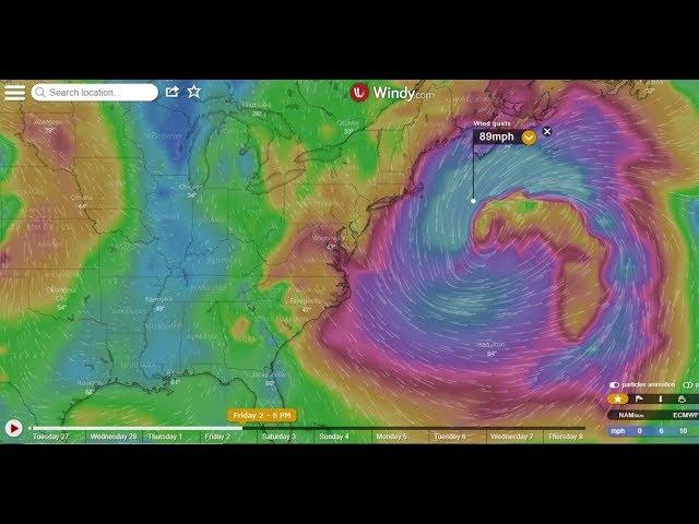
Northeast Coastal Storm Threat Late Week
Thursday night into Friday, a secondary area of low pressure will form near or off the Northeast Seaboard.
Thanks to a recent split of the polar vortex, the weather pattern will be conducive for this low-pressure system to move slowly, potentially resulting in rain, snow, strong winds and coastal flooding in the Northeast. The timeframe for those threats will be Thursday-Friday, potentially lingering into Saturday.
This is because of a westward shift of blocking high pressure near Greenland, which can cause any low-pressure system to move slowly near or just off the East Coast and not move quickly out to sea.