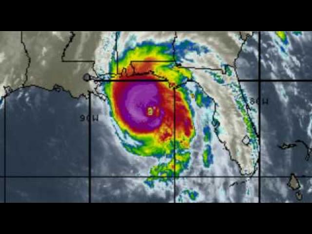
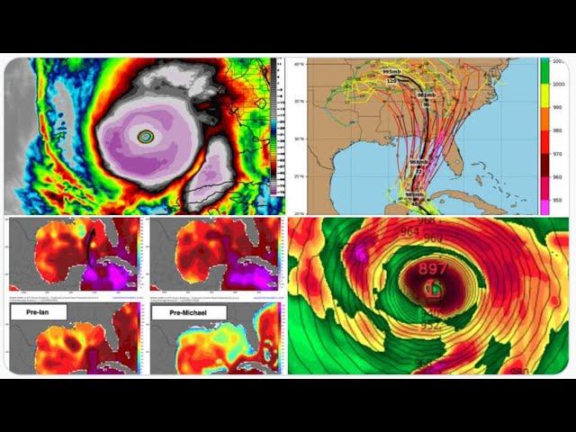
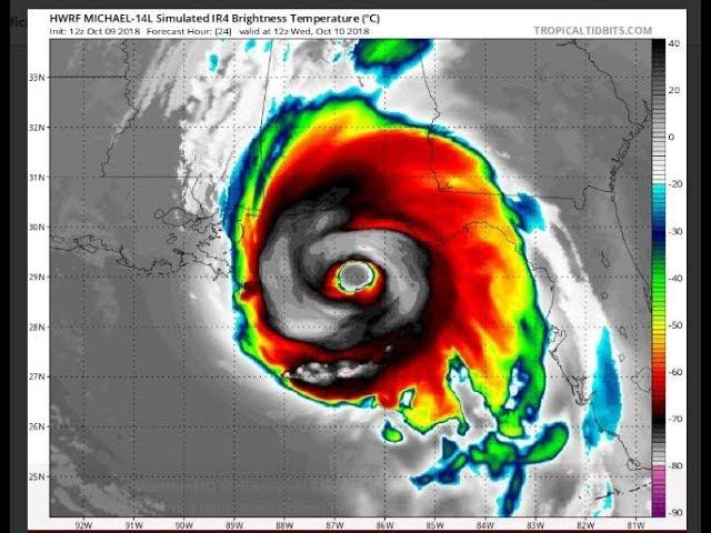
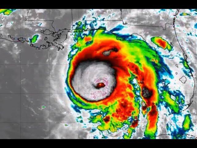
Hurricane Michael - Category 3 & Florida landfall - latest GFS prediction
Description
follow cranky's blog. he called this storm sept 18th.
http://www.stormhamster.com/entry/e100618.htm
god bless everyone,
T
https://www.paypal.me/THORnews
Tshirts
https://hitthebuttonbaby.com/
THORNEWS
PO BOX 35946
HOUSTON TEXAS
77235-5946
@newthor on twitter
https://www.facebook.com/thornewsgo
https://weather.com/storms/hurricane/news/2018-10-06-potential-tropical-cyclone-fourteen-tropical-storm-michael-gulf
The National Hurricane Center has initiated advisories on Potential Tropical Cyclone Fourteen in the northwestern Caribbean.
It is expected to track northward and become Tropical Storm Michael by Sunday night.
Tropical storm warnings have been issued for parts of western Cuba.
A tropical storm watch has been posted for parts of Mexico's Yucatan Peninsula.
Heavy rain and flooding are threats in western Cuba, the Yucatan Peninsula and Central America.
The U.S. Gulf Coast could be threatened by this system next week.
Tropical storm warnings have been posted for the western Cuban provinces of Pinar del Rio and the Isle of Youth. A tropical storm watch has been issued for the northeastern coast of Mexico's Yucatan Peninsula, from Tulum to Cabo Catoche.
Tropical-storm-force winds (39-plus mph) are expected to first reach the tropical storm warning area Sunday night, making outside preparations difficult or dangerous. Tropical-storm-force winds are possible in the tropical storm watch area Sunday night and Monday.
Potential Tropical Cyclone Fourteen is expected to drift northward toward Mexico's Yucatan Peninsula, then into the southern Gulf of Mexico by Monday.
It is expected to organize into a tropical depression by late Saturday night or Sunday and strengthen to a tropical storm Sunday night, receiving the name Michael once it does so.
The National Hurricane Center has scheduled a reconnaissance flight to investigate the system Sunday.
The majority of our forecast guidance suggests the system will then be drawn northward and could eventually pose a threat to parts of the U.S. Gulf Coast by the middle of next week.
For now, interests along the U.S. Gulf Coast should monitor the progress of Potential Tropical Cyclone Fourteen.
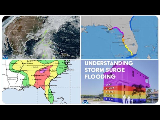
In the meantime, this system will bring torrential rainfall to portions of Central America, Mexico's Yucatan Peninsula and western Cuba over the next few days, a feature common to most all CAGs.
Rainfall totals of 3 to 7 inches are forecast over western Cuba, with 2 to 4 inches over the Yucatan Peninsula, Belize and northern Honduras through Tuesday. Isolated maximum amounts of 12 inches are possible in western Cuba.
These downpours could contribute to life-threatening flash flooding and mudslides.
A ribbon of strong westerly winds aloft is over the western Caribbean Sea, providing wind shear – the change in wind speed and/or direction with height – that is typically hostile to developing and active tropical cyclones. This wind shear over the western Caribbean Sea is notably stronger than one year ago when Nate formed.
However, this ribbon of wind shear appears to be just far enough north, which will allow a tropical depression to develop on the eastern or northeastern side of the CAG.
Wind shear is expected to be lower in the Gulf of Mexico, and sea-surface temperatures are above average in much of the Gulf of Mexico as well. Both of these factors could assist in strengthening.
Recent Notable Gyre-Induced Tropical Storms, Hurricanes
Central American gyres (CAG) most often form in late spring and early fall and can spawn tropical storms as late as November and as early as May in both the Atlantic and eastern Pacific basins. Sometimes a CAG can trigger a tropical cyclone in each basin at the same time.
46 people are talking about this
Twitter Ads info and privacy
Roughly 50 percent of CAGs have a tropical cyclone associated with them, according to Dr. Philippe Papin, atmospheric scientist at the U.S. Naval Research Laboratory.
"When a tropical cyclone does occur, it tends to form on the northeastern side of the [gyre] and rotates counterclockwise around the larger circulation," Papin told weather.com in late-September 2017.
As mentioned above, Hurricane Nate was generated from a CAG one year ago.
Nate was retired from future use as a hurricane name, primarily due to catastrophic flooding in Central America as Nate was forming. Thousands of homes were damaged or destroyed, and both agriculture and transportation infrastructure was significantly damaged.
Another recent example of gyre-induced tropical cyclone formation occurred in 2010, when Tropical Storm Nicole formed just south of Cuba from the gyre in late September.
Nicole was a short-lived and ill-formed tropical storm that tried to cross Cuba. It brought heavy rain to the Cayman Islands, Jamaica, Cuba and portions of South Florida.