Hurricane Michael = 50 foot waves & Strong Category 4 projected at landfall.
Description
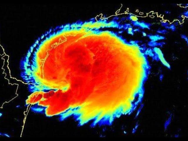
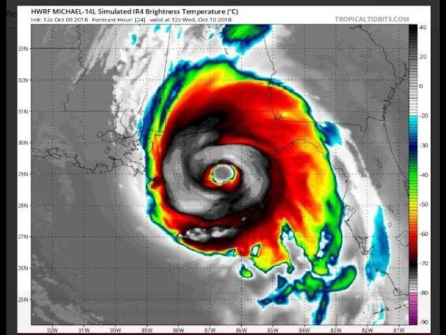
19 more hours to develop, no wind shear, no dry air & Wilma went from TS to Cat 5 in 54 Hours, It is within the realm of possibilities that Michael can go from Car 3 to cat 5 in 19 hours.
God bless everyone, T
https://www.paypal.me/THORnews
Tshirts
https://hitthebuttonbaby.com/
THORNEWS
PO BOX 35946
HOUSTON TEXAS
77235-5946
@newTHOR on twitter
https://www.facebook.com/thornewsgo
the crankywxguy blog
http://www.stormhamster.com/entry/e100818.htm
Bobbistorm's blog
https://hurricaneharbor.blogspot.com/2018/10/hurricane-michael-what-kind-of.html
Mike's Weather Page
http://www.spaghettimodels.com/
Tropical Tidbits for models
https://www.tropicaltidbits.com/analysis/models/
https://weather.com/storms/hurricane/news/2018-10-08-hurricane-michael-forecast-gulf-coast-florida
Hurricane Michael Forecast to Intensify and Bring a Dangerous Threat of Storm Surge, Damaging Winds to Florida's Northeast Gulf Coast
Michael is forecast to intensify as it tracks into the Gulf of Mexico.
Michael will threaten the northeastern Gulf Coast by Wednesday, potentially as a major hurricane.
Storm surge, damaging winds and heavy rain are likely impacts along the northeastern Gulf Coast.
Hurricane watches and storm surge watches have been issued along the northeast Florida Gulf Coast.
Heavy rain and strong winds will spread farther inland across parts of the Southeast after landfall.
Hurricane Michael will continue to intensify and is forecast to strike the northeast Florida coastline as a Category 3 with dangerous storm surge flooding, destructive winds and flooding rainfall. Michael will also bring heavy rain and strong winds to other parts of the Southeast after it moves inland.
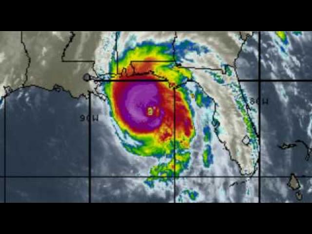
Michael is currently centered about 20 miles southwest of the western tip of Cuba and is moving north.
Outer rainbands from Michael are already soaking the Florida Keys, and rainfall totals of 2 to 4 inches are likely there through Tuesday.
Michael rapidly intensified from Sunday 11 a.m. EDT to Monday 11 a.m. EDT when its winds increased from 35 mph to 75 mph in that 24-hour period.
A hurricane watch is now posted for the northeast Gulf Coast from the Alabama/Florida border to Suwanee River, Florida, including Pensacola, Panama City and Tallahassee. Also in a hurricane watch is southwest Georgia. Hurricane watches are issued 48 hours before the arrival of tropical-storm-force winds, which is when outside preparations become dangerous.
Tropical storm watches are in effect from Suwanee River, Florida, to Anna Maria Island, Florida, including Tampa Bay. Also in a tropical storm watch is a swath from the Alabama/Florida border to the Mississippi/Alabama border as well as inland areas of southern Alabama and southwest Georgia.
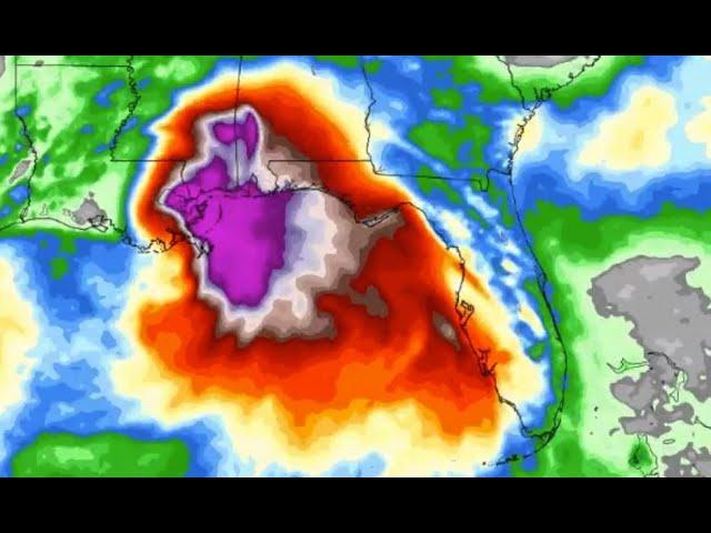
Additional intensification is expected during the next day or so and Michael is forecast by the National Hurricane Center (NHC) to be at major hurricane strength (Category 3+) before it makes landfall. This will be due to a combination of increasingly favorable upper-level winds and above average sea-surface temperatures along Michael's path.
Here's an overview of what we know right now.
Timing
- Landfall is most likely to occur somewhere between the Florida Panhandle and the Big Bend of Florida Wednesday into Wednesday night. Depending on how quickly or slowly Michael begins to turn northeast, landfall could be delayed until early Thursday.
- Conditions may begin to deteriorate as early as Tuesday night on the northeast Gulf Coast.
- After landfall, Michael will then move farther inland across the southeastern U.S. into late-week with gusty winds and heavy rain.
- Michael could enhance rainfall in the mid-Atlantic and southeast New England later this week.
Intensity
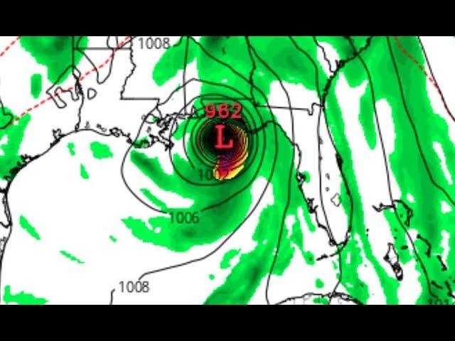
- The NHC is forecasting Michael to be a Category 3 when it approaches the Florida coast.
- There remains some uncertainty in the intensity forecast and Michael could be slightly weaker or stronger near landfall.
- Michael will still be a dangerous hurricane even if it does not intensify as much as currently forecast.
Wind
- Hurricane-force winds (74-plus mph) could arrive in the hurricane watch area on the northeast Gulf Coast by Wednesday.
- Tropical-storm-force winds (39-plus mph) are most likely to arrive in the tropical storm watch area on the northeastern Gulf Coast by Tuesday night or Wednesday morning.
- Widespread power outages, major tree damage and structural damage will occur along the path of Michael near and just inland from where it makes landfall on the northeastern Florida Gulf Coast.
- Strong winds may extend farther inland across parts of the Southeast as Michael moves northeast, including parts of southern Alabama, Georgia and the Carolinas. Although there is uncertainty with the strength of winds across inland locations, there could be scattered tree damage and scattered power outages in those areas.