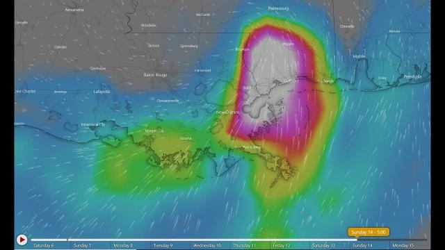
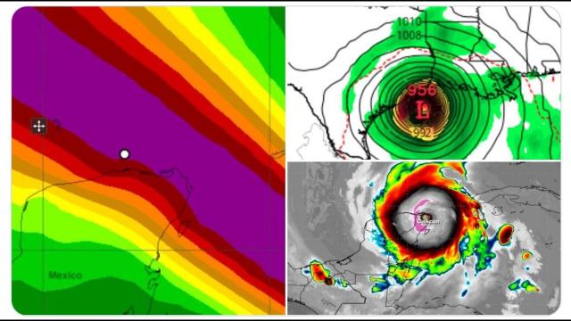
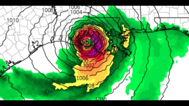
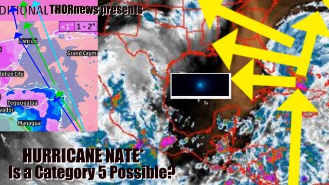
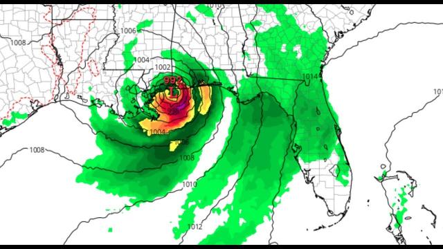
Alert! Category 3 Hurricane Barry VERY Possible for Gulf of Mexico around the 13th
Description
Unless major factors change, i'm calling it like i see it and if this low pressure system sits over hot water for 18+ hours then YES rapid intensification is possible. This is like Hurricane Harvey but WORSE. Only STRONG Wind Shear could keep it down.
God bless everyone,
T
T LEWISON
5430 BIRDWOOD RD. #416
HOUSTON TEXAS 77096
HTTPS://WWW.PAYPAL.ME/THORNEWS
https://weather.com/storms/hurricane/news/2019-07-05-tropical-disturbance-gulf-of-mexico-southeast-coast
A Tropical Depression or Tropical Storm Might Form in the Gulf of Mexico Later This Week. Here's What We Know Now.
An area of low pressure may form along a front in the northern Gulf of Mexico late in the week ahead.
This is an area where July tropical storms have formed in the past.
If low pressure does develop and enough thunderstorms persist, a tropical depression or storm could form.
Whether or not development occurs, locally heavy rain is possible from the northern Gulf Coast to the Southeast coast.
There is an increasing chance low pressure may develop into a tropical depression or tropical storm late in the week ahead in the northern Gulf of Mexico. Locally heavy rain will soak parts of the Gulf Coast and Southeast regardless of whether the low develops.
Computer forecast models over the past several days have shown that an upper-level disturbance meteorologists call a mesoscale convective vortex (MCV) will move from the Deep South into the northeastern Gulf of Mexico early this week.
These swirling areas a few thousand feet above the ground are produced by thunderstorm clusters. Because they already have spin, moisture and energy, they can occasionally become tropical systems once over water.
As this occurs, a weak cold front will glide through the South, then stall out off the Southeast coast to the northern Gulf of Mexico.
These old frontal boundaries with converging winds often serve as breeding grounds for tropical development early in the hurricane season.
If the upper-level system can maintain itself over land before moving over the northern Gulf of Mexico, it could help spin up an area of low pressure along the old front. This could start the process of developing a tropical depression over Gulf waters that are already warmer than average for early July.
It's also possible a second area of low pressure could briefly form along the old front somewhere off the Southeast coast.
What We Know and Don't Yet Know
The National Hurricane Center has outlined a medium possibility – a six in 10 chance – of tropical development late in the week ahead in the northern and eastern Gulf of Mexico.
It is still far from certain whether any tropical development over the Gulf of Mexico or off the Southeast coast will occur at all late in the week.
For now, residents along the northern Gulf Coast and Southeast coast should simply monitor the forecast for late in the week and next weekend, knowing that conditions could change. It's also a good time to make sure your preparedness kit is ready to go for the rest of hurricane season.
What is more certain, however, is an extended period of locally heavy rain is in play over parts of the Gulf Coast and Southeast that is different from the more typical daily afternoon scattered thunderstorms of summer.
There will be patches of locally heavy rain scattered about the Southeast from the Carolinas to the northern Gulf Coast through the week ahead.
If a tropical depression or storm does form, it would have its own footprint of heavy rain late in the week into next weekend over the Southeast.
Despite areas of drought from southern Alabama and extreme North Florida to South Georgia and the coastal Carolinas, any heavy rainfall could trigger localized flash flooding where rainbands or clusters of thunderstorms stall for a few hours.
Onshore winds could eventually lead to dangerous rip currents along parts of the northern and eastern Gulf Coast and possibly parts of the Southeast coast later in the week.
We'll continue to monitor this forecast in the days ahead, but for now, let's take a look back at what has happened in July.
Tropics in July
July has accounted for only 8% of the Atlantic hurricane season's named storms since 1851, according to NOAA's Hurricane Research Division.
From 1950-2018, 67 named storms formed in July, averaging about one named storm in July each year.
Most tropical depression and tropical storm formation occurs in the Gulf of Mexico and the far western Atlantic over the warm Gulf Stream, particularly in early July.
Development then becomes more common throughout the rest of the Atlantic Basin as July progresses. By late July, development occurs more frequently due to the warmth of ocean temperatures and disturbances, like tropical waves and thunderstorm complexes, instead of old frontal boundaries.