Triple Trouble for USA & Canada - Nor'Easter #4, California Floods & Tornadoes for the South
Description
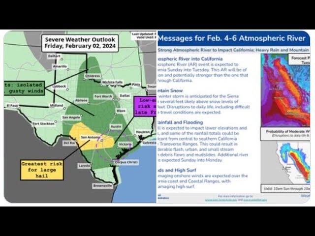
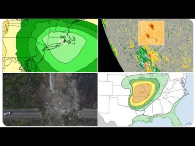
We have Triple Weather Trouble for the USA & Canada.
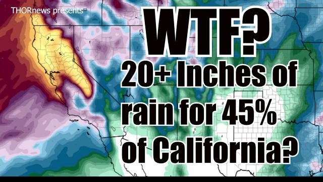
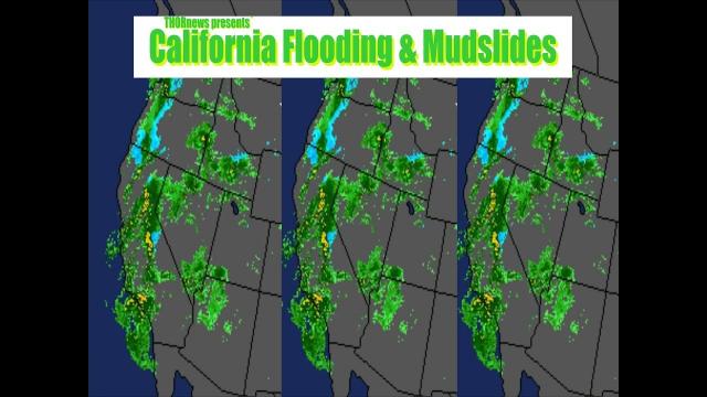
An atmospheric river for California & the West Coast.
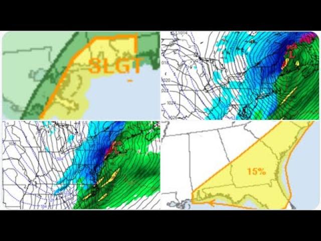
An ooutbreak of Tornadoes for the South. and.
Nor'Easter #4 of March in this wave after wave after
wave Winter Hurricane Parade.
California. Take this flood threat VERY SERIOUSLY.
The models have had a very bad habit of under selling the
rain all year.
God bless everyone,
T
https://www.paypal.me/THORnews
https://www.patreon.com/thornews
@newTHOR on twitter
https://www.facebook.com/THORnewsthornews
THORNEWS PO BOX 35946
HOUSTON TEXAS
77235-5946
article on the situation
https://weather.com/storms/winter/news/2018-03-19-winter-storm-toby-fourth-march-noreaster-northeast-snow
Winter Storm Toby Will Lash the East Coast as a Nor'easter Midweek and Also Blanket the Ohio Valley, Appalachians
Toby will be the fourth nor'easter this month to affect the Northeast.
Accumulating snow, strong winds gusts and coastal flooding are once again possible along the Northeast seaboard.
The wet snow and gusty winds could contribute to power outages and tree damage in the Northeast.
Snow will also blanket parts of the Ohio Valley and central Appalachians.
Winter Storm Toby will spread snow across the Ohio Valley and Appalachians before forming into another nor'easter that will bring more snow, wind, and coastal flooding to the East Coast Tuesday-Thursday.
There has been uncertainty the last several days surrounding the snowfall potential along the Interstate 95 corridor in the mid-Atlantic and Northeast, but recent guidance has trended towards a snowier forecast. Changes to the forecast are still possible depending on the exact track of a low-pressure system that is expected to intensify off the Eastern Seaboard Wednesday-Thursday.
Winter storm watches have now been posted by the National Weather Service throughout the Northeast Interstate 95 corridor, from Washington, D.C. to New York City and Boston. Winter storm watches, winter storm warnings and winter weather advisories have also been hoisted in parts of central Appalachians and upper Ohio Valley.
Forecast Timing
Tuesday
Snow or a rain and snow mix should affect a narrow zone in the mid-Atlantic and central Appalachians, including Philadelphia, Baltimore, and at least the northern and western suburbs of the Washington D.C. metro.
The greatest chance for any accumulating snow during the daytime will be west of the Interstate 95 corridor from southern New Jersey and southern Pennsylvania to northern Virginia.
By Tuesday night, the second area of low pressure should begin to take shape along the mid-Atlantic coast.
Snow or a rain and snow mix could affect a swath from the upper Ohio Valley into the mid-Atlantic region, including Washington D.C. and Baltimore, perhaps extending northward into Philadelphia and New York City, as well.
Tuesday's Forecast
Tuesday's Forecast
Areas in darkest teal have the best chance of snow. Areas in pink may see either rain or snow. Areas shown in green are expected to see mainly rain.
Wednesday
Snow or rain changing to snow is expected from the upper Ohio Valley to the Appalachians, mid-Atlantic, coastal and southern New England. Some sleet is possible as well. Rain may change to snow overnight as far south as parts of northern North Carolina and southern Virginia.
Snow will persist Wednesday night in New England, particularly coastal New England.
It should be noted that snow may be heavy at times along the Northeast coastline Wednesday into Wednesday night, falling at rates of an inch or more per hour.
Strong winds should build from Delaware and the Jersey Shore to Long Island, and New England Wednesday, tapering off farther south Wednesday night. For now, these winds don't look as strong as this month's earlier nor'easters, but may still lead to some power outages and tree damage when combined with accumulating snow.
Coastal flooding and beach erosion, yet again, is possible from the Delaware coast to New England Tuesday through Thursday.
(FORECAST: Boston | NYC | Philly | Baltimore | Washington D.C. | Pittsburgh)
Areas in darkest have the best chance of snow.
Thursday
Snow may linger in parts of northern New England, particularly Maine.
Some gusty winds are also likely to linger in these areas, diminishing slowly through the day.
Snowfall Forecast
Northeast I-95 corridor: Snow totals of 6 inches or more are possible from Philadelphia to New York City and Boston Wednesday-Wednesday nightchange, given lingering uncertainty throughout this region. The wet nature of the snow and gusty winds could result in power outages and tree damage in the Northeast.
Mid-Atlantic: Several inches of snow could accumulate in the Washington, D.C. and Baltimore metros, mainly Tuesday night-Wednesday. Heavy snow is most likely in the Appalachians and areas to the north and west of the Washington and Baltimore metro areas.
Upper Ohio Valley: Most areas can expect totals of 6 inches or less, including Cincinnati and Columbus, Ohio.
Snowfall