Red Alert! Tropical Storm Isaias could hit Florida to NC to NE as a Hurricane! + New Wave to Watch!
Description
2020 is getting extra cray cray.
God bless everyone,
T LEWISON
5430 BIRDWOOD RD. #416
HOUSTON TEXAS 77096
https://www.paypal.me/THORnews
https://venmo.com/TEric-Lewison
$THORnews on CashApp
https://www.patreon.com/thornews
twc notes
https://weather.com/storms/hurricane/news/2020-07-30-tropical-storm-isaias-forecast-florida-united-states
Tropical Storm Isaias Carving Through the Caribbean. Could Head Toward Florida, Southeast Coast
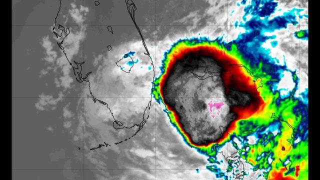
Tropical Storm Isaias is bringing heavy rain to parts of the Caribbean, including Puerto Rico.
Tropical storm warnings and watches are posted from Puerto Rico and the Virgin Islands to the Bahamas
The forecast for this system beyond the Caribbean is still highly uncertain because of multiple factors.
First impacts could be felt in parts of Florida as soon as Saturday.
Other parts of the U.S. East Coast could also eventually see impacts from Isaias.
Tropical Storm Isaias (ees-ah-EE-ahs) is dumping heavy rain on parts of the Caribbean and could eventually track near Florida and possibly other parts of the Southeast coast this weekend into early next week.
Tropical storm warnings and watches are in effect from Puerto Rico and the Virgin Islands into the Bahamas. A warning means tropical storm conditions are expected in the next 36 hours. A watch means tropical storm conditions are possible within 48 hours.
Bands of heavy rain with gusty winds are rotating through Puerto Rico and the Virgin Islands right now. Winds in those rainbands could gust to 50 mph at times.
Below is a look at what we know about the forecast for any potential U.S. and Caribbean impacts.
Florida, Southeast U.S. Concern
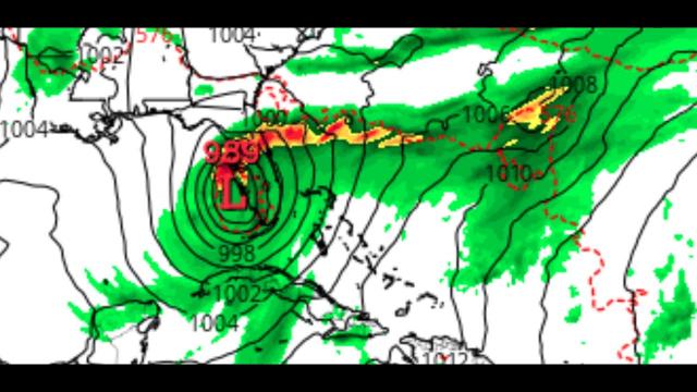
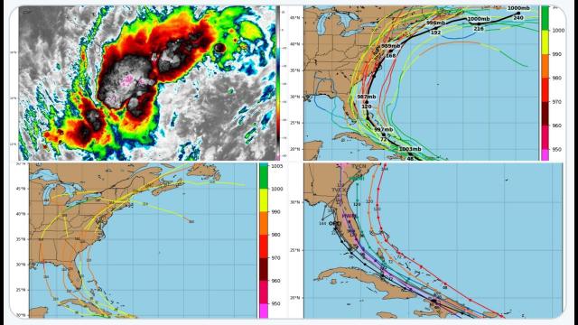
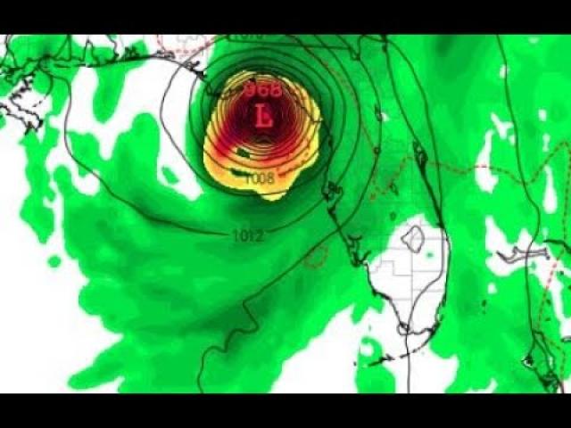
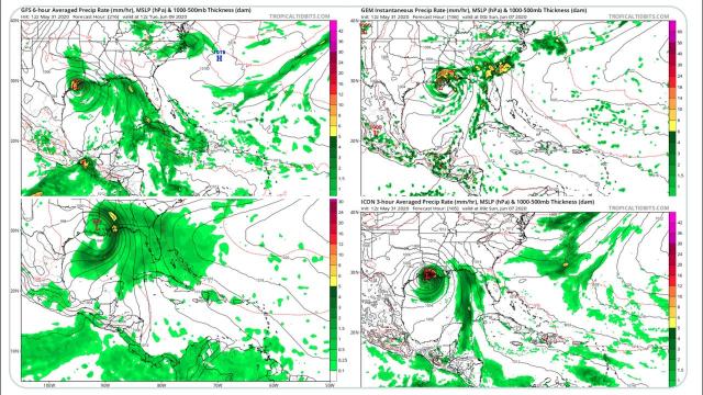
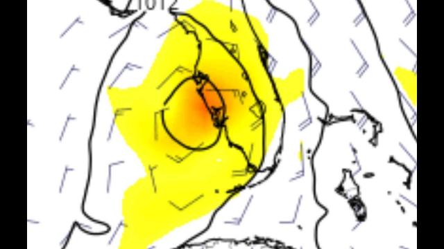
The NHC projected path below shows that this system could be located near or east of the Florida Peninsula by this weekend, then gradually northeastward along the Southeast coast. However, this forecast is not nearly as straightforward as it might seem.
There are a number of reasons for this uncertainty.
One reason is the current center of the storm is expected to track over Hispaniola (the Dominican Republic and Haiti). Land interaction with the higher terrain of this island could make it become disorganized.
However, a new circulation center could form in association with the ongoing cluster of rain and thunderstorms near Puerto Rico. Where exactly that occurs is uncertain, and could cause a shift to the position, and, hence, the forecast path of this system.
This system may also have to battle unfavorable upper-level winds - producing what meteorologists refer to as wind shear - along its Bahamas track. This is a nemesis of tropical cyclones.
If wind shear isn't too hostile, warm water is plentiful, and could allow the system to intensify into at least a strong tropical storm, as the current NHC forecast shows.
The bottom line is that it's too early to precisely determine this system's future track and intensity, especially with regard to the mainland U.S. But the forecast could become more clear once this system moves north of Hispaniola and Puerto Rico.
"We should have a better idea of how strong Isaias will become near the U.S. after reconnaissance aircraft sample the storm and after it passes Hispaniola later today," the NHC said in its forecast early Thursday morning.
As it stands now, the system, in whatever form, is expected to arrive near eastern Florida Saturday, and possibly central or northern Florida Saturday night into Sunday. That would result in at least some rain and wind impacts in Florida this weekend.
However, the possible outcomes with regard to the mainland U.S. range from a track over Florida or the extreme eastern Gulf of Mexico to a track over at least parts of the U.S. East Coast to a near-miss of the Eastern Seaboard.
This is due to the steering features in the atmosphere - the Bermuda high and an upper-level dip in the wind flow over the Mississippi Valley - as well as the strength of the system.
In general...
-Farther west track: If the system is weaker and/or the Bermuda high is stronger and extends farther west.
-Farther east track: If the system is a bit stronger and/or the Bermuda high is not as strong and farther east.
Residents along the Southeast and Gulf Coasts should monitor the progress of this system closely and have their plans ready to go, in case they're needed.
Heavy rain and gusty winds in Puerto Rico and the Virgin Islands will last into Thursday morning before conditions improve later in the day.
For the Dominican Republic and Haiti, their worst conditions with the system will occur from Thursday morning through Thursday night.
Conditions will begin to deteriorate in the southeast Bahamas and Turks and Caicos Thursday afternoon, with rain and squalls possible into Friday.
While some rain is needed to help the long-term drought in eastern and southern Puerto Rico and the Virgin Islands, locally heavy rainbands will likely trigger dangerous flash flooding and mudslides, particularly in higher terrain.
Hispaniola