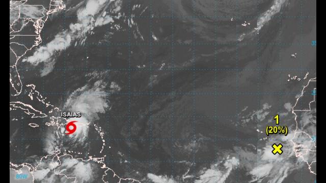
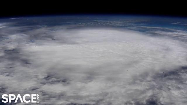
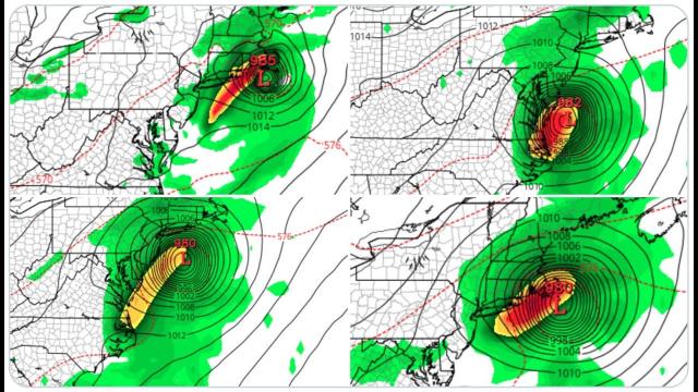
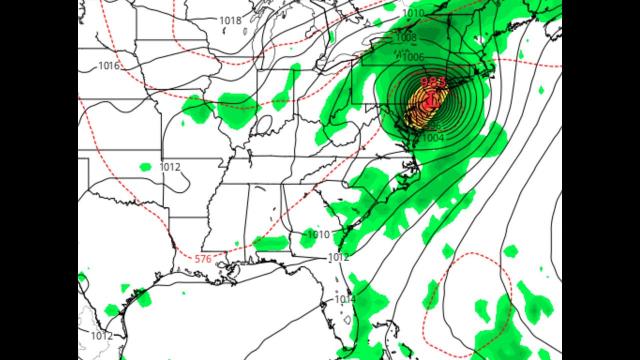
RED ALERT! Isaias will HIT the USA. Prepare for a Category 3 Hurricane but Pray for a Tropical Storm
Description
Now would be a great time for everyone to level up.
God bless everyone,
T LEWISON
5430 BIRDWOOD RD. #416
HOUSTON TEXAS 77096
https://www.paypal.me/THORnews
https://venmo.com/TEric-Lewison
$THORnews on CashApp
https://www.patreon.com/thornews
TWC notes
https://weather.com/storms/hurricane/news/2020-07-26-invest-92l-forecast-atlantic-tropical-development-isaias
Another Tropical Depression or Storm Could Form in the Atlantic and Head Toward Leeward Islands
A broad area of low pressure is being watched for possible tropical development.
This system could be located near or north of the Lesser Antilles by Wednesday night.
It could bring at least some rain and gusty winds to the Lesser Antilles and Puerto Rico.
It's too early to know what impacts this system might bring to any other land areas, including the United States.
Another tropical disturbance may become the latest Atlantic tropical depression or tropical storm this week, piling on to the busy start we've already seen this hurricane season.
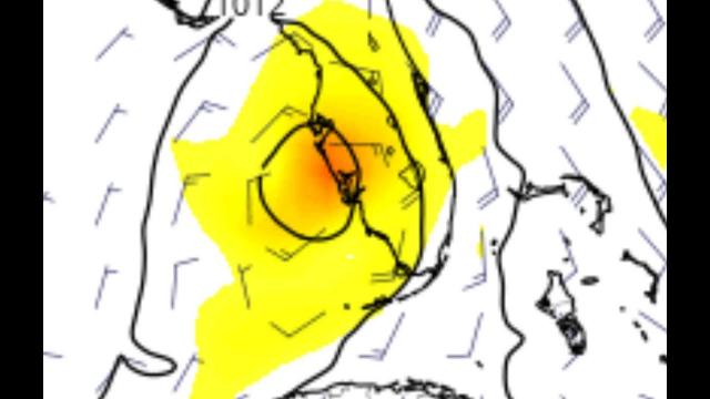
This latest disturbance is a broad area of low pressure located several hundred miles east of the Lesser Antilles. The system has been dubbed Invest 92L – a naming convention used to identify areas being watched for tropical development – by the National Hurricane Center (NHC).
Invest 92L will be steered west-northwest the next several days by the clockwise flow around a high-pressure system centered to its north.
Shower and thunderstorm activity in this system is increasing, but the area of low pressure has not yet become organized enough for this system to be called a tropical depression or storm.
The NHC says there is a high chance of Invest 92L forming into a tropical depression or tropical storm during the next few days.
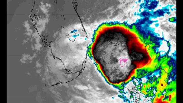
If this system were to become the next Atlantic tropical storm, it would be named Isaias (ees-ah-EE-ahs).
Regardless of development, this system should be located near the Leeward Islands as soon as Wednesday and near the Virgin Islands and Puerto Rico by Wednesday night or Thursday. These areas will see some rain and gusty winds from this system no matter what it's called.
Tropical storm watches or warnings could be issued on Tuesday for parts of the Leeward Islands, according to the NHC.
Beyond that time the forecast is less certain.
A majority of the computer model forecast guidance tracks this system in the general direction of the Bahamas by late this week or this weekend. That assumes the area of low pressure does eventually develop into a tropical depression or storm.
It's possible this system will have to battle unfavorable upper-level winds and/or dry air along its track to near the Bahamas. That could hinder its ability to intensify, however, that forecast factor is not yet certain.
The bottom line is that it's too early to determine what, if any, impacts this system could bring to any other land areas, including the United States.
Check back to weather.com for updates on this system throughout the week ahead.