Pray for a Miracle! Models Hint at Hurricane Dorian could curve out to Sea!
Description
Prayer Warriors, now is your time to shine!
Prepare for the worst, Pray for the best.
God bless everyone,
T LEWISON
5430 BIRDWOOD RD. #416
HOUSTON TEXAS 77096
HTTPS://WWW.PAYPAL.ME/THORNEWS
www.venmo.com/TEric-Lewison
$THORnews on CashApp
https://www.patreon.com/thornews
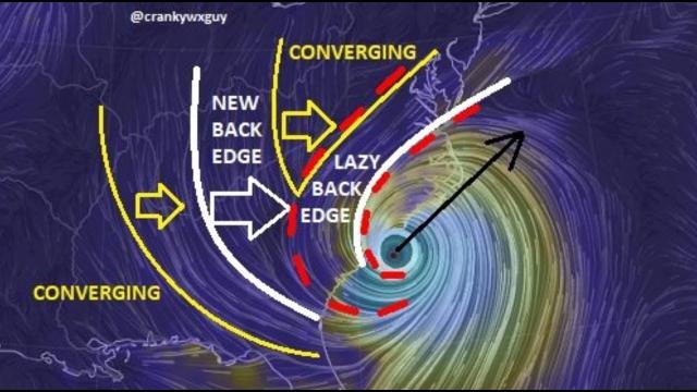
the crankywxguy blog (not me but good info)
a wc video
https://weather.com/storms/hurricane/news/2019-08-30-hurricane-dorian-florida-southeast-bahamas-forecast
Hurricane Dorian Expected to Strengthen into a Category 4; Prolonged Threat to Florida Increasing
Hurricane Dorian is now moving through the western Atlantic Ocean.A hurricane watch has been issued for the northwestern Bahamas.Dorian will threaten parts of the Bahamas and the southeastern U.S. over Labor Day weekend.The most likely scenario is a track near the Florida Peninsula late in the weekend, but exact details will change.Residents from the northern Gulf Coast to Florida, Georgia and the Carolinas should monitor forecasts closely.
Dorian is a Category 2 hurricane and is forecast to intensify into a powerful Category 4, posing a prolonged danger that may last days in Florida and the southeastern United States beginning Labor Day weekend.
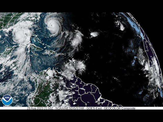
Dorian's center is about 480 miles east of the northwestern Bahamas, with maximum sustained winds of 110 mph. The hurricane is moving toward the northwest around 10 mph.
A hurricane watch has been issued for the northwestern Bahamas.
A watch is typically issued 48 hours before the anticipated first occurrence of tropical-storm-force winds (39-plus mph), conditions that make outside preparations difficult or dangerous.
Below is the latest on Dorian's timing and what we know about potential forecast impacts right now.
Dorian's Forecast Timing
Friday: Dorian's center is expected to track to the north and east of the Turks and Caicos and the southeastern Bahamas. Dorian will strengthen and likely become a major hurricane (Category 3 or stronger) later Friday.
Saturday: Dorian will bend west-northwest to westward by early Saturday, and it is expected to slow its forward motion. Dorian will likely begin to impact the northwestern Bahamas by Saturday night or early Sunday.
Sunday-Monday: Dorian will continue to slow down as it approaches and begins to impact the southeastern U.S., most likely somewhere between Florida and southeastern Georgia. That said, areas as far north as the Carolinas should also monitor for potential impacts from Dorian early next week.
Tuesday-Wednesday: Dorian's slow movement could allow it to continue impacting the Florida Peninsula and possibly other parts of the Southeast into the middle part of next week.
Uncertainty continues to be high when it comes to exact forecast impacts in the southeastern U.S. However, all interests in the Bahamas, the northern Gulf Coast, Florida, Georgia and the Carolinas should have their hurricane plans ready and monitor the forecast of Dorian closely.
Among the myriad track possibilities are a track farther north toward the southeastern Georgia coast and the Carolinas or one slicing across the Florida Peninsula, then emerging into the Gulf of Mexico and potentially threatening parts of the northern Gulf Coast next week.
The uncertainty in Dorian's exact track is mainly related to an area of high pressure off the East Coast. If high pressure remains relatively strong over the Southeast, then Dorian would track straight into Florida. But if the western periphery of the high is significantly eroded by a subtle disturbance moving through the eastern United States, then Dorian could turn more northward near the coast of Florida.
Regardless of its exact track, Dorian is likely to be a dangerous hurricane – potentially a Category 4 – when it approaches Florida later this weekend or early next week.
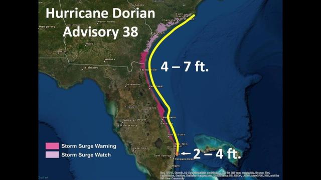
Dorian's Storm Surge, Wind and Rain Impacts
In the northwestern Bahamas, the risk of life-threatening storm surge and hurricane-force winds (74-plus mph) this weekend continues to increase. Rainfall totals of 6 to 12 inches are expected, with isolated amounts up to 18 inches, which may cause flash flooding, according to the National Hurricane Center. The central Bahamas can expect 1 to 2 inches, with isolated totals up to 4 inches.
Storm surge may cause water levels to be as much as 10 to 15 feet above normal tide level in areas of onshore winds in the northwestern Bahamas. Near the coast, that storm surge will be accompanied by large, destructive waves.