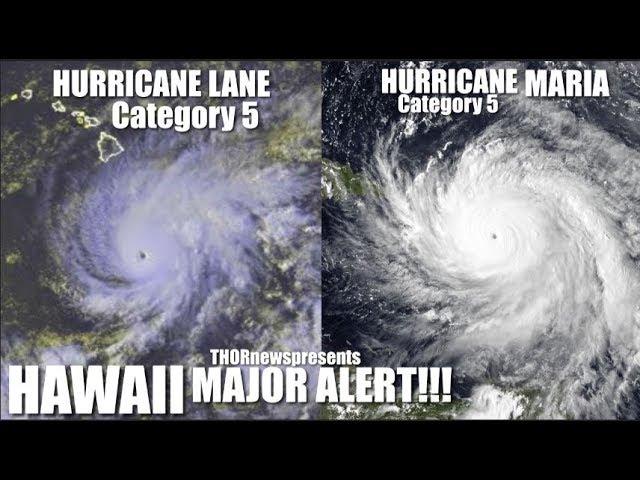
MAJOR DANGER! Hawaii Hurricane Lane - 60+ inches of rain & near Future Volcano Eruption possible
Description
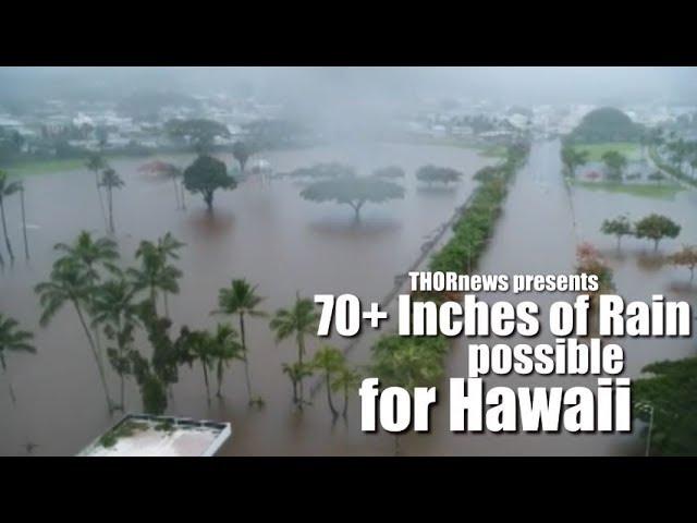
If this is a WORST CASE SCENARIO, we are looking at over 60 inches of rain for days & we have the same signal that made me accurately predict the Kiluea Volcano eruption earlier this year. This could be a major disaster unfolding as Hurricane Lane has gone Stationary. Please help me sing & pray for Hawaii.
God bless everyone,
T
https://www.paypal.me/THORnews
Tshirts
https://hitthebuttonbaby.com/
THORNEWS
PO BOX 35946
HOUSTON TEXAS
77235-5946
the crankywxguy blog
http://www.stormhamster.com/entry/e082218.htm
the wave master
https://dabuh.com/
https://www.khon2.com/news/hurricane-lane-update-aug-22-2018-at-11-pm-hst/1390181019
At 1100 PM HST (0900 UTC), the eye of Hurricane Lane was located by satellite and radar near latitude 16.3 North, longitude 156.9 West. Lane is moving toward the northwest near 7 mph (11 km/h). This general motion is expected through Thursday, with a gradual turn toward the northwest. On Friday, a turn toward the north is anticipated as Lane's forward motion slows even more. A turn back toward the west is expected on Saturday. On the forecast track, the center of Lane will move very close to or over the main Hawaiian Islands tomorrow through Friday.
Maximum sustained winds remain near 145 mph (230 km/h) with higher gusts. Lane is a powerful category 4 hurricane on the Saffir-Simpson Hurricane Wind Scale. Some weakening is forecast during the next few days, but Lane is expected to remain a hurricane as it approaches the islands.
Hurricane-force winds extend outward up to 40 miles (65 km) from the center and tropical-storm-force winds extend outward up to 140 miles (220 km).
The estimated minimum central pressure is 939 mb (27.73 inches).
SUMMARY INFORMATION
LOCATION:
16.3N 156.9W
ABOUT 235 MI...380 KM SSW OF KAILUA-KONA HAWAII
ABOUT 350 MI...565 KM S OF HONOLULU HAWAII
MAXIMUM SUSTAINED WINDS...145 MPH...230 KM/H
PRESENT MOVEMENT...NW OR 315 DEGREES AT 7 MPH...11 KM/H
MINIMUM CENTRAL PRESSURE...939 MB...27.73 INCHES
WATCHES AND WARNINGS
A Hurricane Warning is in effect for Oahu, Maui County, including the islands of Maui, Lanai, Molokai and Kahoolawe, and Hawaii County.
A Hurricane Watch is in effect for Kauai County.
A Hurricane Warning means that hurricane conditions are expected somewhere within the warning area. A warning is typically issued 36 hours before the anticipated first occurrence of tropical-storm-force winds, conditions that make outside preparations difficult or dangerous. Preparations to protect life and property should be rushed to completion.
A Hurricane Watch means that hurricane conditions are possible within the watch area. A watch is typically issued 48 hours before the anticipated first occurrence of tropical-storm-force winds, conditions that make outside preparations difficult or dangerous.
Interests elsewhere in the main Hawaiian Islands, and across the Northwestern Hawaiian Islands, should continue to closely monitor the progress of Hurricane Lane. Additional Tropical Storm or Hurricane Watches or Warnings may be issued tonight or Wednesday.
HAZARDS AFFECTING LAND
WIND: Tropical storm conditions are expected on portions of the Big Island beginning early Thursday morning, with hurricane conditions expected in some areas Thursday afternoon or Thursday night. Tropical storm conditions are expected to begin over portions of Maui county on Thursday, with hurricane conditions expected in some areas Thursday night into Friday. Tropical storm conditions are expected to begin on Oahu late Thursday night, with hurricane conditions expected Friday into Friday night.
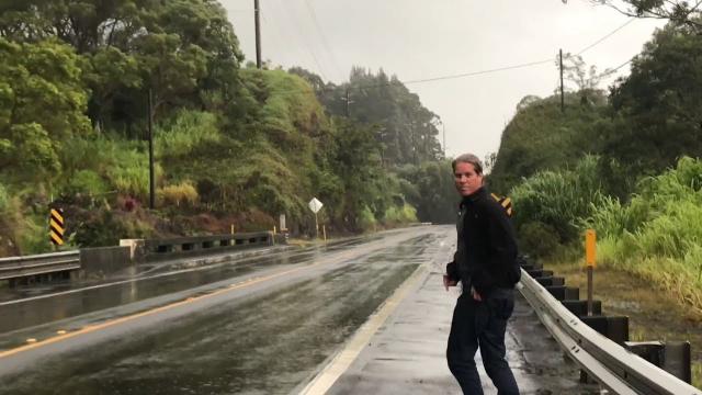
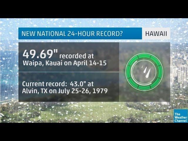
RAINFALL: Rain bands from Hurricane Lane will continue to overspread the Hawaiian Islands tonight and Thursday. Excessive rainfall associated with Lane will impact the Hawaiian Islands into the weekend, leading to significant and life-threatening flash flooding and landslides. Lane is expected to produce total rain accumulations of 10 to 20 inches, with localized amounts in excess of 30 inches over the Hawaiian Islands.
SURF: As Lane is slow-moving, large swells generated by Lane will severely impact the Hawaiian Islands over the next couple of days. These swells will produce very large and damaging surf along exposed west and south facing shorelines. A prolonged period of high surf will likely lead to significant coastal erosion.
STORM SURGE: The combination of a dangerous storm surge and large breaking waves will raise water levels by as much as 2 to 4 feet above normal tide levels along south and west facing shores near the center of Lane. The surge will be accompanied by large and destructive waves.