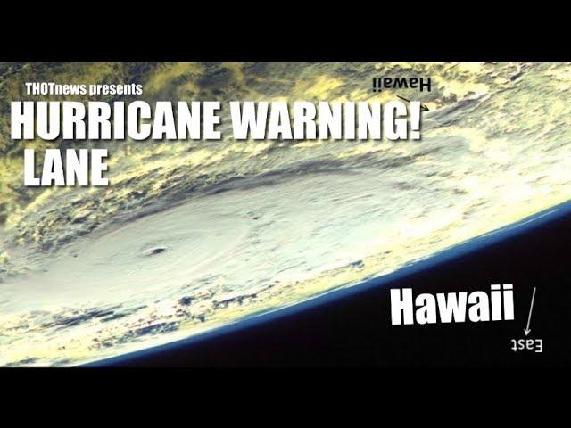
Alert Hawaii! Hurricane Lane is now Category 5 & a MAJOR DANGER to all the Islands
Description
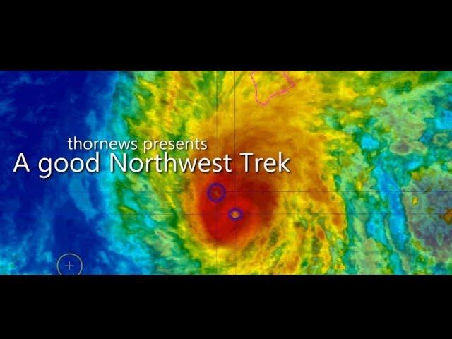
Hurricane Lane looks freakishly like Hurricane Maria which decimated Puerto Rico & was a catastrophe.
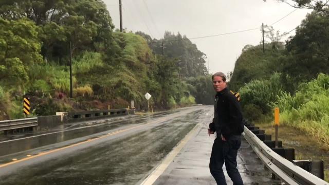
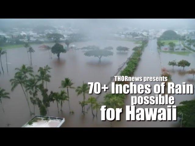
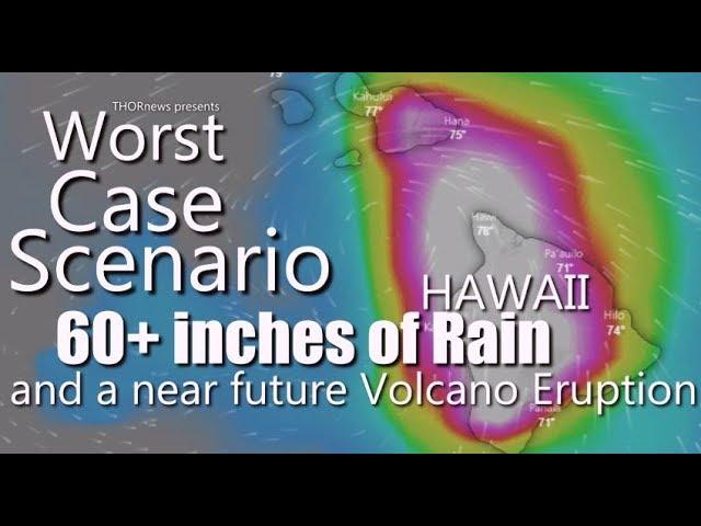
Hurricane Lane is now at sustained wind speeds of 160 mph & has had gusts of up to 177 mph. The GFS model is showing some pretty intense rain situations for the main island Saturday afternoon.
God bless everyone,
T
https://www.paypal.me/THORnews
Tshirts
https://hitthebuttonbaby.com/
THORNEWS
PO BOX 35946
HOUSTON TEXAS
77235-5946
the crankywxguy blog
http://www.stormhamster.com/entry/e073118.htm
the wave master
https://dabuh.com/
https://weather.com/storms/hurricane/news/2018-08-21-hurricane-lane-hawaii-forecast-impacts
Rare Hurricane Warning Issued for the Hawaii's Big Island as Powerful Hurricane Lane Threat Increases; Watch Issued for Oahu, Maui
Hurricane warnings have been issued for Hawaii County.
Lane is a Category 5 hurricane hundreds of miles southeast of Hawaii.
Lane will curl northwestward later this week toward Hawaii, eventually weakening.
A direct strike on parts of the Hawaiian Islands is possible late this week.
The island chain will see high surf, rip currents, winds and heavy rain, regardless of the exact track.
Whether the core of Lane's strongest winds affects parts of the islands remains uncertain.
Hurricane Lane continues to intensify and is now an extremely dangerous and rare Category 5 hurricane nearing Hawaii.
Hurricane warnings are in effect in parts of Hawaii as Hurricane Lane now poses an increasing, but still uncertain, danger to parts of the Hawaiian Islands late this week with high winds, flooding rain, battering surf and coastal flooding possible.
A hurricane warning was issued by the Central Pacific Hurricane Center Tuesday for the Big Island of Hawaii.
A hurricane watch is in effect for Maui and Honolulu Counties, including the islands of Maui, Lanai, Molokai, and Kahoolawe and the city of Honolulu.
A hurricane warning means that hurricane conditions are expected within the watch area.
A hurricane watch means hurricane conditions are possible within the watch area, and is typically issued 48 hours before the onset of tropical storm-force winds that may make preparations difficult or dangerous, according to CPHC.
Current Status and Forecast Track Uncertainty
The center of Lane is about 370 miles south-southeast of the Big Island's Kona coast or about 530 miles south-southeast of Honolulu, Hawaii, moving west-northwestward. Lane is now an immensely powerful Category 5 hurricane with 160 mph winds.
The hurricane hunters have reported a rapid lowering of pressure over the last 24 hours. Lowering pressures typically are followed by an increase in wind speeds.
The forecast track and intensity of Lane is still considerably uncertain, and small changes to its track and intensity are important for potential impacts in the Hawaiian Islands.
Lane is being steered west by subtropical high pressure to its north. It will soon reach the western edge of that high, which will allow Lane to curl northwest starting Wednesday.
Further complicating this, as noted by the University of North Carolina - Charlotte graduate student Eric Webb, was the potential of Lane's wind field to interact with the terrain of the Big Island.
Lane is then forecast to eventually turn back to the west by sometime Friday or Saturday.
The key for some impacts is when those two turns occur and how sharp those turns are, which will determine how close the core of Lane's strongest winds come to the islands.
If Lane moves along the southern portion (left side) of its forecast projected path, it would be far enough south of the islands to cause peripheral impacts: increased rainfall, windy conditions, high surf and rip currents.
However, it is increasingly likely that Lane will turn sharp enough northwest or even north along the northern or eastern side (right side) of its forecast projected path to increase the possibility of significant direct impacts in at least parts of the Hawaiian Islands.