Hurricane Marco is headed to Louisiana & Laura could become a MAJOR Hurricane & hit TX/LA/AL/MS
Description
We're looking at two hurricane landfalls over the next 80 hours.
Please stay aware, be prepared & get ready for a wild week.
God bless everyone,
T LEWISON
5430 BIRDWOOD RD. #416
HOUSTON TEXAS 77096
https://www.paypal.me/THORnews
https://venmo.com/TEric-Lewison
$THORnews on CashApp
https://www.patreon.com/thornews
twc outlook
https://weather.com/storms/hurricane/news/2020-08-23-tropical-storm-marco-forecast-hurricane-warnings-louisiana
Marco Strengthens Into a Hurricane Ahead of Gulf Coast Strike on Monday
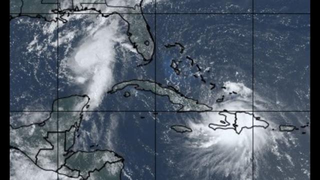
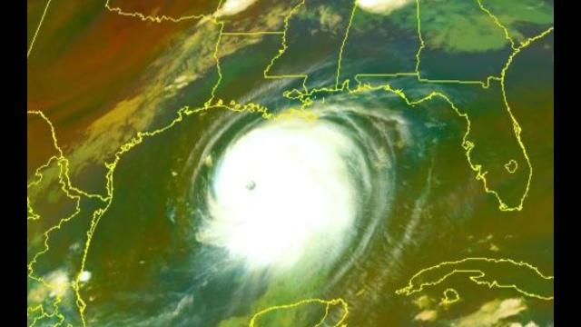
Marco has strengthened into a hurricane in the Gulf of Mexico.
Marco is expected to strike the Louisiana Gulf Coast on Monday.
Hurricane and storm surge warnings have been issued for a part of the northern Gulf Coast.
Storm surge flooding, localized flooding rainfall and strong winds are the expected impacts from Marco.
Marco has strengthened into a hurricane ahead of its strike on the northern Gulf Coast on Monday, where it will bring storm surge, heavy rainfall and strong winds to parts of Louisiana, Mississippi and Alabama.
A hurricane warning is now in effect for a portion of the Louisiana coast, from Morgan City to the Mouth of the Pearl River. Hurricane conditions are possible by midday Monday in this area.
A storm surge warning has also been issued from Morgan City, Louisiana, to Ocean Springs, Mississippi. This means there is a danger of life-threatening inundation from rising water moving into the coastline.
Tropical storm warnings along with hurricane and tropical storm watches have been issued for other parts of the northern Gulf Coast. New Orleans is currently under a tropical storm warning and hurricane watch.
At this time, the National Hurricane Center is forecasting Marco to be a Category 1 hurricane when it makes its closest approach to Louisiana and Mississippi on Monday. Marco should then weaken quickly through Tuesday because of land interaction and hostile winds in the upper atmosphere.
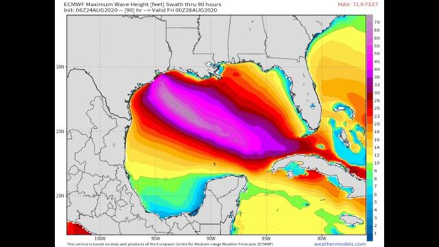
Storm Surge
Marco is expected to bring a surge of water from the Gulf of Mexico to parts of the coastline from Louisiana eastward to coastal Alabama, which could become life-threatening.
The highest storm surge usually occurs near and east of the path of a tropical storm or hurricane.
Right now, the highest surge from Marco is predicted to be from southeast Louisiana to a portion of coastal Mississippi. Water levels could reach 4 to 6 feet above normal in these areas if the peak surge arrives at the time of high tide. Monday's high tide in these areas will be early in the morning.
Rainfall
Since Marco is small, it will not produce a widespread area of heavy rainfall, however, localized flash flooding is still expected.
The area with the greatest chance of seeing some flash flooding on Monday is from southeast Louisiana into coastal parts of Mississippi and Alabama.
Rainfall totals are forecast to be 2 to 4 inches, but locally up to 6 inches could soak some areas.
Wind
Tropical-storm-force winds will arrive on the northern Gulf Coast by early Monday. Hurricane conditions could occur in a smaller area near where Marco approaches the coastline.
Marco's strongest winds will not be widespread, but there could be some tree damage and power outages, particularly in areas where a hurricane warning or a tropical storm warning is in effect.
An isolated tornado threat also cannot be ruled out in southeast Louisiana on Monday.