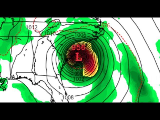
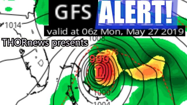
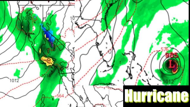
East Coast are you ready for a Hurricane?
Description
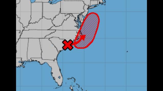
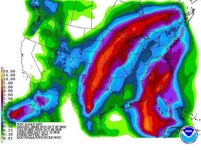
We've got a Lunar Eclipse on Friday & then we go into the wild part of Hurricane season August & September. Mother Nature has been picking on the East Coast & that Azores High would guide it into the East Coast. And. We just had a big wave roll off Africa.
Be prepared. Have a Plan. Stay Cool.
God bless everyone,
T
https://www.paypal.me/THORnews
Tshirts
https://hitthebuttonbaby.com/
THORNEWS
PO BOX 35946
HOUSTON TEXAS
77235-5946
the excellent cranywxguy blog
http://www.stormhamster.com/entry/e071818.htm
The Surf Master
http://www.dabuh.com
data site
http://www.spaghettimodels.com/
article on storms
https://www.accuweather.com/en/weather-news/torrential-rain-flooding-in-northeastern-us-to-slowly-shift-eastward-into-thursday/70005585
Torrential rain, flooding in northeastern US to slowly shift eastward into Thursday
Rounds of torrential rain and serious flooding will continue in a tropical atmosphere in the mid-Atlantic and spread into more territory of the northeastern United States into Thursday.
So far this week, a swath of heavy rain and flooding, like that of a fire hose, has focused from parts of the Carolinas northward to portions of Virginia, Maryland and central and eastern Pennsylvania.
Many communities that have been hit hard already by the downpours, such as Washington, D.C., Baltimore and Harrisburg and Williamsport, Pennsylvania, will continue to be hit hard into midweek.
Meanwhile, some areas that have escaped the wrath of torrential rain and flooding so far, such as Philadelphia and New York City, can expect downpours to be persistent enough to cause travel and localized flooding problems into early Thursday.
What are the main impacts?
When and where the torrential rain hits during rush hour, the commute on the roads could be brought to a standstill. Torrential downpours may greatly impair visibility and increase the risk of hydroplaning. Underpasses prone to flooding could be submerged.
Rainfall could be intense enough to cause water to flow into some subway stations.
Airline passengers should anticipate delays related to torrential rainfall and a low cloud ceiling, resulting in poor visibility.
What areas have been hit hard?
Rainfall has topped a foot in some areas, since the pattern of tropical downpours began last weekend.
Some streets and backyards have been submerged, while high water along small streams has forced some roads and bridges to close from North Carolina to Pennsylvania thus far.
On Monday, surging water on small streams flooded portions of Hersheypark, ZooAmerica and Knoebels in Pennsylvania. Flooding problems are expected to continue in these areas and may get worse into Wednesday night. Hersheypark was closed again on Wednesday.
Water rescues were reported as far to the southwest as northern Charlotte, North Carolina on Tuesday.
Baltimore has received more than 15 inches of rain thus far in July as of 12 a.m. EDT Wednesday. This amount is nearly four times the average for the entire month. Since record have been kept since the late 1800s, this month is the wettest July and is the second wettest month ever. The wettest month recorded was in August 1955 with 18.35 inches.
Trees have been toppling in the Washington, D.C., and Baltimore areas due to saturated ground, with little to no wind, according to the National Weather Service.
Where the fire-hose-effect sets up for a few hours, some neighborhoods could face a flash flood disaster similar to Ellicott City, Maryland, earlier this year.
In addition, highly localized strong wind gusts can occur in some of the thunderstorms.
Saturated ground alone can cause some diseased and poorly-rooted trees to topple, block roads and cause sporadic power outages. Pockets of strong winds can greatly add to the risk.
Moving forward, when will the heaviest rain hit and how long will it last?
Within the fire-hose of moisture, rainfall at the rate of 1-2 inches per hour can continue to occur with the potential for 2-4 inches of rain to fall in 8 hours.
While most shower and thunderstorm activity occurs during the afternoon and early evening, torrential downpours can occur any time during the tropical weather pattern.
Sporadic downpours have extended to the east and the west of the heaviest rain and will continue to do so, while most of the time is free of rain.
Into Wednesday night, bands of heavy rain will extend from eastern North Carolina to northern New York state.
Cities such as Salisbury and Ocean City, Maryland; Wilmington and Dover, Delaware; Philadelphia, Scranton and Allentown, Pennsylvania; Trenton, New Jersey; and Binghamton and Syracuse, New York, are likely to experience an uptick in downpours and flooding incidents as Wednesday night progresses.
By late Wednesday night, the corridor or heavy rain and risk of urban and small stream flooding will exit the hardest hit areas, but is expected to swing across eastern New York state, much of New