Alert! TEXAS Prepare for Hurricane* Hannah!
Description
Most models think this will be a Tropical Storm but several models believe this will be a Hurricane. Prepare for the Worst and Pray for the Best.
God bless everyone,
T LEWISON
5430 BIRDWOOD RD. #416
HOUSTON TEXAS 77096
https://www.paypal.me/THORnews
https://venmo.com/TEric-Lewison
$THORnews on CashApp
https://www.patreon.com/thornews
notes from TWC
https://weather.com/storms/hurricane/news/2020-07-19-tropical-disturbance-gulf-of-mexico-late-july
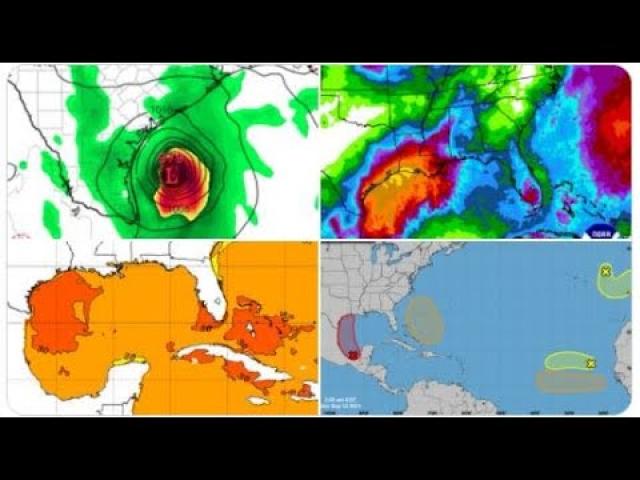
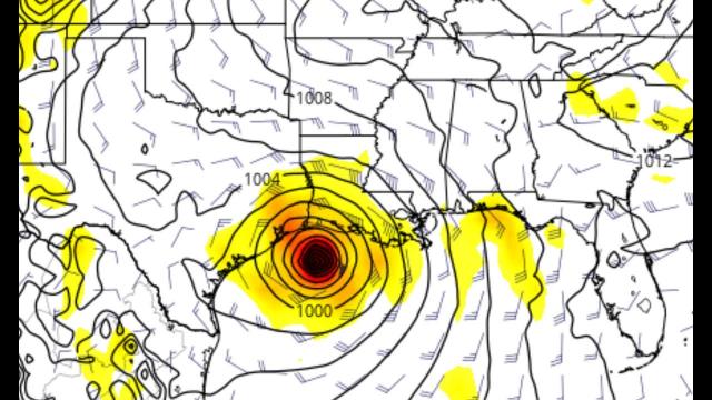
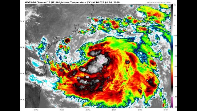
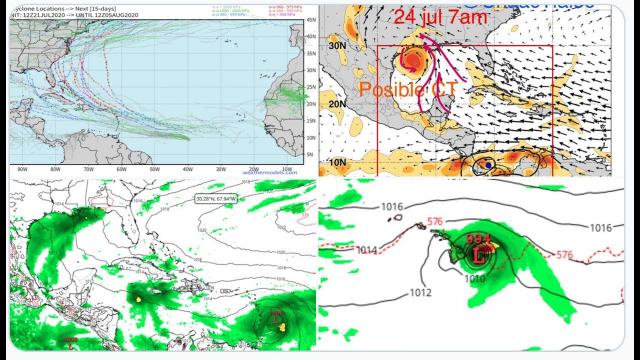
Tropical Depression Eight Could Become a Tropical Storm as it Tracks Toward Texas
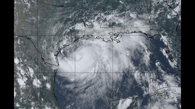
A tropical depression is tracking through the Gulf of Mexico.
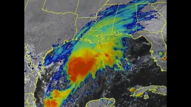
Bands of locally heavy rain may trigger local flash flooding along the northern and western Gulf Coast.
Some locally heavy rain may also spread inland over parts of central and South Texas.
Some gusty winds, rough surf and minor coastal flooding are possible along the northern and western Gulf Coast.
Tropical Depression Eight is tracking through the Gulf of Mexico and could become a tropical storm before it slides inland over Texas as the week comes to a close. The main threat from this system will be locally heavy rain, but there is also the potential for gusty winds, high surf and minor coastal flooding.
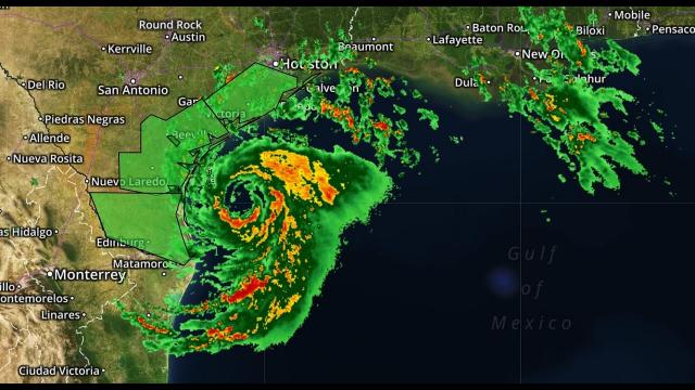
A tropical storm watch has been issued for much of the Texas coast from Port Mansfield to High Island, including Galveston and Corpus Christi. Tropical storm conditions are possible in this area by late Friday.
Tropical Depression Eight is tracking in a westerly direction across the Gulf of Mexico toward Texas. Satellite imagery shows this system is producing concentrated thunderstorms, and it could slowly strengthen before it reaches the coast either late Friday or early Saturday.
There is the possibility this system could strengthen into Tropical Storm Hanna before it reaches the Texas coast.
Typical of weaker systems, this one may be a bit lopsided, with most of its bands of showers and thunderstorms along and to the east of its path.
Parts of the northern and western Gulf Coast, particularly the Texas and Louisiana coasts, could see bands of showers and thunderstorms from this system through at least Friday or Saturday.
An inch or more of rain might fall in the above-mentioned areas through the weekend. Some locations could see 3 to 5 inches (locally up to 8 inches) of rain, from coastal Louisiana to the Texas coast and parts of south-central Texas, according to the National Hurricane Center.
Persistent winds blowing onshore to the east of the system may produce areas of high surf, rip currents and possibly some minor coastal flooding, particularly along the northern Gulf Coast. Keep this in mind if you're spending time on the beaches.
Localized flash flooding is possible in these areas, particularly where bands of rain focus on one area for several hours at a time.