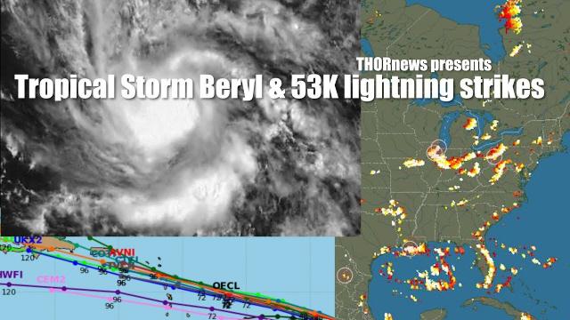
Tropical Storm Chris expected to be a Hurricane & Tropical Remnant Beryl
Description
God bless everyone.
T
https://www.paypal.me/THORnews
Tshirts
https://hitthebuttonbaby.com/
THORNEWS
PO BOX 35946
HOUSTON TEXAS
77235-5946
the excellent cranywxguy blog
http://www.stormhamster.com/entry/e070818.htm
The Surf Master
http://www.dabuh.com
data site
http://www.spaghettimodels.com/
https://www.accuweather.com/en/weather-news/tropical-trouble-third-atlantic-tropical-depression-storm-may-form-near-carolina-coast-this-weekend/70005413
Tropical storm, 3rd of Atlantic hurricane season, may brew near Carolina coast this weekend
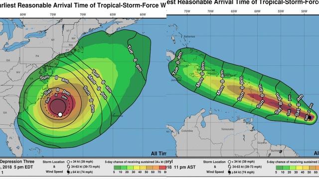
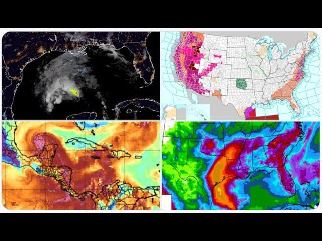
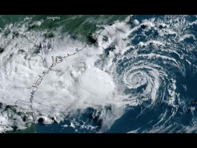
Warm waters of the Gulf Stream just off the Carolina coast will be a tropical trouble spot for days and may soon help fuel the formation of the third tropical depression and storm of the 2018 Atlantic hurricane season.
The third name on the list of tropical storms for this season is Chris.
People living or vacationing along the coast from South Carolina to North Carolina and southeastern Virginia should monitor the forecast for the risk of a near-coast tropical storm.
A currently disorganized batch of showers and thunderstorms between the Carolinas and Bermuda has begun to conglomerate and may develop spin this weekend.
Should a tropical depression or storm take shape, weakening steering winds may allow that feature to linger within a couple hundred miles of the coast of North and South Carolina for several days.The latest indications are that the feature may miss a period of southwesterly steering winds. These winds would guide the system to the northeast and out to sea.
Instead, light winds in the area later this weekend into early next week may cause a tropical depression or storm to meander over a couple-hundred-mile radius centered just off the Carolina coast. The meandering includes the possibility that the feature may wander onshore in the region.
With the scenario, "There is the potential for a few days of heavy rainfall that could result in flooding in parts of the Carolinas, especially in coastal areas, if the feature wanders close to shore," according to AccuWeather Storm Warning Meteorologist Brian Knopick.
Should the system meander offshore long enough over warm waters, there is a chance it could strengthen into a hurricane.
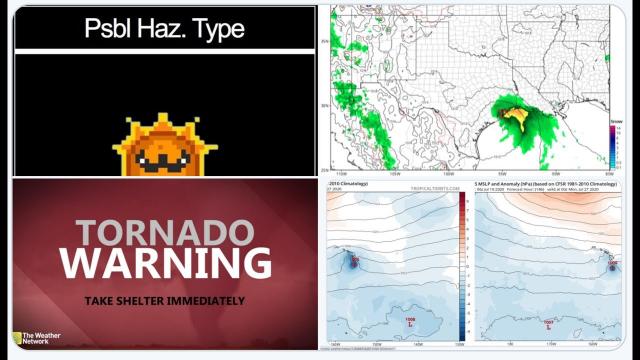
A strengthening tropical storm is likely to cause building seas and rough surf from northeastern Florida to southeastern Virginia this weekend into next week. Locally severe thunderstorms, including the risk of waterspouts spinning ashore, would also be a concern.
Coastal interests in the region should be on the lookout for changing sea conditions, including the risk of strengthening rip currents, this weekend into next week.
Small craft venturing outside of the protection of the Intercoastal Waterway could be at risk for a sudden tropical storm and building seas.
Cruise companies should closely monitor this developing situation and consider a path around the zone of potential tropical trouble.
Later next week, there is a chance the feature is picked up by another round of southwesterly winds that could pull the feature along the East Coast or out to sea.
Depending on how close to the coast the feature is, areas farther north along the mid-Atlantic, New England and Canada coasts could have an encounter with heavy rain and gusty winds from a tropical storm spanning next Thursday to Saturday, July 12-14.
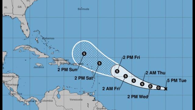
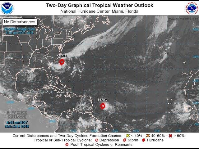
AccuWeather will continue to provide updates on this area of concern as well as Hurricane Beryl, which is scheduled to approach the western Caribbean Sea