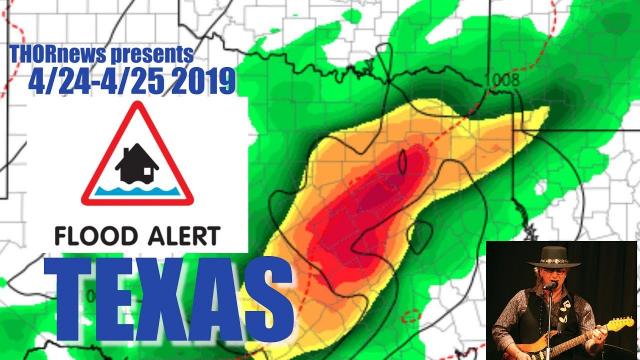
TEXAS RAIN & FLOODS & SEVERE WEATHER = 3/27 - 3/30/2018
Description
We've got a thick tube of rain that is going to be crawling over Texas from late Monday night and it won't let up until Friday. This could include a few tornadoes. Don't be scared, stay aware and alert and be prepared.
God bless everyone,
T
https://www.paypal.me/THORnews
https://www.patreon.com/thornews
@newTHOR on twitter
https://www.facebook.com/THORnewsthornews
THORNEWS PO BOX 35946
HOUSTON TEXAS
Articles on Storm
http://www.cbs19.tv/article/news/local/weather-update-flooding-rains-severe-weather-ahead/501-532288025
WEATHER UPDATE: Flooding Rains & Severe Weather Ahead
A warm and muggy, but mostly dry, Monday will be the last day of calm weather in East Texas before a slow moving, and heavy rain producing, system takes over. Threats range from severe weather to flooding rains. We are breaking down the risk below.
Tuesday & Tuesday Night:
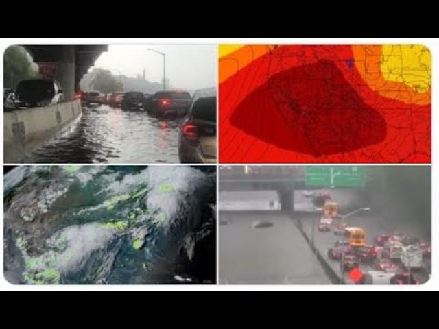
On Tuesday expect a widespread showers and storms around the region. During the daytime and afternoon hours rain will be less likely, but mostly cloudy skies and scattered rain showers and storms will be around the region
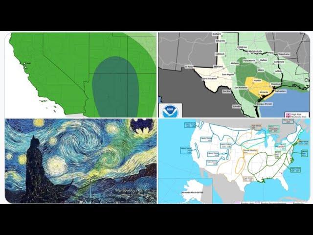
As we head into Tuesday night the first of several lines of showers and storms will move into East Texas. This line will bring heavy rain, the possibility for large hail, and at least some risk for damaging winds and an isolated tornado. The SPC has placed pretty much the entire CBS 19 viewing area under a slight risk for severe weather on Tuesday.
Wednesday & Wednesday Night:
Storms and heavy rain will be ongoing as Wednesday kicks off in East Texas. Expect showers and storms to last throughout the day on Wednesday, again dropping heavy rain and the possibility for some severe weather. Much of the CBS 19 viewing area will be under some risk for severe weather for the second day in a row, including a marginal risk for the Tyler and Longview region, with a slight risk further south for places like Lufkin and Nacogdoches. The main threat will once again be for flooding rains and large hail. Lower threats for damaging winds and the possibility for an isolated tornado.
Thursday:
Rain and storms will linger into the start of your Thursday, with the highest risk for heavy rain staying south and east of Tyler and Longview. While this is where the heaviest rain is expected to set up, do not think that means a dry start, as rain will still be possible around much of the viewing area on Thursday morning. Rain threats will decrease throughout the day, before we finally see dry weather return for Friday.
https://www.houstonchronicle.com/news/article/Heavy-rain-brings-threat-of-flood-12781479.php
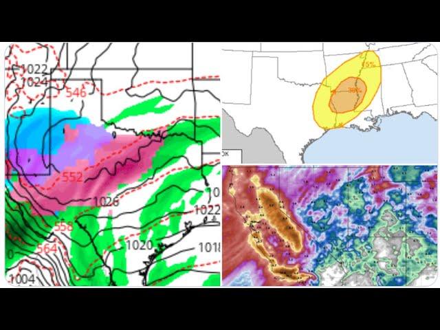
TULSA, Okla. (AP) — Heavy rain is forecast across parts of the central United States and the National Weather Service says there is a threat of flooding.
The weather service issued a flood watch Monday that will continue through Thursday night for northeast Oklahoma, northwest Arkansas, southern Missouri and southern Illinois.
The weather service says rainfall totals of 2 to 4 inches are expected with locally heavier amounts of 5 to 6 inches, particularly in Oklahoma and Arkansas.
Flash flooding will also be possible along streams, creeks and low lying areas