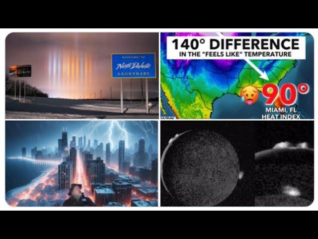
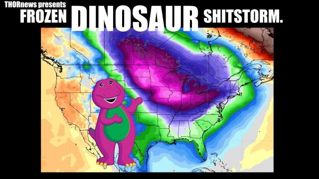
Storm FREEZE Storm Freeze round 2: The World Weather is getting 2019 Wild.
Description
Wave after Wave after Wave of Freeze then Storm then Freeze then Storm then freeze. Be prepared. I don't know how many rounds this is going to go.
God bless everyone,
T
https://www.paypal.me/THORnews
@newTHOR on twitter
https://www.facebook.com/thornewsgo
Tshirts
https://hitthebuttonbaby.com/
the crankywxguy blog
http://www.stormhamster.com/entry/e012219.htm
mike's weather page
http://www.spaghettimodels.com/
models
https://www.tropicaltidbits.com/analysis/models/
a look at the Sun
https://sdo.gsfc.nasa.gov/data/
https://weather.com/forecast/national/news/2019-01-21-arctic-cold-midwest-east-south-late-january
January's Bitterly Cold Finish Continues as More Rounds of Arctic Air Arrive in Midwest and East
After a brief moderation in temperatures, more arctic air will arrive late-week.
Parts of the Midwest could be colder than what was observed the last few days.
Early next week will feature yet another intrusion of bitterly cold air.
January's final days will have more rounds of bitterly cold air diving south across the central and eastern states, bringing widespread subzero temperatures to the Midwest while also keeping the South and Northeast shivering at times.
The next round of arctic air will seep into the northern Plains and upper Midwest Thursday and spread through the Great Lakes and Northeast by Friday, remaining entrenched through parts of those regions over the weekend.
Another widespread blast of arctic air will then sweep southward across the Midwest in the first half of next week.
For some cities, temperatures at times through the first half of next week will be even colder than what was just experienced a few days ago when this pattern change began.
Friday morning will be brutally cold in much of the Midwest, with lows dipping 20 to 30 degrees colder than average for late January.
Lows around 10 below zero are possible in Minneapolis/St. Paul and Des Moines, Iowa, the first such readings that cold so far this winter season in both cities.
Chicago and Milwaukee could experience their first subzero temperatures of the season on Friday morning.
The cold air will surge into the Northeast on Friday, yielding Saturday morning lows in the single digits above and below zero across the interior Northeast.
Despite the intense cold, few, if any, daily record lows will be threatened. Daily records are hard to set, in this, the coldest time of the year.
High temperatures will also plunge 10 to 20 degrees below average starting in the northern Plains Thursday and then spreading across the Midwest and Great Lakes Friday through Saturday.
Subzero high temperatures will grip parts of North Dakota, northern Minnesota and the Upper Peninsula of Michigan.
A large area from the upper Midwest into the Great Lakes is likely to see highs either in the single digits or teens Friday through at least Sunday. Subzero highs are possible closer to the Canadian border in those regions.
The next expansive round of arctic air will plunge southward from Canada into the Midwest during the first half of next week.
Since its arrival is still several days away, the timing and magnitude of this batch of cold air is still uncertain. But we still know it has the potential to be at least as potent as the cold air coming to the Midwest late this week.
Here's an early glimpse of morning low temperatures next Monday through Wednesday. Keep in mind the forecast is subject to change.
Temperatures dropped into the 30s and 40s below zero over the weekend in northern Minnesota, though no daily record lows were set.
Worcester, Massachusetts, tied its daily record low of minus 6 degrees Monday morning. The wind chill at that time was minus 34 degrees.
Muskegon, Michigan, set a daily record low of minus 12 degrees Monday morning, topping the previous record for Jan. 21 of minus 5 degrees.