Snow & Tornadoes & Atmospheric River for USA & CANADA & Wild Europe Weather
Description
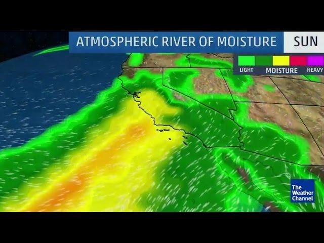
It's super wild weather season around the globe in this wave after wave after wave period of endless storms. Heads up California, you've got trouble brewing. Europe & The UK are getting slammed & most of the states in the USA can't catch too long of a break from the seesawing temperatures and storms.
God bless everyone,
T
https://www.accuweather.com/en/weather-news/largest-severe-weather-outbreak-of-the-season-to-strike-southern-central-us-into-tuesday-night/70004581
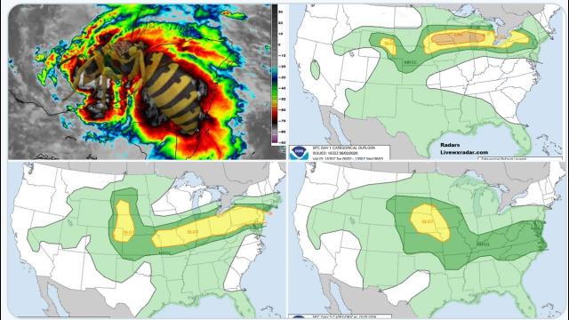
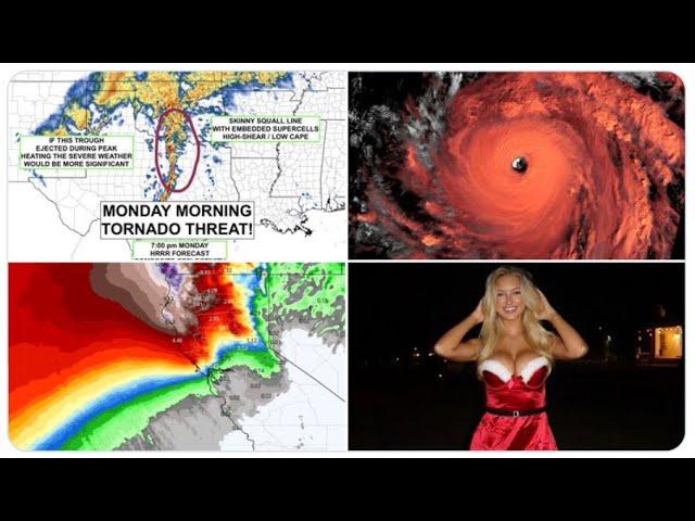
Largest severe weather outbreak of the season to strike southern, central US into Tuesday night
Residents from the Ohio Valley to the lower Mississippi Valley should brace for the year’s most extensive severe weather outbreak into Tuesday night.
Following tranquil conditions on Monday, the same storm system bringing a heavy, travel-disrupting snowstorm to the Upper Midwest will trigger severe thunderstorms to the south of its track.
The storm’s trailing cold front, separating May-like warmth to its east from arctic air to its north and west, will serve as the focal point for the storms.
“Areas across the Arklatex that faced heavy rain last week will deal with severe weather this week, with flooding being a primary concern,” said AccuWeather Lead Long-Range Meteorologist Paul Pastelok.
Erupting storms are likely to reach their maximum intensity by the early evening hours.
“Powerful thunderstorms containing damaging winds, hail, flooding downpours and isolated tornadoes will impact areas from northeastern Texas to central Indiana,” warned AccuWeather Senior Meteorologist Michael Doll.
Cities that are within the threat zone into Tuesday evening include Cincinnati; Louisville, Kentucky; Cape Girardeau, Missouri; and Little Rock.
“Thunderstorms will reach Houston; Shreveport, Baton Rouge and New Orleans, Louisiana; Memphis and Nashville; Jackson, Mississippi; and Columbus, Ohio, Tuesday evening before losing their intensity later Tuesday night,” Doll said.
The strongest storms may contain wind gusts as high as 80 mph and can bring down trees and power lines. Residents in the path of the storms should be prepared for roof and property damage, as well as power outages. People should move to an interior room or basement if a severe weather warning is issued.
Motorists traveling on interstates 10, 20, 40, 55, 70 and 75 through the central and southern United States can expect to face rapidly changing conditions.
Parts of the Ohio Valley states were bombarded by heavy rain which resulted in flooding earlier on Tuesday. While the area where heavy rain fell earlier in the day may take the edge off the severity of some of the storms, winds can still be locally strong and the potential for another round of flooding downpours will be elevated.
Downpours can briefly reduce visibility to near zero, and dangerous crosswinds can make it difficult to maintain control of a vehicle.
Although the risk for severe weather will be much less on Wednesday than what it was on Tuesday, a gusty line of showers and thunderstorms will still impact areas from the Florida Panhandle northward through the southern and central mid-Atlantic.
“The storms will be moving rapidly eastward in the form of a squall line,” Pastelok said. “Wind gusts of 40-50 mph will be possible across a large area.”
The storms should move through the Interstate-95 corridor from New York City to Washington, D.C., during the late morning and early afternoon, posing little if any impact to the morning and evening commutes.
Dry conditions should return to much of the eastern half of the country on Thursday, but winterlike air will rush back into these regions as winter refuses to relinquish its grip just yet.