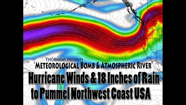
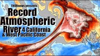
Red Alert! California & W Pacific Coast - RECORD Atmospheric River & Wind Inbound
Description
California just had a 5.3 Earthquake & is now facing a 2 day deluge of rain and wind that will cause major travel trouble, flash flooding & river flooding. We are looking at possibly a record storm here.
No Fear. Stay Aware. Be Prepared.
God bless everyone,
T
https://www.paypal.me/THORnews
THORNEWS PO BOX 35946
HOUSTON TEXAS
https://www.patreon.com/thornews
@newTHOR on twitter
https://www.facebook.com/THORnewsthornews
articles on situation
https://weather.com/forecast/regional/news/2018-04-03-atmospheric-river-heavy-rain-flooding-california
Atmospheric River to Pummel California With Heavy Rain and Possible Flooding Late This Week
At a Glance
Heavy rain could cause flooding, rockslides and mudslides in California late this week.
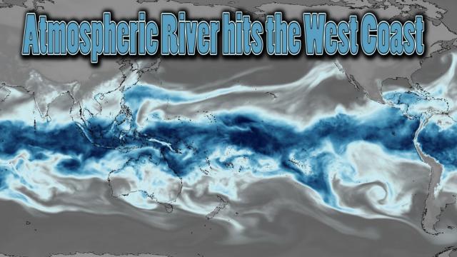
This will be fueled by an atmospheric river originating from the subtropical and tropical Pacific Ocean.
A storm system tapping into an atmospheric river of moisture will pummel California late this week, wringing out heavy rain that could potentially cause flooding, mudslides and rockslides.
This pipeline of moisture will be a classic "Pineapple Express," so named due to the origin of the moist plume in the central Pacific Ocean near Hawaii. The image below shows Friday's forecast of the moisture snaking from near Hawaii to the California coastline.
Helping to pull that moisture into California will be a strengthening area of low pressure pivoting northward offshore of the northwestern U.S. coastline.
Since this moist plume will be warm in nature, it will push snow levels to the highest peaks of the Sierra Nevada, likely 10,000 feet or above. That will result in melting snowpack, which in combination with rain, could cause flooding on streams and rivers.
Moderate to heavy rainfall is expected, mainly Friday into Saturday.
As a result, the National Weather Service has issued flood watches for the Sierra Nevada and much of central California.
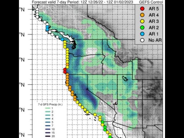
One interesting note is that the projected total water vapor transport during this upcoming atmospheric river event is greater than approximately 25 Mississippi Rivers worth of water, according to the Center for Western Weather and Water Extremes. This is actually the average amount of moisture that an atmospheric river transports.
Details on the exact impacts are still uncertain, but here's an overview of what to expect.
California
Timing: Showers will begin to arrive Thursday, but the most intense rain is expected from about midday Friday through midday Saturday.
Where: The heaviest rain will be focused on northern and central California. Lighter amounts are forecast in Southern California, including over recent burn areas, such as the Thomas Fire.
Rain amounts: Much of northern and central California can expect 1 to 3 inches of rain Thursday through Saturday. Foothill and mountain locations will see heavier totals in the range of 3 to 6 inches (locally 8 inches). Less than an inch of rain is expected in most of Southern California.
Flooding potential: Streams and rivers likely will rise rapidly given the heavy rain and snowmelt, potentially resulting in some flooding. Urban locations and other poor-drainage areas could also see flooding. The best chance of flooding will be between the San Francisco Bay Area northward to northern California and along the front range of the northern Sierra.
Landslides: As is typical during heavy rain events in California, rockslides and mudslides could occur. The burn areas from last October's wildfires in the North Bay region could be prone to mudslides depending on the intensity of rainfall in that region.
Snow: Snow levels will be high much of this event, initially preventing any travel impacts on passes. Colder air will filter into the Sierra Nevada Saturday night, allowing a few inches to accumulate before the precipitation ends.
View image on Twitter
Gusty winds are also possible across the region. In addition, a few thunderstorms also cannot be ruled out.
Oregon and Washington
The Pacific Northwest will also get periods of rain from this storm system Thursday through Saturday, but the largest concern of flooding will remain to the south in California.
Strong winds could also impact the coasts of Washington and Oregon. Depending on the track of the offshore low-pressure system, gusty winds are a possibility farther inland, as well.
Breaking: Earthquake hits off coast of Southern California, shaking felt in Los Angeles
A total of 1-3 inches of rain may pour down on the communities of Redding, San Francisco, Sacramento and Santa Rosa, heightening the risk of urban and flash flooding.
Airline passengers with flights through San Francisco International Airport should anticipate delays, while drivers along Interstate 5 can expect times of reduced visibility and slow travel.
Motorists should turn around and find an alternate route if standing water is encountered on the roadways. Some roads may be closed due to high water or debris.


Comments