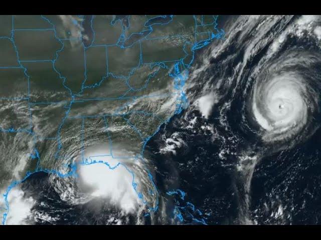
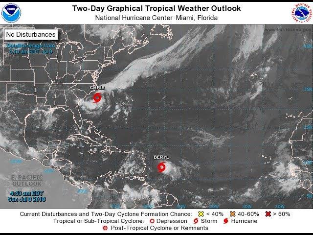
potential Hurricane Gordon is a flood machine & the Atlantic is look extremely dangerous,
Description
Gordon looks like a major rain maker with 70+ mph wind gusts possible, major storm surge and some dangerous flooding and storms go up to Canada with the Atlantic showing some wild signals. Don't be scared. Be prepared. Have a Plan. It's going to be a wild september to remember. Stay Cool God Bless everyone - T
https://www.paypal.me/THORnews
Tshirts
https://hitthebuttonbaby.com/
THORNEWS
PO BOX 35946
HOUSTON TEXAS
77235-5946
the crankywxguy blog
http://www.stormhamster.com/entry/e090418.htm
the wave master
https://dabuh.com/
https://weather.com/safety/hurricane/news/2018-09-03-tropical-storm-gordon-hurricane-gordon-forecast-us-gulf-coast
Tropical Storm Gordon Approaching Northern Gulf Coast, Expected to Make Landfall as a Hurricane Tonight; Hurricane, Storm Surge Warnings Issued
Tropical Storm Gordon's outer rainbands have reached the western Florida Panhandle.
Gordon will make landfall tonight along the northern Gulf Coast, likely as a hurricane.
A hurricane warning is in effect for the Alabama and Mississippi coasts.
Tropical storm warnings are posted for other portions of the northern Gulf Coast.
Storm surge warnings and watches are also in effect for a part of the northern Gulf Coast.
Heavy rain, storm-surge flooding and strong winds are expected from Gordon on the Gulf Coast.
The National Hurricane Center has issued a hurricane warning from the mouth of the Pearl River, Mississippi, to the border between Alabama and Florida.
A hurricane warning means hurricane-force winds (74-plus mph) are expected in the area indicated beginning this evening.
Tropical storm warnings are posted from west of the mouth of the Pearl River, Mississippi, to east of Grand Isle, Louisiana, including Lake Pontchartrain and Lake Maurepas, as well as from the Alabama-Florida border to the Okaloosa-Walton County line in Florida.
A tropical storm warning is typically issued when tropical-storm-force winds (39-plus mph) are expected in 36 hours or less – by this afternoon, in this case.
Residents along the northern Gulf Coast should rush preparations to completion before conditions begin deteriorating this afternoon.
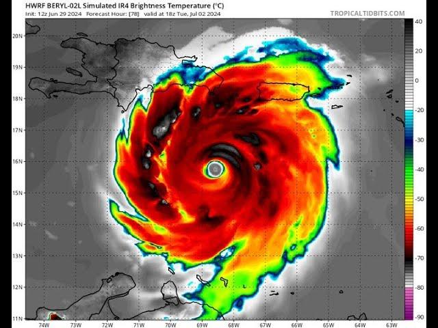
Gordon is currently centered about 130 miles south-southeast of Mobile, Alabama. Gordon's forward speed is relatively fast for a tropical cyclone, generally from 15 to 20 mph.
Gordon's heavier rainbands have reached the coast of the western Florida Panhandle but have cleared the rest of the Florida Peninsula.
The risk for isolated tornadoes will also increase late this afternoon into this evening from the western Florida Panhandle into southeastern Mississippi.
Gordon is forecast to be a Category 1 hurricane near the time it makes landfall on the northern Gulf Coast tonight, most likely along the Mississippi Gulf coast. Given a tropical cyclone's strongest winds are usually on its eastern side, that's why the National Hurricane Center issued a hurricane warning for parts of the Mississippi and Alabama coasts.
Rainfall
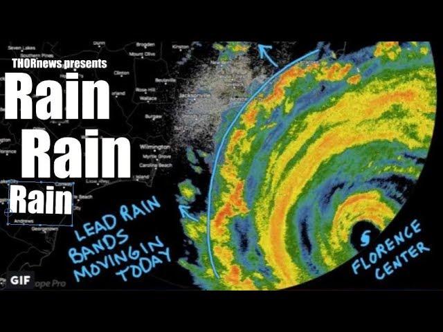
The heaviest rainfall from Gordon is expected to occur generally along or to the east of its track from the northern Gulf Coast to parts of Arkansas through Thursday. Localized totals up to 12 inches are possible in some areas.
Local flash flooding and some river flooding is a good bet in this region, spreading from south to north late today into Thursday, including the Mobile, Alabama, and Jackson, Mississippi, metro areas.
Flash flood watches have been posted by the National Weather Service for parts of southeastern Louisiana, southern and central Mississippi, far southeastern Arkansas, southwestern Alabama and the western Florida Panhandle.
Separate flash flood watches are in effect in southeastern Texas due to heavy rain from another weather system affecting that region.
That system produced street flooding in downtown Galveston, Texas, Monday morning, as can be seen in the tweet above.
Storm Surge, Rip Currents and High Surf
A storm surge warning has been issued from Shell Beach, Louisiana, to Dauphin Island, Alabama. This means in the hours prior to and after landfall, parts of this coastline will see a dangerous, life-threatening storm-surge inundation.
A storm surge watch continues from west of Shell Beach, Louisiana, to the mouth of the Mississippi River and from east of Dauphin Island, Alabama, to Navarre, Florida.
The deepest water will occur along the immediate coast near and to the east of the landfall location, where the surge will be accompanied by large waves, according to the National Hurricane Center.
The National Hurricane Center said water could reach the following heights above ground somewhere in the indicated areas if the peak surge occurs at the time of high tide:
Shell Beach, Louisiana, to Dauphin Island, Alabama: 3 to 5 feet
Navarre, Florida, to the Dauphin Island, Alabama, including Mobile Bay: 2 to 4 feet
Shell Beach, Louisiana, to the mouth of Mississippi River: 2 to 4 feet
Mouth of the Mississippi River to the Louisiana-Texas border: 1 to 2 feet