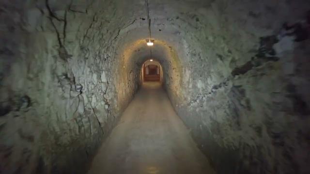
NEVER ENDING TUNNELS at Scraesdon Fort PLYMOUTH
Description
Scraesdon Fort, near the village of Antony, is one of several forts in South East Cornwall which formed part of the ring of forts surrounding Plymouth to protect Plymouth Sound and, in particular, the naval dockyard of Devonport from enemy naval attack. They were built as a result of a decision in Lord Palmerston's premiership to deter the French from attacking naval bases in the south of England.
Aerial view
Scraesdon Fort was designed in 1859 by Captain (later Maj General) William Crossman,[1] and was built by F Roach and Company, Plymouth.
Defensive caponier in the ditch around the fort
East wall and barrack chimneys
It was completed at a cost of £137,000. It is constructed in the Land Front, polygonal, near octagonal format. It has a dry ditch, and was designed to have twenty-seven 7-inch breech-loading guns on the ramparts.[2] By 1893 it mounted one 64 Pounder Rifled Muzzle Loading Guns, eight 7-inch Rifled Breech Loading (RBL) gun, two 32 Pounder Smooth Bore Breech Loading (SBBL) guns and two 5-inch Breech Loading guns.[3]
The upper level is 254 ft above mean sea level (AMSL) and the lower level is 173 feet AMSL.
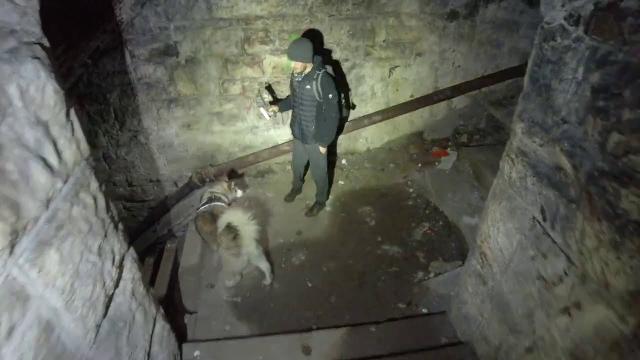
The fort was used by the MOD as a training barracks, but it is currently empty, derelict and overgrown. It was[when?] used to train Royal Navy Artificer Apprentices from HMS Fisgard and HMS Raleigh; it is occasionally used now by Royal Marine Commandos recruits as part of their final exercise, as well as being used by local Army Reserve units. The fort is also used for airsoft events on an ad hoc basis. It was Grade II listed in 1968.[4]
A military railway. used from 1893 to 1903, connected the fort with the River Lynher at Wacker Quay, near St. Germans. It also provided a link to the main fort on the Rame peninsula at Fort Tregantle. The railway ran underneath the metal bridge and down a gradient, then went underneath the current A374 road, and alongside Wacker Quay. The locomotive shed was extant on the quayside until the late 2000s,when it was removed by Cornwall CC, who had been using it as a highways depot. and other remnants of the railway can also be seen . There was also an extensive marshalling area next to the east wall of the fort.
My Instagram: https://www.instagram.com/mattswilli/
Facebook: https://www.facebook.com/groups/1228424283971624/
email me at me@thematthewwilliams.com
Also present on this explore were
Delelict Plymouth Unearthed - https://www.youtube.com/channel/UC9V8fRxaGBzQwXMPw5HOJAA
Equipment used:
DJI Mavic Zoom DRONE
Sony A7s ii with Samyang 14mm full frame lens
Dji Pocket 2 camera
Insta 360x R
Adobe Premiere Pro 2020
Ryzen 5950X
65GB Ram
Windows 10 (No Apple shiz here)
Nvidia RTX 3950 GFX
#Abandonedplaces #Abandonedplacesuk #urbexuk #undergroundbunker #urbexexploration #urbex_europe_ #urbextreme #urbexphotography #DerelictBuildings #frozenintime #timecapsule