Nasty Election Day Storm & more Major Flood Troubles USA + Atlantic Volcano Heat
Description
https://www.paypal.me/THORnews
The Cranky Weather Guy Hurricane Ida BLOG.
http://www.stormhamster.com/entry/ida.htm
Stay Cool.
T
@newTHOR on twitter
https://www.facebook.com/thornewsgo
the crankywxguy blog
http://www.stormhamster.com/entry/e110318.htm
the wave master
https://dabuh.com/
mike's weather page
http://www.spaghettimodels.com/
models
https://www.tropicaltidbits.com/analysis/models/
a look at the Sun
https://sdo.gsfc.nasa.gov/data/
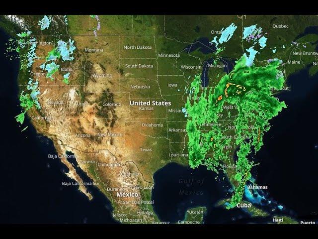
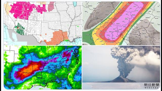
https://weather.com/storms/severe/news/2018-11-02-severe-thunderstorms-tornado-wind-hail-south-lower-mississippi-valley
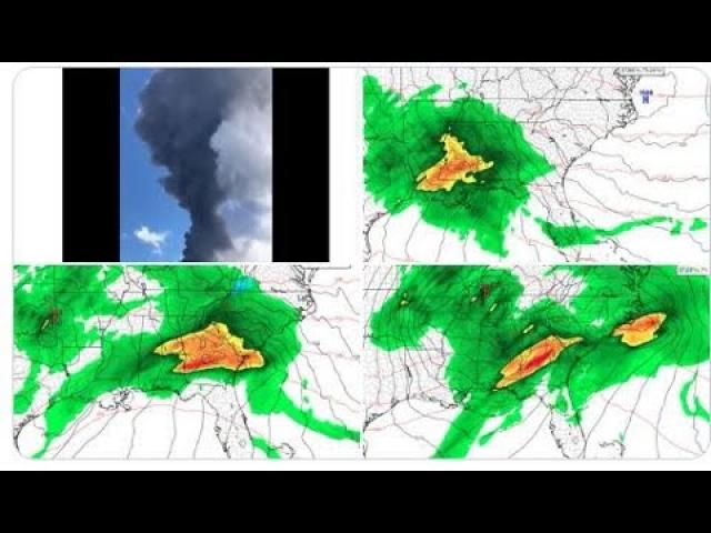
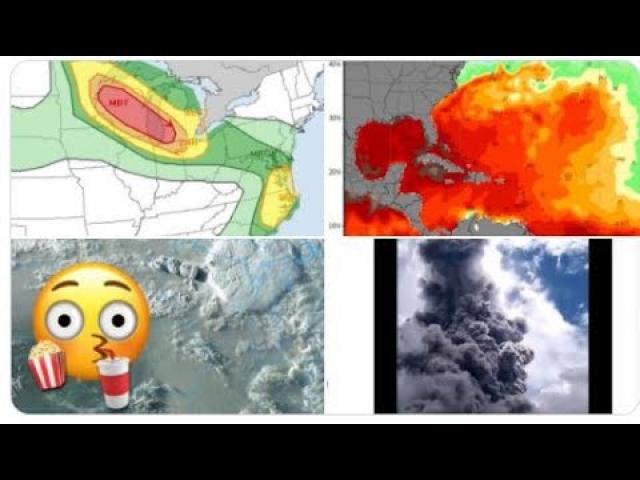
Severe Weather Outbreak, Tornado Threat Possible in South Early Next Week
Strengthening low pressure will track from the Plains to the Great Lakes early next week.
Severe thunderstorms are possible from parts of the South to the mid-Atlantic Monday and Tuesday.
The severe weather threat includes tornadoes, damaging winds and hail in areas hit this week.
A potential severe weather outbreak, including tornadoes, is possible early next week in the Lower Mississippi Valley, Southeast and possibly into the mid-Atlantic as an area of low pressure strengthens in the Midwest.
The jet stream pattern will bring a powerful southward plunge over the central U.S. early next week, helping to set the stage for an area of low pressure to strengthen as it tracks from the central Plains to the Great Lakes.
The cold front associated with this system will slide eastward through the Lower Mississippi Valley and into the East.
Ahead of this cold front, warm, moist air will surge northward, with dew points into the 60s as far north as portions of the Ohio River Valley and mid-Atlantic Monday and Tuesday. Some spots along the northern as far north as Jackson, Mississippi and Tuscaloosa, Alabama may see summer-like muggy dew points near 70 degrees – plenty moist for severe weather.
The strong upper-level winds and ample moisture will help create an unstable atmosphere in the South as the cold front approaches.
Strong to severe thunderstorms will likely be the result.
The National Weather Service in Jackson, Mississippi, noted Friday morning that "this setup seems to be very favorable for a more significant severe weather event overnight Monday into Tuesday."
The NWS office in Birmingham, Alabama, agreed, calling it a "potentially dangerous setup" and mentioning "it has the look of a classic severe weather outbreak."
Monday
Forecast: The threat of severe storms will develop late in the afternoon and continue overnight from eastern Texas and southeastern Oklahoma into north Georgia as well as northward into southern Illinois, southern Indiana and southwestern Ohio.
Threats: Damaging wind gusts, large hail and tornadoes are all concerns. A couple of strong tornadoes cannot be ruled out, especially in the lower Mississippi and Tennessee valleys into Monday evening. Locally heavy rainfall is also possible.
Tuesday
Forecast: Severe storms will spread from eastern Alabama into the Carolinas and northward into southern Pennsylvania.
Threats: Damaging winds, large hail and a few tornadoes are all possible, as well as locally heavy rainfall.
Many of the areas that could experience another round of severe weather in the week ahead just saw dangerous storms that spawned more than 40 confirmed tornadoes in six states.
There are still uncertainties in exactly where, when and how widespread the severe threat will be next week, given this is still several days away, so be sure to check back frequently for updates.
Second Severe Weather Season
Although the threat of tornadoes is generally highest in the spring, fall is considered the second severe weather season.
The highest threat of tornadoes in November is from eastern Texas into Alabama, which is included in the area to watch next week.
This is due to southward dips in the jet stream and cold fronts that track across the South and Midwest, where warmer temperatures and higher dew points are more likely to be found in November compared to areas farther north.
Just two years ago, November had more than 35 tornadoes from Louisiana to the Carolinas. Three of these tornadoes were rated EF3, and there were five deaths.
Another recent November tornado outbreak occurred on Nov. 17, 2013, when over 70 tornadoes tore across seven states. More than 50 of those tornadoes were in Illinois and Indiana. Two tornadoes from this outbreak were rated EF4 and three were rated EF3.
In late-November 1992, there was a tornado outbreak with more than 90 tornadoes across the South that killed 26.