NASA uses laser to measure Earth's 'ice loss'
Description
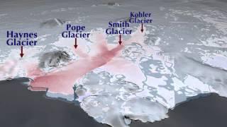
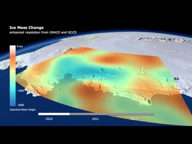
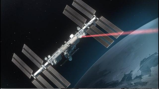
NASA’s Ice, Cloud and land Elevation Satellite 2 (ICESat-2) has used its laser instrument to make "precise, detailed measurements of how the elevation of the Greenland and Antarctic ice sheets have changed over 16 years," according to the space agency's Goddard Space Flight Center.
Credit: NASA Goddard Space Flight Center
Lead Producer: Ryan Fitzgibbons (USRA)
Lead Writer: Kate Ramsayer (Telophase)
Scientist: Thomas A. Neumann Ph.D. (NASA/GSFC)
Lead Scientists: Benjamin E. Smith (University of Washington Applied Physics Lab Polar Science Center)
Helen Amanda Fricker (Scripps Institution of Oceanography, University of California, San Diego)
Alex S. Gardner (NASA/JPL CalTech)
Lead Visualizer: Kel Elkins (USRA)
Lead Editor: Ryan Fitzgibbons (USRA)
Lead Narrator: LK Ward (USRA)
Lead Animator: Adriana Manrique Gutierrez (USRA)
Videographer: Jefferson Beck (USRA)