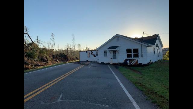
Major Tornado Trouble USA! The storm continues to move East.
Description
https://www.paypal.me/THORnews
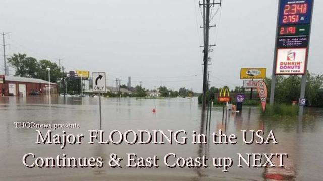
This storm has produced 18 Tornadoes already and is on the move for another day of severe weather. Tornadoes, Hail. Wind, Rain, Floods and a lot of lightning.
God bless everyone.
T
THORNEWS PO BOX 35946
HOUSTON TEXAS
77235-5946
https://www.accuweather.com/en/weather-news/severe-storms-to-blast-central-us-for-3rd-consecutive-day-slice-into-northeastern-us-warmth/70004852
Severe storms to blast central US for 3rd consecutive day, slice into northeastern US warmth
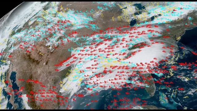
For the third consecutive day, severe weather will take aim at the central United States into Thursday night as violent storms also slice into the warmth in the Northeast.
Residents across the Plains will not have much time to cleanup from the severe weather that spawned tornadoes and produced dozens of reports of wind and hail damage Tuesday into Wednesday.
"Areas from around northern Missouri, including Kansas City, and southern Iowa have seen strong to severe storms move through each day since Tuesday, and will face another threat on Thursday," AccuWeather Meteorologist Jake Sojda said.
While a line of thunderstorms with hail and damaging winds are crossing north-central Texas on Thursday morning, severe weather will become more numerous as the day progresses from central Texas to Iowa and Illinois.
Residents from Tyler, Texas, to Tulsa, Oklahoma; Kansas City, Missouri; Des Moines and Davenport, Iowa; and Chicago should closely monitor weather alerts and be ready to seek shelter.
However, some areas could be spared from the severe weather where morning clouds and rain linger the longest.
All modes of severe weather are expected into Thursday evening with damaging winds, large hail, flooding downpours and tornadoes.
The violent thunderstorms will also endanger motorists planning to travel on stretches of interstates 20, 35, 40, 44, 55, 70, 74 and 80. Ground stops may affect airline travelers.
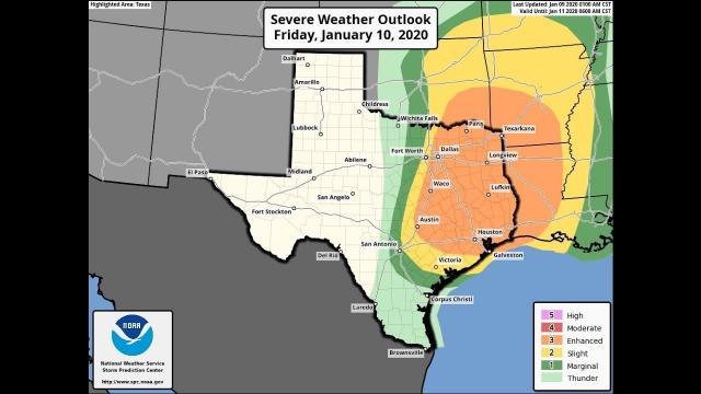
Another round of severe thunderstorms and flooding may target Texas on Friday as the rest of the central U.S. finally quiets down.
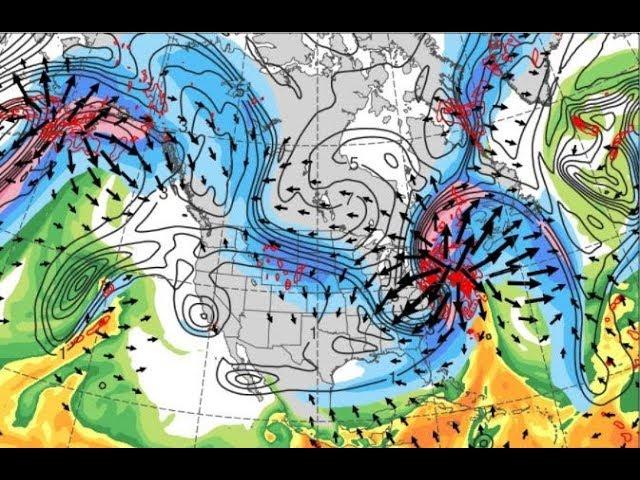
Severe weather to slice into warmth in the Northeast
Unlike the past couple of days, severe weather on Thursday will not be limited to the central U.S. Strong thunderstorms will also erupt from around Lake Erie to southern New England.
"As heat and humidity continue to build into the Northeast, a front will serve as the focus for thunderstorms with gusty winds and hail," Sojda said.
The winds can be strong enough to cause localized damage in and around Detroit; Erie, Pennsylvania; Syracuse, Binghamton and Albany, New York; and eastward to Boston. The strongest thunderstorms may rattle the far northern and western suburbs of New York City.
Anyone enjoying the warmth outdoors ahead of the storms should seek shelter as soon as thunder is heard to avoid being struck by lightning.
"Even in these areas, a brief tornado or two cannot be ruled out," Sojda said.
Overnight, the danger for damaging winds and hail is expected to wane in the Northeast. However, Sojda is concerned for the flooding risk to increase.
"Thunderstorms may then ‘train’ (repeat) along the front overnight in the Northeast, elevating the threat for flash flooding," he said.
The risk for damaging winds will not end as the sun rises on Friday.
"The eastern Ohio Valley through the Northeast will have a repeat risk for thunderstorms with damaging wind gusts on Friday as a cold front pushes through," Sojda said.
Downpours will also be produced and can lead to flooding in areas that receive heavy rain into Thursday night.
The areas at greatest risk will lie across the eastern Great Lakes and the northern Appalachians. This includes Cleveland, Ohio, as well as Erie, Buffalo, Syracuse and Albany.
Wind damage may not be confined to thunderstorms. Especially downwind of the eastern Great Lakes, non-thunderstorm winds can reach 50 mph on Friday. Residents in Buffalo and Watertown, New York, will face an increased threat for power outages and tree damage.
The severity of the thunderstorms is expected to lessen prior to reaching the I-95 corridor. However, outdoor plans can still be impacted due to lightning concerns and downpours from Boston to New York City, Philadelphia and Washington, D.C.
The front will work to trim the warmth out of all of the Northeast by the start of the weekend, but there will still be opportunities for rain and thunderstorms to spoil outside plans across parts of the region Saturday into Sunday.


Comments