MAJOR Hurricane Trouble brewing for East Coast & Gulf of Mexico & Hawaii
Description
It's fixing to be on like Donkey Kong. Don't be scared. Be Prepared.
God bless everyone,
T
https://www.paypal.me/THORnews
Tshirts
https://hitthebuttonbaby.com/
https://www.facebook.com/thornewsgo
THORNEWS
PO BOX 35946
HOUSTON TEXAS
77235-5946
@newTHOR on Twitter
the crankywxguy blog
http://www.stormhamster.com/entry/e083118.htm
the wave master
https://dabuh.com/
https://www.accuweather.com/en/weather-news/tropical-threat-may-evolve-near-florida-us-gulf-coast-during-early-september/70005946
Tropical threat may evolve near Florida, US Gulf Coast during early September
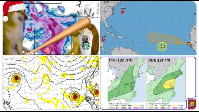
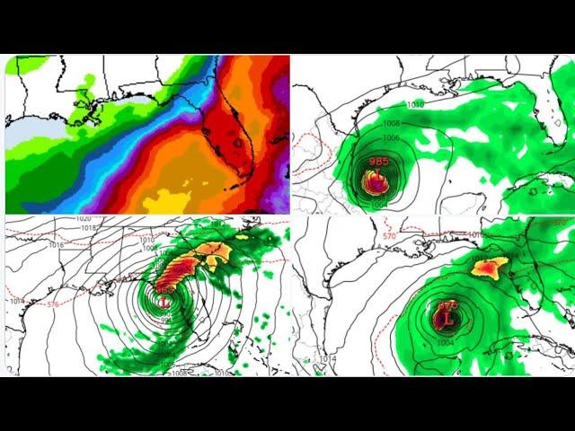
A tropical disturbance that brought flooding downpours to parts of the Caribbean this week may organize and strengthen into next week while crossing Florida and the Gulf of Mexico.
A tropical disturbance, known as a tropical wave, was sputtering around the islands of Puerto Rico and Hispaniola on Friday.
This tropical wave brought torrential downpours over the Lesser Antilles in recent days and caused localized flooding in some communities, including in Tortola, part of the British Virgin Islands, late Thursday.
Wind shear was preventing the feature from developing this week and may prevent rapid organization this weekend.
Wind shear is the increase in wind speed with altitude and over geographical distance. Strong wind shear can prevent a tropical storm from forming or may cause a hurricane to weaken.
"At this time, the feature has no circulation in the lowest layer of the atmosphere, so rapid development prior to crossing the Florida Straits or South Florida is unlikely," according to AccuWeather Hurricane Expert Dan Kottlowski.
Localized torrential downpours and gusty thunderstorms are in store for these locations as the feature moves along to the west and northwest over the next several days.
Puerto Rico, the southeastern Bahamas, central Cuba, Haiti, the Dominican Republic and the Turks and Caicos will be mostly affected by the downpours and squalls through Saturday.
Sunday and into Labor Day, South Florida, northwestern Cuba and the northwestern Bahamas can expect flooding showers and locally gusty thunderstorms to be most prevalent.
Early next week, the feature is projected to reach the eastern Gulf of Mexico.
Rounds of downpours will continue to occur well ahead of the feature across a large part of the Gulf coast due to a tropical flow of moisture through the holiday weekend.
Not only may the downpours interrupt a day at the beach, they may also lead to urban and low-lying area flooding to the Interstate 10 corridor and beyond.
People venturing into the water for a last dip in the ocean during the summer season should be wary of the risk for strong and frequent rip currents.
"If wind shear were to drop off as the feature moves over the Gulf of Mexico next week, development and strengthening may take place," Kottlowski said.
If the feature remains weak and poorly organized, then it is more likely to travel on a more westerly path toward Texas.
If the feature develops into a tropical storm or hurricane, then it is more likely to turn more to the north and possibly reach the upper Gulf coast somewhere from the Florida Panhandle to Louisiana.
All interests from Florida to Texas should monitor this feature, especially during next week when the risk of development may increase substantially.
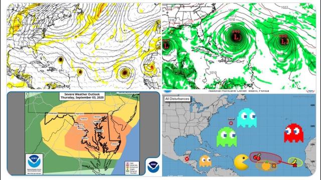
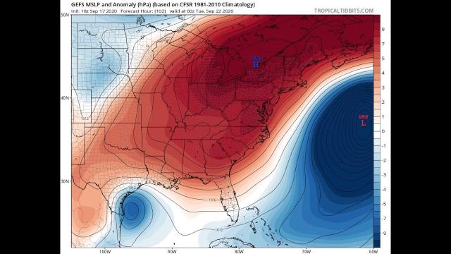
Even if this system were not to strengthen, there will be other areas of concern over the Atlantic basin in the coming weeks. This includes a budding system near Cabo Verde.
The peak of the Atlantic hurricane season is Sept. 10.
"It is possible we could have anywhere from one to perhaps as many as four organized tropical systems across the Atlantic basin by the end of the first week of September," Kottlowski said.
Two additional robust tropical waves are forecast to move westward off the coast of Africa over the next week.
Download the free AccuWeather app to see tropical forecasts with Superior Accuracy™ and to receive the earliest alerts on tropical hazards.