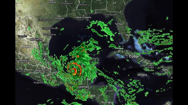
Hurricane watch! Tracking PTC9! Floods for MidEast USA! Mexico Volcano! Mars Volcano?
Description
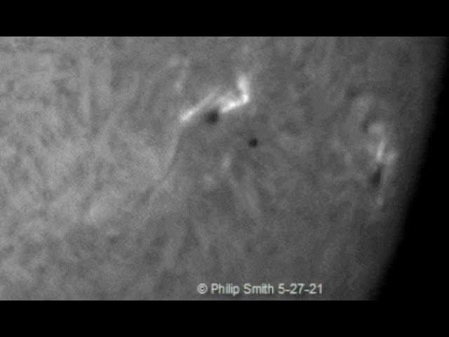
I'm watching this thing like a hawk. Still lots of unanswered questions.
God bless everyone,
T LEWISON
5430 BIRDWOOD RD. #416
HOUSTON TEXAS 77096
https://www.paypal.me/THORnews
https://venmo.com/TEric-Lewison
$THORnews on CashApp
https://www.patreon.com/thornews
https://weather.com/storms/hurricane/news/2020-07-29-potential-tropical-storm-isaias-forecast-florida-caribbean
Tropical Storm Warnings Issued For the Caribbean, Including Puerto Rico; Isaias May Impact Florida This Weekend
A broad area of low pressure will likely become Tropical Storm Isaias in the eastern Caribbean.
Tropical storm warnings and watches are posted from the Leeward Islands to the southeast Bahamas
Heavy rain is expected through Thursday from the Leeward Islands to Puerto Rico and Hispaniola.
The rainfall could trigger flash flooding and mudslides.
The forecast for this system beyond the Caribbean is highly uncertain because of multiple factors.
First impacts could be felt in parts of Florida as soon as this weekend, but it's too early to know any details.
Tropical storm warnings have been issued for parts of the Caribbean, including Puerto Rico, as a disturbance expected to become Tropical Storm Isaias could eventually approach Florida this weekend.
The National Hurricane Center (NHC) dubbed this system "Potential Tropical Cyclone Nine" Tuesday, a procedure allowing the NHC to issue advisories, watches and warnings for a system that hasn't yet developed, but poses a threat of tropical storm-force or hurricane-force winds to land areas within 48 hours.
The latest watches and warnings are shown in the map below, from the Leeward Islands to the southeast Bahamas. A warning means tropical storm conditions are expected in the next 36 hours. A watch means tropical storm conditions are possible within 48 hours.
While this large system is slowly consolidating its thunderstorms, it has not yet developed a well-defined closed low-pressure center.
Once it develops enough thunderstorms near a closed low-pressure center, this system will be designated Tropical Storm Isaias (ees-ah-EE-ahs).
Below is a look at what we know about the forecast for any potential U.S. and Caribbean impacts.
Florida, Southeast U.S. Concern?
The NHC projected path below shows that this system could be located near or on either side of the Florida Peninsula by this weekend. However, this forecast is not as straightforward as it might seem.
There are a number of reasons for this uncertainty, which is rather common for tropical cyclones heading into the Caribbean Sea.
First, this system is in a formative state, without a clear surface low-pressure center.
Eventually, one cluster of thunderstorms should begin to take over in this large disturbance. Where that occurs is uncertain, and could cause a significant shift to the position, and, hence, the forecast path of this system.
In addition to the uncertain track forecast, this system has multiple obstacles to combat with the next few days.
One of those obstacles is the expected track of this system over the mountainous terrain of Hispaniola (Dominican Republic and Haiti). That land interaction could disrupt the system, at least for a time.
This system may also have to battle unfavorable upper-level winds - producing what meteorologists refer to as wind shear - and/or dry air along its Caribbean and Bahamas track. These are both nemeses of tropical cyclones.
The bottom line is that it's too early to precisely determine this system's future track and intensity, especially with regard to the mainland U.S.
If this system were to threaten the mainland U.S., it could do so first in the Florida Peninsula as soon as this weekend.
However, the possible outcomes with regard to the mainland U.S. ranges from a track into the eastern Gulf of Mexico to a track over at least parts of the U.S. East Coast to a near miss of the Eastern Seaboard.
Residents along the Southeast and Gulf Coasts should monitor the progress of this system closely and have their plans ready to go, in case they're needed.
Caribbean Forecast
This system is tracking through the Leeward Islands with heavy rain and gusty winds right now.
It should then spread rain and gusty winds into Puerto Rico and the Virgin Islands beginning Wednesday afternoon and pass near or over Hispaniola Thursday.
While some rain is needed to help the long-term drought in eastern and southern Puerto Rico and the Virgin Islands, locally heavy rainbands may lead to dangerous flash flooding and mudslides, particularly in higher terrain.
The NHC says rainfall totals of up to 10 inches are possible in these islands.
Hispaniola's mountainous terrain will also make it very prone to flooding and mudslides. Locally up to 8 inches could fall in some areas through Thursday.