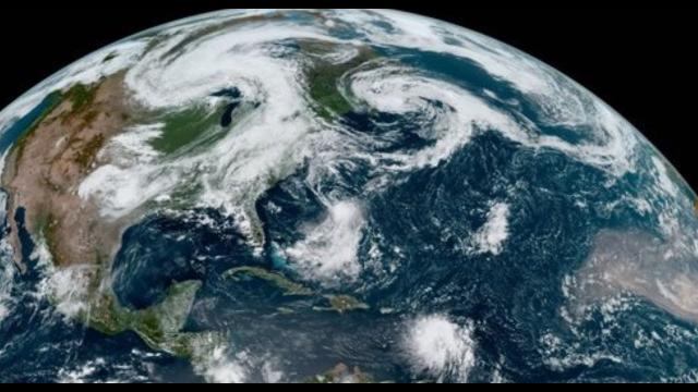
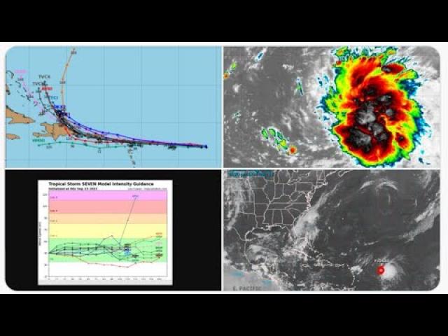
Hurricane Dorian a Danger to Puerto Rico, Dominican Republic & Florida
Description
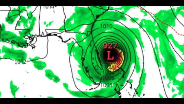
a Category 4 Florida Hurricane landfall
is possible if #Dorian threads the needle between
Puerto Rico and the Dominican Republic.
Be ready for a Nasty hurricane season.
God bless everyone,
T LEWISON
5430 BIRDWOOD RD. #416
HOUSTON TEXAS 77096
HTTPS://WWW.PAYPAL.ME/THORNEWS
www.venmo.com/TEric-Lewison
$THORnews on CashApp
https://www.patreon.com/thornews
https://weather.com/storms/hurricane/news/2019-08-24-tropical-storm-dorian-hurricane-caribbean
Tropical Storm Dorian to Strike Windward Islands With Heavy Rain and Strong Winds
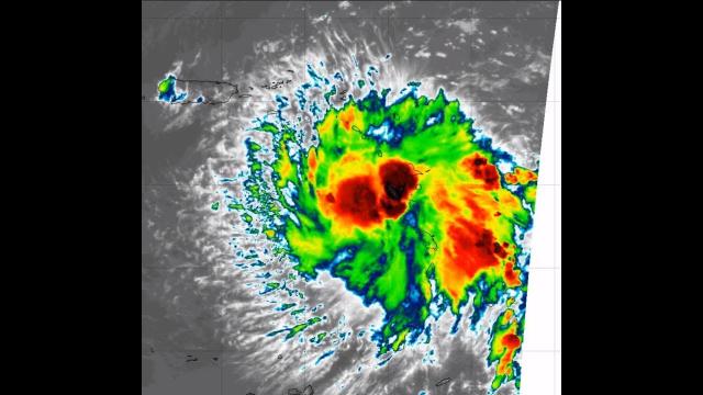
Tropical Storm Dorian is tracking toward the Caribbean.
It is forecast to reach the Windward Islands as a tropical storm by tonight.
Tropical storm watches and warnings have been issued.
Its future is uncertain late in the week.
Tropical Storm Dorian is headed toward the Windward Islands where it will bring heavy rain and strong winds later Monday into Tuesday, but has an uncertain future beyond that in the Caribbean Sea.
Dorian is currently centered about 200 miles east-southeast of Barbados, moving steadily west at 10 to 15 mph.
A tropical storm warning has been issued for Barbados, St. Lucia, and St. Vincent and the Grenadines. That means tropical storm conditions (39-73 mph winds) are expected there within the next 36 hours.
Tropical storm watches are in effect for Dominica, Martinique, Grenada, Saba and St. Eustatius. Tropical storm conditions are possible in those areas within the next 48 hours.
On its predicted path, Dorian will move through the Windward Islands in the southern Lesser Antilles late Monday through Tuesday.
Dorian is most likely to be a tropical storm when it pass through those islands, but wind impacts will vary greatly from one island to the next due to the small size of this system. Higher elevations will receive the strongest wind gusts.
Tropical storm-force winds may approach Barbados by Monday evening and the rest of the Windward Islands by dawn Tuesday morning.
Flooding rainfall is possible near where Dorian tracks through the Windward Islands. Rainfall totals of 2 to 4 inches (locally 6 inches) are possible in portions of the Lesser Antilles.
Dorian will then move through the eastern Caribbean Sea and turn more toward the northwest during the middle portion of this week.
Its intensity forecast later this week remains highly uncertain.
Sea surface temperatures are warm ahead of the system, favoring intensification.
However, the mid-level atmosphere is moderately dry, and and that may keep a brake on any rapid strengthening. If the storm can develop an inner core of moisture and keep it walled off from the dry air, more sustained intensification would be possible.
Wind shear, the change in wind speed and direction with height, is also expected to increase over the eastern Caribbean Sea. Shear can disrupt tropical storms and hurricanes by tilting the circulation or blowing thunderstorms away from the center.
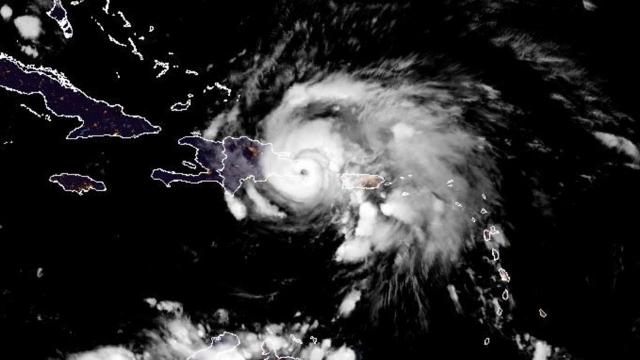
The latest forecast from the National Hurricane Center (NHC) calls for Dorian to be a hurricane as it approaches Hispaniola and Puerto Rico later this week. Again, the intensity forecast is very challenging.
It's too soon to know what impacts Dorian might bring later this week to Puerto Rico, the Virgin Islands and Hispaniola. Locally heavy rain is at least possible in parts of those islands.
Possible interaction with Caribbean islands that could shred the circulation adds yet more uncertainty to Dorian's forecast.
It's too soon to know if Dorian will bring significant impacts to the Bahamas or some part of the mainland U.S. coastline.
As of the now, the NHC forecasts Dorian to be a tropical depression as it moves through the Bahamas late this week, but that forecast is subject to change.
Check back with us at weather.com for the latest on this system.
Prime Time and a Prime Location
Dorian is located in the heart of the deep Atlantic tropics, also known as the Main Development Region. Tropical storms and hurricanes are most common in this region from late July into September as tropical waves move off Africa and into the Atlantic.
Such tropical waves emerging off the west coast of Africa are often referred to as Cabo Verde systems because many of them pass near the Cabo Verde Islands.