Hurricane Barry will be a MAJOR danger to Louisiana & multiple states along the coast.
Description
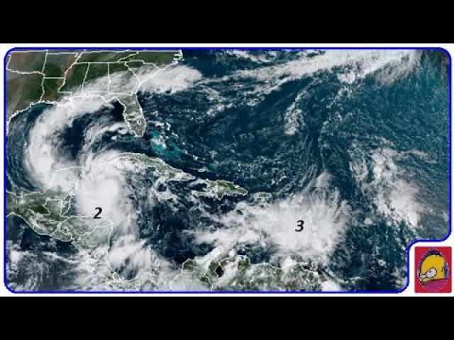
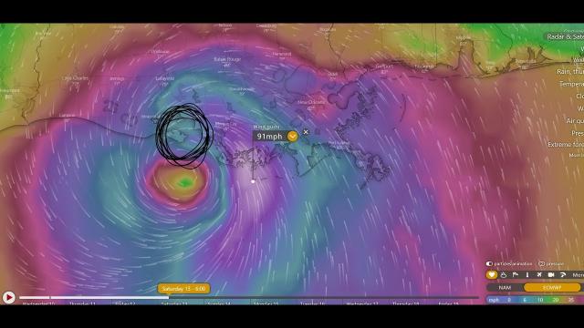
We've got three more days of this storm sitting and spinning and developing off of the Coast. This is like Hurricane Harvey part 2 but worse 210 miles East over blazing hot waters. Take this very seriously. Stay aware. Have a plan.
God bless everyone,
T
https://www.paypal.me/thornews
mail me stuff at
5430 Birdwood Rd. #416
Houston, Texas 77096
https://weather.com/storms/hurricane/news/2019-07-05-tropical-disturbance-gulf-of-mexico-southeast-coast
A Tropical Depression or Tropical Storm Will Likely Form in the Gulf of Mexico; Here's What We Know
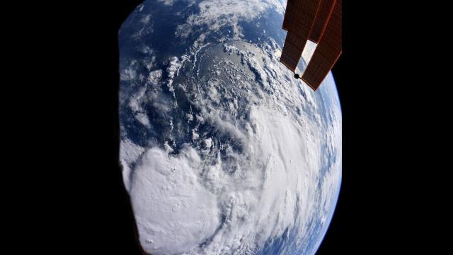
A broad area of low pressure has emerged over the northeastern Gulf of Mexico.
This is an area where July tropical storms have formed in the past.
A tropical depression or tropical storm is likely to form within the next day or two.
Tropical storm, hurricane and storm-surge watches could be required for a portion of the northern Gulf Coast on Wednesday.
The future track and intensity of this potential tropical system remain a bit uncertain.
Heavy rain leading to flash flooding is a threat along the northern Gulf Coast, dependent on the exact track.
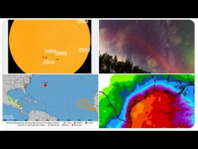
Low pressure in the northeastern Gulf of Mexico is increasingly likely to develop into a tropical depression or tropical storm within the next day or two and then head toward the Gulf Coast this weekend, bringing heavy rain, winds and some coastal flooding, though the exact track of the system remains uncertain.
The National Hurricane Center (NHC) has assigned a 90% chance of tropical development, possibly as soon as late Wednesday or Thursday while the system moves westward across the northern Gulf of Mexico.
This area of interest has been deemed Invest 92L by the NHC. That's a naming convention used to identify weather systems that could potentially develop into a tropical depression or storm.
If the circulation center of this area of low pressure becomes better defined with concentrated shower and thunderstorm activity, then the NHC could deem it a tropical depression or storm by late Wednesday or Thursday.
The NHC mentioned tropical storm, hurricane and storm-surge watches could be required for a portion of the northern Gulf Coast on Wednesday.
An Air Force Reserve Unit reconnaissance aircraft is scheduled to investigate the Gulf low Wednesday afternoon if enough thunderstorms flare up around it that soon.
Recent computer model forecast guidance suggests the area of low pressure should be steered westward or west-northwestward through the northern Gulf of Mexico in the general direction of Louisiana and East Texas. That movement would be induced by the clockwise flow around a high-pressure system centered in the southern Rockies and Plains.
The system would then be drawn inland this weekend somewhere from East Texas into the lower Mississippi Valley through a gap between the aforementioned Plains high-pressure system and an extension of the Bermuda high over the Bahamas and the Florida Peninsula.
The intensity of the system remains uncertain, ranging from either a tropical depression to a tropical storm, which would be named "Barry." There are a few model solutions which suggest it could even reach low-end hurricane status before landfall this weekend, but that seems to be a small chance at this time.
For now, residents along the Gulf Coast from East Texas to the western Florida Panhandle should simply monitor the forecast, knowing that conditions could change. It's also a good time to make sure your preparedness kit is ready to go for the rest of hurricane season.
Potential Impacts
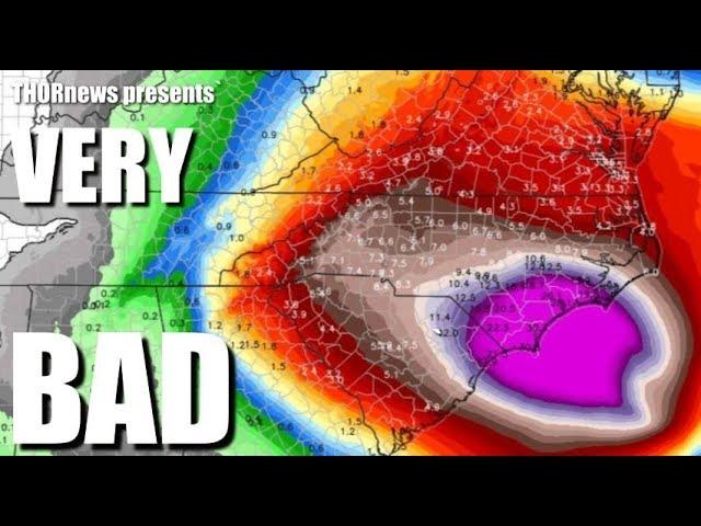
Regardless of whether a tropical depression or storm forms, a threat of heavy rain and flash flooding is in play late this week into this weekend somewhere near and inland from the Gulf Coast.
Typically, these types of tropical depressions or storms produce their heaviest rain along and to the east of their tracks. This suggests heavy rain is possible from the upper Texas coast to southern Louisiana, southern Mississippi, southern Alabama and parts of the Florida Panhandle.
How much rain falls depends on how fast the system moves, rather than the intensity of the tropical system itself.
For now, this system does not appear to be the type of stalling tropical cyclone to the magnitude of either Florence in 2018 or Harvey in 2017 that produced prolific rainfall.
However, areas of heavy rain are likely to persist over parts of the Deep South well after the center moves ashore and may persist into early next week.
Onshore winds should eventually lead to dangerous rip currents along parts of the northern and eastern Gulf Coast.