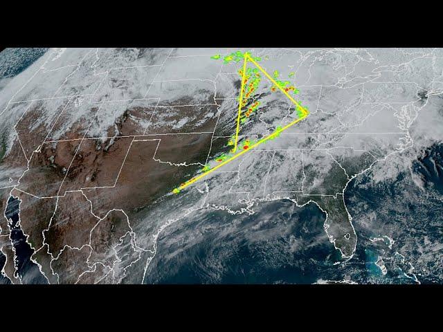
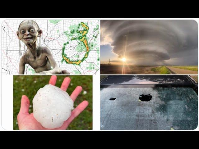
Giant HAIL & Big TORNADO 3 Day Storm Event Begins in Texas Tomorrow & heads East
Description
The Hail could be scary sized tomorrow.
Stay indoors DFW.
God bless everyone,
T
https://www.venmo.com/TEric-Lewison
https://www.paypal.me/thornews
send mail to
5430 Birdwood Rd. #416
Houston, Tx 77096
latest crankywxguy blog
http://www.stormhamster.com/entry2/e041619.htm
videos
https://weather.com/storms/severe/news/2019-04-12-severe-threat-tornado-wind-hail-mid-april
Three-Day Threat of Severe Thunderstorms, Including Tornadoes, in the Plains, South, Midwest and East Begins Wednesday
Yet another multi-day severe weather threat looms this week.
It begins in the Plains and parts of the Midwest Wednesday.
Severe thunderstorms will then spread to the Ohio Valley and Deep South Thursday.
By Friday, the severe threat should reach the East.
Damaging winds, hail, tornadoes and flooding rain are all threats.
This could include areas hit by severe weather this past weekend.
Following a severe weather outbreak this past weekend, another multi-day siege of severe thunderstorms and heavy rain is expected to begin Wednesday in the Plains before spreading into parts of the South, Midwest and East.
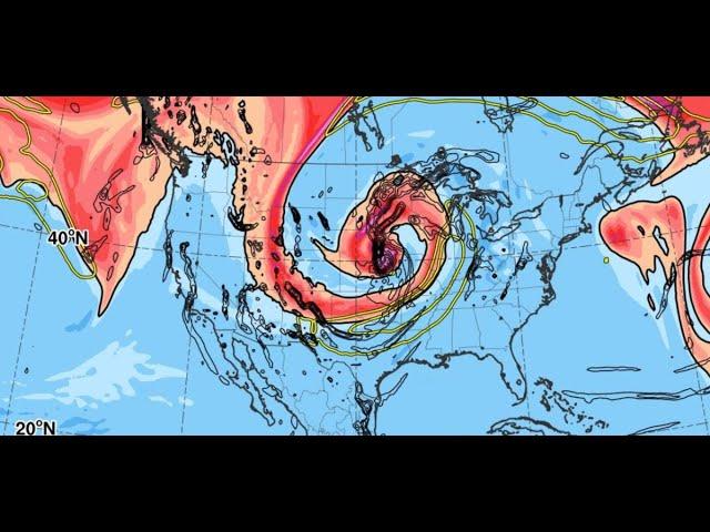
Another rather vigorous southward plunge of the jet stream will pivot out of the Desert Southwest into the Plains Wednesday, then lumber through the rest of the South and East through the end of the week.
In response to that active jet stream, a low-pressure system will develop in the Plains, importing increasingly warm and humid air from the Gulf of Mexico ahead of it.
As a result, we expect numerous thunderstorms to develop in the Plains, Midwest and South starting Wednesday, spreading eastward Thursday and Friday.
While key details such as exact timing and the magnitude of the event remain uncertain at this time, damaging thunderstorm winds, hail, tornadoes and some flooding rainfall are all threats.
Here's a look at the day-by-day overview of what we know right now.
Wednesday
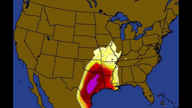
After a brief lull, severe thunderstorms are expected to flare up once again Wednesday afternoon, particularly in portions of Oklahoma, Texas and western Arkansas. Large hail, damaging winds and tornadoes are all threats there, although large hail appears to be the main threat.
Other severe thunderstorms are possible Wednesday from parts of Kansas to the Midwest, with large hail being the primary threat, although damaging winds and locally flooding rain are also possible.
Severe thunderstorms may sweep into the mid-Mississippi Valley southward into Louisiana and southeastern Texas Wednesday night.
Heavy rainfall may also result in flash flooding.
Thursday
Thunderstorms will be ongoing early Thursday and will continue into Thursday night.
Severe thunderstorms are most probable Thursday in the Deep South from the lower Mississippi Valley to parts of the Florida Panhandle, Alabama and Middle Tennessee. At least a few severe storms are possible farther north into parts of the Ohio Valley.
This activity may be in the form of a long line of thunderstorms with damaging winds, hail and perhaps some tornadoes.
Parts of Louisiana and Mississippi appear to have the greatest chance for tornadoes Thursday, particularly if any supercells develop ahead of the main line of thunderstorms.
This line of storms may sweep eastward Thursday night into the Ohio Valley, southern Appalachians and Tennessee Valley.
Locally heavy rain may trigger flash flooding in some areas.
Friday
Thunderstorms should be quite numerous Friday up and down the East Coast from Florida to the Northeast.
The magnitude of the severe threat remains uncertain. Strong thunderstorm winds, hail and flooding rain are on the table Friday as this line of storms lumbers eastward.
Some areas may pick up as much as 3 inches of rainfall from parts of Texas to the Mississippi and Tennessee valleys. Heavy rainfall on already-saturated ground may lead to flash flooding in some locations.
This system will also bring soaking rain to the upper Midwest, where snowpack remains in place. The melting of that snow, in combination with the rain, could aggravate ongoing river flooding.
April is generally the first month in what is typically the peak of severe weather activity in the United States, which runs from April through June.