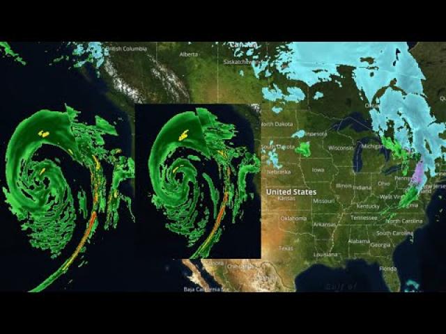
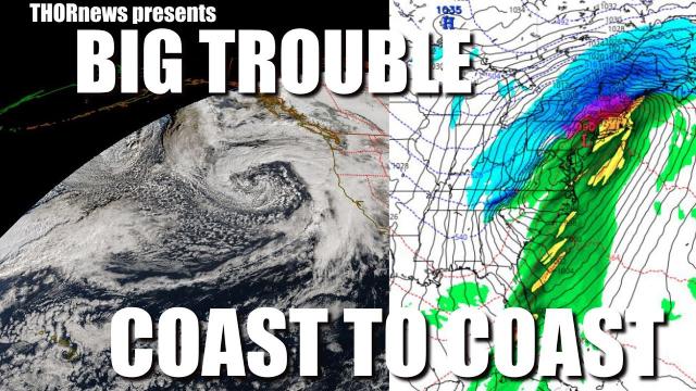
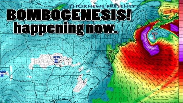
Cyclonic Action all over the Oceans & Big East Coast Storm happening Now
Description
Hurricane Lane to brush by Hawaii.
tropical storm Ernesto headed to the United Kingdom.
Typhoon Soulik threatens Japan next week
India Monsoon death toll rates continue to rise.
Typhoon Bebinca to flood Vietnam
Tropical Storm Leepi to cause trouble for Japan & South Korea
Tropical Storm Rumbia set to hit China
Invest 99L is being watched in the Atlantic with interest.
and a storm is hitting the central portion of the USA hard right now.
God bless everyone,
Stay Cool.
T
https://www.paypal.me/THORnews
Tshirts
https://hitthebuttonbaby.com/
THORNEWS
PO BOX 35946
HOUSTON TEXAS
77235-5946
the crankywxguy blog
http://www.stormhamster.com/entry/e073118.htm
the wave master
https://dabuh.com/
https://www.accuweather.com/en/weather-news/north-atlantic-subtropical-depression-to-strengthen-this-week-pose-no-threat-to-land/70005792
Tropical Storm Ernesto may bring rain, gusty winds to the British Isles
The Atlantic Basin is uncharacteristically quiet for mid-August, with the exception of Tropical Storm Ernesto in the north-central Atlantic Ocean.
Ernesto was once a subtropical storm, having both tropical and non-tropical characteristics. However, it became a tropical storm late on Thursday.
According to AccuWeather Hurricane Expert Dan Kottlowski, Ernesto has some potential for further strengthening before weakening over colder waters during the next couple of days.
Airborne Saharan dust, which has been recorded as far away as Texas this season, is also keeping the atmosphere dry and unfavorable for tropical weather to form in the heart of the basin.
However, another area to watch has evolved over the past couple of days.
"A tropical wave approaching the Windward and Leeward islands currently in a patch of moisture
Severe storms to threaten damage, power outages in northeastern US to end the week
While the risk of flash flooding remains the greatest risk to lives and property, locally severe thunderstorms will bring the potential for falling trees and power outages to the northeastern United States to end the week.
The ground is soggy and soft following relentless rounds of rain this summer over a large part of the central Appalachians and portions of the mid-Atlantic and New England.
Trees have been drawing a great deal of moisture up their trunk and limb systems due to the above-normal rainfall. Many trees may be top-heavy as a result.
Even an isolated, non-severe thunderstorm has the potential to bring down large tree limbs and even topple trees in this situation.
There is a chance the thunderstorms will be more robust than the garden variety summer storm and may occur on a more regional basis during Friday afternoon and evening.
In this setup, solid lines of storms may form.
Some of the stronger storms may bring gusts in the neighborhood of 30-50 mph, with a few gusts past 50 mph possible. The anticipated gusts are strong enough to topple weakly rooted trees and break diseased or stressed tree limbs.
As the storms approach, people should avoid standing, camping or parking beneath large trees due to the risk.
Fallen tree limbs may block city streets and secondary roads in some neighborhoods and rural areas. Where utility lines run through wooded areas, localized power outages can occur.
If a solid line of severe thunderstorms develops, power outages on a more regional basis are possible.
Flash flooding remains a serious threat
Beyond the risk of damaging wind gusts and lightning strikes from the storms, enough rain can fall to cause another round or two of urban and small stream flooding into this weekend.
In large portions of New York state, Pennsylvania, northern New Jersey, northern Maryland, northwestern Virginia and West Virginia, a mere 0.50 to 1 inch of rain in three hours can trigger flash flooding, according to the National Weather Service (NWS) mid-Atlantic River Forecast Center.
Motorists are reminded never to drive through flooded roadways, even if the road surface is visible. The foundation beneath the road surface may have been weakened and could crumble without notice.
Each year in the U.S., more fatalities (over 140) occur due to flooding than from any other thunderstorm-related hazard, according to a NWS bulletin.
The risk of flooding downpours will extend across much of the Northeast on Friday and then settle southward over the Tennessee Valley, mid-Atlantic and central Appalachians this weekend.


Comments