Bristols Oldest 1366 Spring Well Tunnels DUG BY MONKS
Description
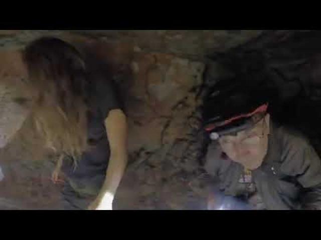
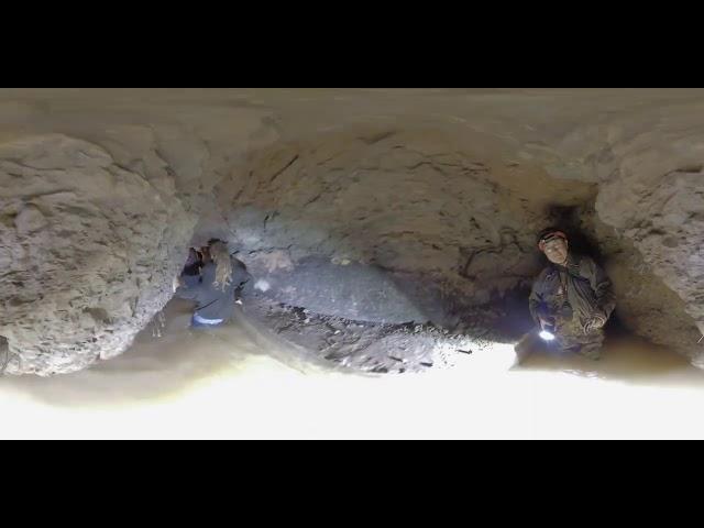
These are probably the oldest tunnels in Bristol and we explore some of what is left of them with the 360 camera. Normal views coming soon. They were a spring well which went to a nearby church and were its water source and that of many locals.
Apparently its "This is Bristol's oldest underground tunnel, a medieval system that was hand carved by monks to supply their church with fresh spring water back in 1366" info from Sam and Jess Explores...
Skip to content
inbfo from Tresa website from Simon Holbeck
Simon Hobeck
A spring at Pylle Hill was named Ravenswell. In 1370 the monks of Austin Friars who were building a religious house in Temple Parish (the area north of Pylle Hill of which Temple Meads Station and the leaning tower of Temple Church are the last vestiges) negotiated a grant of spring water from Sir John de Gourney, whose family had by then acquired the Manor of Knowle.
The monks constructed a reservoir and a conduit to intercept and conduct the water down to Temple Gate so that the Friars would have access to pure water. Medieval monasteries were notable for water engineering innovation, and Temple Pipe is one of several such spring-to-monastery conduits in Bristol. The water was intended for the use of the orders but where there was an excess its use was extended to local parishioners. The gift of clean water was arranged before the site of Austin Friars was begun.
The conduit was twice extended in later years to enable the parishioners of Temple to make use of it and various bequests from rich Temple residents and later on the Royal Grant of an annual fair, enabled the pipe to be maintained in good order. In 1651 when the pipe was extended to a second fountain in Temple Street, the Neptune statue, which nowadays stands on the pedestrian area between Broadquay and Anchor Road, was commissioned to adorn the new fountain. The top water-collection chambers of the conduit are subterranean, several metres below ground level and are located beneath the lower end of Cambridge Street, on Pylle Hill. From there the conduit drops away in three steps and runs into a slope with a channel cut into the floor to carry the water.
The most accurate survey of the still surviving system has probably been the one carried out by Freeman Fox and Partners as part of their civil engineering preparations to build the Outer Circuit Road across Totterdown in the 1970s. It shows that the tunnel ran almost due north, passed under the lower end of Bellevue Terrace and below the garden of no.3 Wells Road. It then passed under both the Bath and Wells Roads close to the former site of Three Lamps sign and near to May Lane steps, north of which is the location of the great underground storage cistern, on the east side of the Bath Road. The flow of water was interrupted by the construction of the New Cut in 1804 and the outflow of the cistern was further interrupted by the cutting of the Bristol Relief Rail line. Julian Lee Jones who has researched the medieval conduits of Bristol in detail has suggested that parts of the TemplePipe remain intact below the area cleared for the abortive Bristol arena project east of the Bath Road.
The medieval boundaries of the City of Bristol included a mark place called ‘The Well in The Way’, ‘the way’ meaning the road to Bath; it seems very likely that Ravenswell and the Well in the Way are the same feature and this is connected to a strange diversion of the City Boundaries., Following a line close to that now followed by the New Cut the medieval boundary swung westward from the river Avon, and then at the Bath Road it took a long diversion southwards along the east edge of the Bath Road to a point close to where the Three Lamps now is, before returning northward along the west edge of the Bath Road and resuming its earlier westward course. This diversion was very likely connected with the Grant of Sir John de Gourney of the right to the waters of Ravenswell and the importance that the City attached to that water supply. This boundary remained in place for over 500 years until 1893 when it was shifted southward to run along County Street, Bushy Park and St John’s Lane.
Many thanks to James from this facebook page for taking us there:
https://www.facebook.com/groups/bristolthenandnow/?ref=share
if you want to see what these videos look like uploiade to youtube in their raw unprocessed 360 as the flattened image - its very wierd but here is the link... https://youtu.be/kGu6evtXOpY
My Instagram: https://www.instagram.com/mattswilli/
Facebook: https://www.facebook.com/groups/1228424283971624/
email me at me@thematthewwilliams.com or truthsee@gotadsl.co.uk
Also present on this explore were
Sam and Jess Explores - https://www.youtube.com/channel/UCeZfXq1On5g1onUaolpcUig
Many thanks to James from this facebook page for taking us there:
https://www.facebook.com/groups/bristolthenandnow/?ref=share