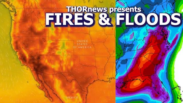
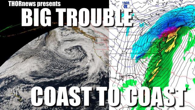
Bombogenesis Storm for East Coast, Almost endless rain for West Coast & Weird Europe Double Lows
Description
Floody Severe Weather Season has begun.
God bless everyone,
Stay Cool.
T
https://www.paypal.me/THORnews
mail
5430 Birdwood Rd. #416
Houston Texas 77096
crankywxguy's blog
http://www.stormhamster.com/entry2/e040119.htm
https://weather.com/forecast/regional/news/2019-04-01-northeast-storm-rain-wind-april-bomb-cyclone
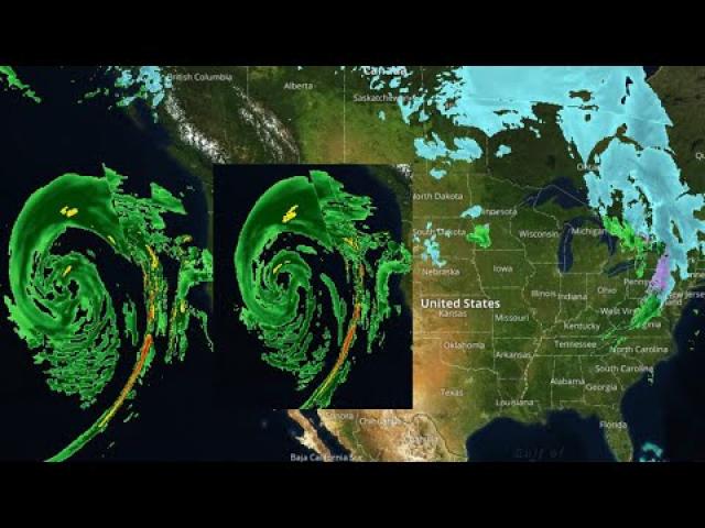
Storm May Become a Bomb Cyclone Off the East Coast, But Here's Why It Likely Won't Be a Major Nor'easter
Low pressure will develop off the East Coast by Tuesday.
This low may strengthen off the East Coast Tuesday night into Wednesday, possibly becoming a bomb cyclone.
Despite this, its track is expected to be too far offshore for major impacts.
Cold air is also lacking with this system.
Rain and some gusty winds are expected from the Southeast to parts of New England.
Low pressure off the East Coast will intensify Tuesday into Wednesday but may track too far offshore and move too quickly to provide anything more than a glancing blow to parts of the Eastern Seaboard.
This low-pressure system is expected to form off the Southeast coast by early Tuesday along an old frontal boundary responsible for delivering a shot of cold air to parts of the South.
From that point, the low will strengthen off the East Coast Tuesday into Wednesday as it tracks northeastward, potentially becoming a bomb cyclone, a term meteorologists use to describe low-pressure systems that strengthen rapidly enough.
Rain and a few thunderstorms will develop from northern Florida into parts of the Southeast.
Parts of northern Florida and southern Georgia have the greatest chance of moderate rainfall.
We can't rule out a few flakes of wet snow in parts of western North Carolina or upstate South Carolina.
Some rain may spread up the mid-Atlantic and New England coasts Tuesday night, with a few patchy areas of wet snow possible in parts of New England.
Winds may also increase near the coast later Tuesday and Tuesday night from North Carolina to southern New England.
Wednesday
The Wednesday portion of the forecast is a bit more uncertain.
As mentioned earlier, the majority of model guidance keeps the center of the low a bit too far offshore for more-significant impacts to the East Coast.
Some wind gusts to 40 mph or higher are most possible on Cape Cod, Nantucket, Martha's Vineyard and in parts of coastal Maine.
Some areas of wet snow are possible in parts of Maine, New Hampshire and possibly a few other parts of eastern and southeastern New England.
Any shift of this low's track either closer to the coast or farther away from the coast could affect the forecast precipitation and wind. Check back with weather.com for updates.
At any rate, this system will move quickly, heading into the Canadian Maritimes by later Wednesday.