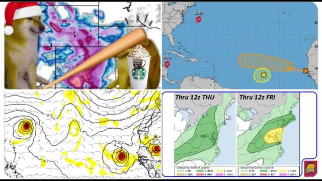
Big Blizzard & Ice Storm & Severe Weather to Hit Texas to the East Coast this Weekend
Description
https://www.paypal.me/THORnews
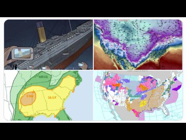
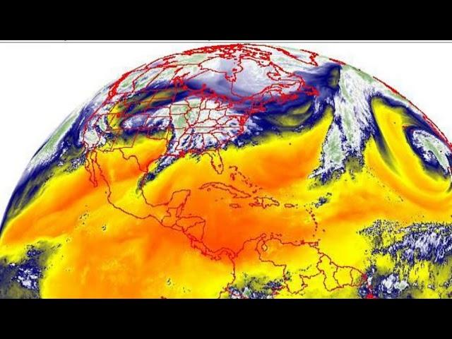
The Storm that slammed into the West Coast is now moving past the Sierra & Rocky Mountains and set to spread across the Central USA and move East. This is a mixed precipitation event that is apparently hard to nail down. Be prepared and stay cool.
God bless everyone,
T
@newTHOR on twitter
https://www.facebook.com/thornewsgo
Tshirts
https://hitthebuttonbaby.com/
the crankywxguy blog
http://www.stormhamster.com/entry/e011719.htm
mike's weather page
http://www.spaghettimodels.com/
models
https://www.tropicaltidbits.com/analysis/models/
a look at the Sun
https://sdo.gsfc.nasa.gov/data/
more info on storm
https://weather.com/storms/winter/news/2019-01-15-winter-storm-harper-snow-forecast-plains-midwest-northeast
Winter Storm Harper, Now Hammering the West; Will Be a Major Snowstorm Friday Into the Weekend From the Midwest to the Northeast
For the second week in a row, a major snowstorm will hammer parts of the Midwest and East.
Heavy snow is expected Friday into Saturday in the Plains and Midwest.
White out conditions are possible in parts of the Plains.
The heaviest snow is likely in parts of the Northeast this weekend.
Winter storm watches have already been issued in the Plains and Northeast.
Harper will snarl weekend travel in the Midwest and Northeast.
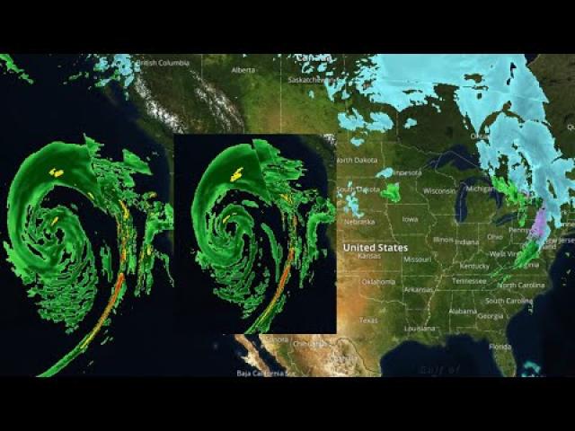
Winter Storm Harper is already pummeling parts of the West with heavy snow and will spread its mess of snow, ice and wind into the Plains, Midwest and Northeast into this weekend.
Harper's heaviest snow, so far, is in the Sierra Nevada of California. Early Thursday morning, Lone Pine, California, reported 5 inches of snow had fallen in just 2 hours.
That storm will tap into cold air once it moves through the central and eastern states Friday through the weekend, delivering a widespread swath of significant snow.
Happening Now
Snow is falling in parts of the Rockies and Utah's Wasatch as Harper is moving eastward through the West. Snow is beginning to spread into the Dakotas and Nebraska.
Snow is winding down in California's Sierra Nevada and the through the Cascades after multiple days of heavy snow and wind.
Winter storm watches and warnings and winter weather advisories have been posted by the National Weather Service from the northern and central Plains eastward through the southern Great Lakes and into the Northeast.
Cities included in the winter storm watches or warnings include Chicago, Milwaukee, Boston, Hartford, Providence, Pittsburgh, Albany, Buffalo, Cleveland and Des Moines.
In general, locations in winter storm warnings can expect the worst conditions from this storm from Friday into the weekend.
Winter weather advisories and warnings are also posted throughout the Mountain West, which will feel the effects of Harper on Thursday.
Additional watches, warnings and advisories will be issued in the days ahead.
As Winter Storm Harper gets east of the Rockies, it will ramp up Friday into Saturday in the Plains and Midwest.
The system will generally travel from Oklahoma northeastward into the Ohio Valley and then the Northeast.
Friday
Snow will continue over the Rockies, including down to valley floors.
Snow, possibly heavy, will continue to spread into the Plains states.
Blowing and drifting snow is likely in parts of the Midwest.
Evening commutes may be impacted by snow in some cities, including Kansas City, Omaha, Des Moines, Sioux Falls and Milwaukee.
A sharp cut off in the snow is expected in southern Minnesota, and at least right now, it appears that Minneapolis will stay out of the most impactful snow.
Friday night, snow should spread east into the lower Great Lakes, and any rain may change to snow in Kansas and in parts of Oklahoma.
Some sleet or freezing rain may develop Friday night in parts of Missouri, southern Illinois and Indiana.
Saturday
A large area of snow, heavy in some areas, is expected from parts of the Midwest, spreading into the Northeast, with snow arriving in New England mainly late Saturday.
Strong winds may accompany the snow in the Midwest, potentially leading to near-blizzard conditions in some areas.
A band of sleet and freezing rain is possible in Kansas and Missouri eastward into Ohio, West Virginia and the mid-Atlantic states. Saturday night, some freezing rain and sleet may spread into parts of the lower Hudson Valley and southern New England.
Precipitation may eventually change to rain along at least parts of the Interstate 95 corridor late, though the details of when and where that may happen remain uncertain.
Sunday
Heavy snow is expected over the interior Northeast from parts of New York state north of the Lower Hudson Valley to parts of New England.
This snow will linger in New England Sunday night.
Strong winds will buffet much of the East, leading to areas of blowing and drifting snow.
Some sleet or freezing rain is possible in coastal and southern New England.