ALERT! Hurricane Barry! Asteroid Fight Club soft evacuation recommendation
Description
This is an Asteroid Fight Club video.
Watch this video at your own risk.
You are an adult. Make your own call.
All I can do is stick my neck out for you time and time again
giving you the best of what I know.
I'm bound to be wrong eventually.
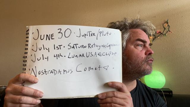
This is my 16th video on this Storm since July 3rd.
I've made 2416 videos in 6.7 years updating & educating
y'all on the state of affairs.
Stay aware. Have a plan. Work together.
God bless everyone,
T
https://www.paypal.me/thornews
you can send letters and contributions snailmail
T Lewison
5430 Birdwood Rd. #416
Houston Texas 77096
https://weather.com/storms/hurricane/news/2019-07-10-barry-hurricane-tropical-storm-flooding-forecast
Potential Tropical Storm Barry to Impact Gulf Coast With Severe Flooding, Surge, Wind Threats; Hurricane Watch Issued
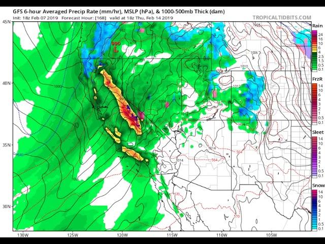
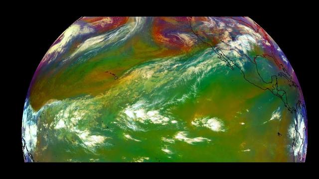
An area of low pressure is likely to develop in the northern Gulf of Mexico.
It will eventually strengthen into Tropical Storm Barry and may become a hurricane before landfall this weekend.
Hurricane, tropical storm and storm-surge watches have been issued on the northern Gulf Coast.
The track of future Barry remains a bit uncertain.
A major threat of rainfall flooding is in play over the northern Gulf Coast and lower Mississippi Valley.
Storm-surge flooding is also likely, particularly to the east of future Barry's track.
A disturbance in the northern Gulf of Mexico has been named Potential Tropical Cyclone Two by the National Hurricane Center and is forecast to become Tropical Storm and possibly Hurricane Barry as it lashes the northern Gulf Coast this weekend. This system will bring a threat of significant rainfall flooding, storm-surge flooding and high winds to parts of Louisiana, Mississippi, Alabama and East Texas.
The NHC began issuing advisories on Potential Tropical Cyclone Two on Wednesday morning.
The potential tropical cyclone category, which was launched in 2017, allows the NHC to issue forecasts for systems that have yet to develop but pose a threat of bringing tropical-storm-force or hurricane-force winds to land areas within 48 hours. Essentially, it allows watches and/or warnings to be issued with more lead time for systems that may develop quickly.
Hurricane watches are now in effect in southern Louisiana from the mouth of the Mississippi River to Cameron, Louisiana. This means hurricane conditions are possible in the area within the next 48 hours.
Tropical storm watches have been issued in southeastern Louisiana from the mouth of the Mississippi River northward to the mouth of the Pearl River at the border with Mississippi. This means tropical storm conditions are possible in the area within the next 48 hours.
Storm-surge watches have been issued for parts of the southeastern and south-central Louisiana coast from the mouth of the Pearl River to Intracoastal City, Louisiana. It does not include Lake Pontchartrain. A watch means life-threatening inundation is possible within the area, generally within 48 hours.
Torrential rain already soaked parts of the Gulf Coast – namely, southeastern Louisiana – on Wednesday morning.
The National Weather Service issued a rare flash flood emergency for much of the New Orleans metro area Wednesday morning. Parts of the city picked up over 10 inches of rain in just a few hours, triggering widespread street flooding.
Water reportedly entered a building in Harahan, just upriver from New Orleans in Jefferson Parish, according to a report received by the NWS.
If that wasn't enough, a tornado was sighted over the western New Orleans metro Wednesday morning.
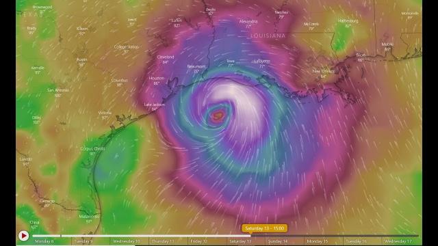
Here's Where It's Headed and How Strong
The U.S. Air Force Reserve Hurricane Hunters are scheduled to fly into the disturbance early this afternoon. If they can find a closed area of low pressure with enough persistent showers and thunderstorms around it, the NHC would then upgrade the disturbance to either Tropical Depression Two or Tropical Storm Barry, depending on the strength of its winds.
This future tropical storm will be steered westward or west-northwestward through the northern Gulf of Mexico in the direction of Louisiana and East Texas. That movement would be induced by the clockwise flow around a high-pressure system centered in the southern Rockies and Plains.
Barry would then be drawn inland this weekend somewhere from East Texas into the lower Mississippi Valley through a gap between the Rockies and Plains high-pressure system and an extension of the Bermuda high over the Bahamas and the Florida Peninsula.
For now, it looks like landfall may occur Saturday any time from early morning into the afternoon or evening.
As far as the system's intensity forecast is concerned, Barry will be at least a tropical storm, and it's increasingly possible it will become a hurricane before its landfall Saturday.


Comments