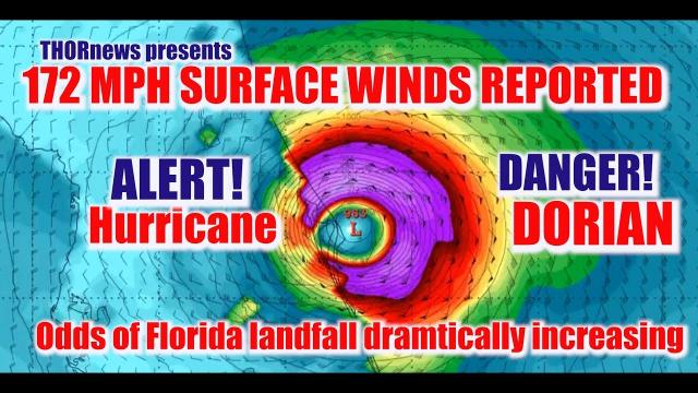
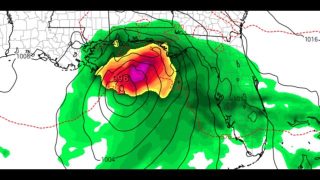
ALERT! FLORIDA! Nestor is already a Hurricane* showing 65 knot winds & has 28 more hours to DEVELOP!
Description
Crankywxguy & Bobbi think this mofo should already be a Tropical Storm.
Stay aware. have a plan & GTFO if need be.
God bless everyone,
T LEWISON
5430 BIRDWOOD RD. #416
HOUSTON TEXAS 77096
HTTPS://WWW.PAYPAL.ME/THORNEWS
www.venmo.com/TEric-Lewison
$THORnews on CashApp
https://www.patreon.com/thornews
check out the crankywxguy blog
http://www.stormhamster.com/entry2/e101819b.htm
video
https://weather.com/storms/hurricane/news/2019-10-16-gulf-of-mexico-tropical-development-possible-central-american-gyre
Potential Tropical Cyclone 16 Will Bring Rain, Wind, Storm Surge Flooding to Parts of Gulf Coast, South; Warnings Issued
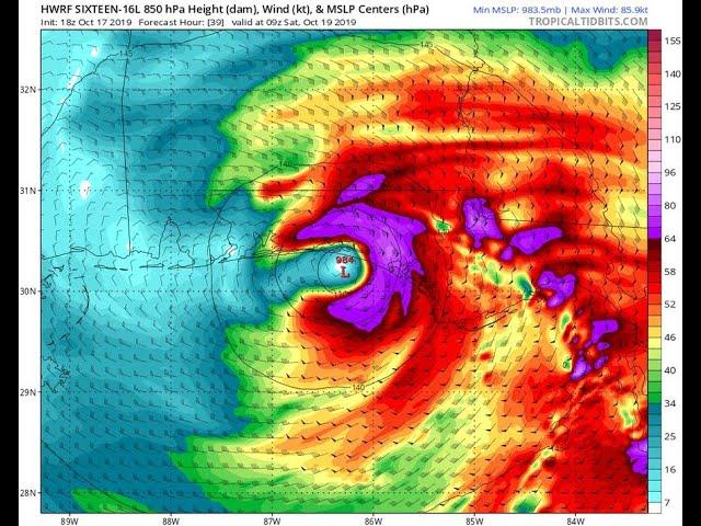
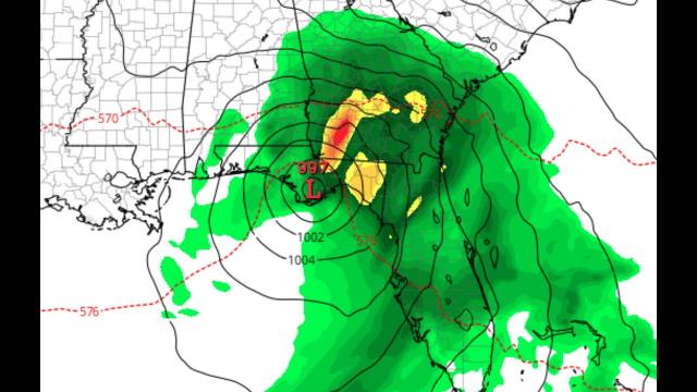
Potential Tropical Cyclone 16 is currently moving through the Gulf of Mexico.
Tropical storm warnings have been posted for parts of the Gulf Coast.
This possible Gulf system is forecast to approach the northern Gulf Coast by Saturday.
Heavy rainfall is possible in parts of the Southeast plagued by a recent flash drought.
This system may also produce some surge flooding along and to the east of its track.
A tropical or subtropical storm, dubbed Potential Tropical Cyclone 16 by the National Hurricane Center, is likely to form in the Gulf of Mexico Friday and will bring soaking rain, winds and coastal flooding to parts of the Southeast this weekend.
Right now, this disturbance is centered over the western Gulf of Mexico. The system is gradually organizing and is expected to gain at least some tropical cyclone characteristics.
Gulf Development Chance
Potential Tropical Cyclone 16 will be designated a tropical or subtropical depression or storm once it has a complete, counterclockwise surface circulation with organized thunderstorms nearby. As of early Friday the National Hurricane Center says there is no evidence that a well-defined center has formed.
If it becomes a tropical/subtropical storm, it would be called Nestor.
A tropical storm warning has been issued for parts of the northern Gulf Coast from the Mississippi/Alabama border to Yankeetown, Florida, and from Grand Isle, Louisiana, to the mouth of the Pearl River.
A tropical storm warning means that tropical storm conditions are expected somewhere within the warning area within 36 hours.
A storm surge warning has also been issued from Indian Pass, Florida, to Clearwater Beach, Florida. A storm surge warning means that there is a danger of life-threatening inundation, from rising water moving inland from the coastline, during the next 36 hours.
Regardless of what meteorologists call it, this system is expected to move northeastward over the Gulf of Mexico and into the Southeast relatively quickly.
This system will produce much of its worst weather ahead and to the right of its center, and well outside of the cone of uncertainty shown below.
The system may gradually strengthen as water temperatures remain unusually warm in the Gulf of Mexico, but increasing upper-level winds over the northern Gulf of Mexico, which will help it move swiftly toward the northern Gulf Coast, should also produce wind shear, typically a strike against significant intensification of tropical cyclones.
Potential Impacts
Wind, waves and coastal flood/surge impacts depend on the size and strength of the Gulf system, which remains somewhat uncertain given the system hasn't formed in the Gulf, yet.
Storm Surge, Coastal Flooding
South to southwest winds ahead of the system blowing over a long fetch of the Gulf of Mexico may generate swells that may reach the northern and eastern Gulf Coasts as soon as Friday.
These swells could generate high surf and rip currents and could persist through Saturday.
The combination of a dangerous storm surge and the tide will cause normally dry areas near the coast to be flooded by rising waters moving inland from the shoreline.
Water could reach the following heights above ground if the peak surge occurs at the time of high tide:
-3 to 5 feet from Indian Pass, Florida, to Chassahowitzka, Florida
-2 to 4 feet from Chassahowitzka, Florida, to Clearwater Beach, Florida
Tornadoes
A few severe thunderstorms, including the risk of tornadoes, are possible in parts of the Southeast on Friday and Saturday, especially across northern and central Florida.
This system's relatively fast movement should keep it from becoming a major, widespread rainfall flood concern. Remember, a tropical storm or hurricane's rainfall potential largely depends on how fast it moves, not how strong it becomes.
Rain and thunderstorms are expected to arrive along parts of the northern and eastern Gulf Coasts Friday.
This rain could become heavy Friday night into Saturday generally along, and to the northeast of, the track of the Gulf system, and may linger in some parts of the Southeast into Sunday.
The National Hurricane Center expects rainfall accumulations of 2 to 4 inches from the central Gulf Coast and northern and central Florida into the eastern Carolinas, with isolated areas receiving up to 6 inches.