Alert! BIG Severe Weather & Flood week for Texas & the South & Midwest
Description
It's about to get wild & dangerous. Stay Cool, Be Aware & Prepare.
God bless everyone,
T
THORnews survives and thrives on your prayers,
good thoughts, defense and support
https://www.paypal.me/thornews
send love, letters and contributions to
5430 Birdwood Rd.
Houston, Texas
77096
the crankywxguy blog of the day
http://www.stormhamster.com/entry2/e050619b.htm
leakcon live stream
LeakCon2019 Live-Stream https://bit.ly/2TTbPIq
video of coming storms
https://weather.com/storms/severe/news/2019-05-05-severe-thunderstorms-flooding-rainfall-central-states-early-may
Outbreak of Severe Storms, Including Tornadoes, to Threaten Parts of the Plains, Midwest and South This Week
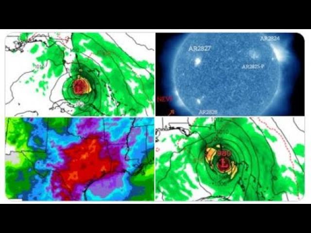
A multi-day outbreak of severe storms, including tornadoes, will threaten parts of the Plains, Midwest and South this week. In addition, more heavy rain in those already soaked regions will triggering flooding as well.
This latest rash of severe weather began with more than a dozen reports of tornadoes in the Plains on Sunday, from West Texas to central Kansas and eastern Nebraska. Some sporadic damage was reported from those twisters.
An upper-level disturbance riding through a southward plunge of the jet stream in the West will nudge into the Plains and Midwest through midweek. More dangerous storms will flare up in the coming days as that weather system interacts with moisture from the Gulf of Mexico.
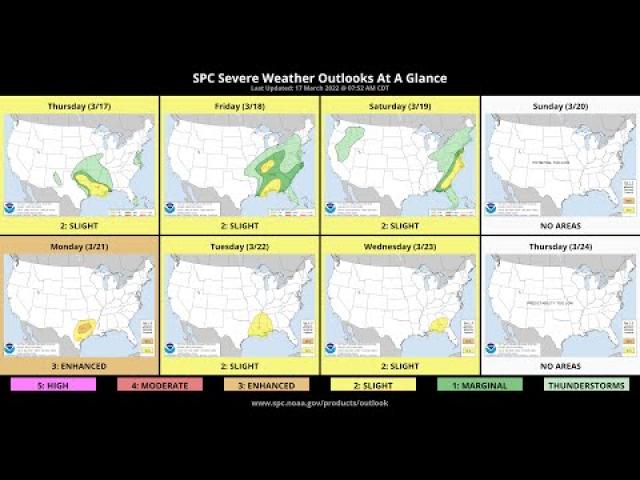
Here's a breakdown of the severe thunderstorm and flooding threats this week, but keep in mind that changes to this forecast are likely in the days ahead.
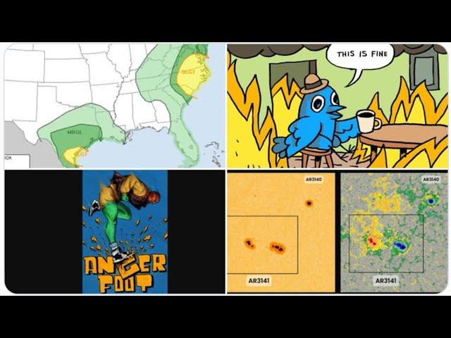
Severe Thunderstorm Threat
Monday
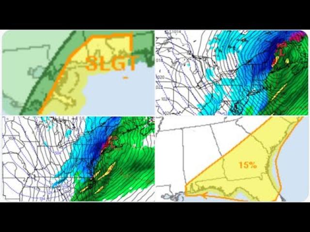
Scattered severe storms with damaging wind gusts, large hail and an isolated tornado threat are expected in parts of the central and southern Plains as the workweek begins.
The chance of severe weather on Monday will be from West and South Texas into parts of southeastern Colorado, Oklahoma, Kansas and western and central Missouri.
In addition, there is the potential for significant flash flooding from portions of Kansas into Missouri.
Tuesday
Severe storms could become more widespread Tuesday and Tuesday night from parts of Kansas into western Oklahoma and western Texas.
Large hail, damaging winds and tornadoes will all be possible threats. The greatest chance of tornadoes and destructive hail is in the Texas Panhandle.
Wednesday
The potential for severe storms will push a bit farther eastward on Wednesday into portions of central and eastern Texas, Oklahoma, Kansas, Missouri, Arkansas and northwestern Louisiana. A few severe storms could develop as far east as the Ohio Valley.
Wednesday's storms could pack large hail, tornadoes, damaging winds and flooding rainfall. Areas from northern and central Texas into Oklahoma and southeast Kansas have the greatest risk of seeing supercell thunderstorms with destructive hail and tornadoes.
Thursday
The storm system could fuel another round of severe storms on Thursday as it pushes farther eastward. This includes a swath from the southern Great Lakes and Ohio Valley southwestward into the lower and mid-Mississippi Valley and eastern Texas.
It's too early to determine what the main threats from those storms will be on Thursday.
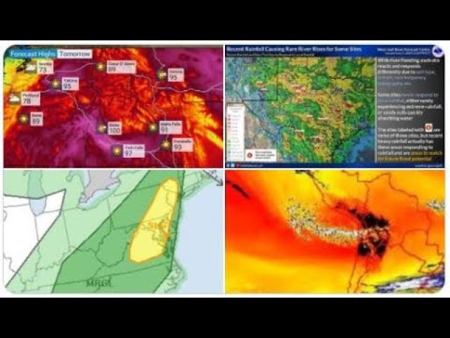
Flood Threat Returns
A wet weather pattern has been in place for much of this year so far in many areas east of the Rockies, soaking the ground. Because of that, rainfall last week resulted in serious flooding in some areas from the southern Plains to Michigan.
More flooding is likely in the week ahead as rain and thunderstorm chances expand through the first half of this week in the Plains and Midwest.
A widespread swath from Texas northward into the Midwest could see 1 to 3 inches of rain through Thursday. Localized heavier totals up to 6 inches are possible in some areas, although it's a bit too early to pinpoint what locations may see the most excessive rainfall.