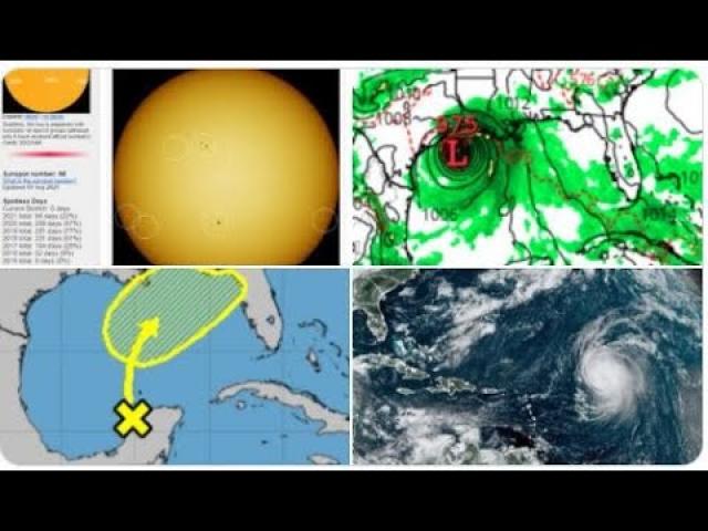
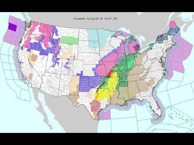
Alert! 3 Areas to watch! Puerto Rico, Gulf of Mexico & South East = Hurricane Watch
Description
It's waking up. Puerto Rico. You are on the clock.
God bless everyone,
T LEWISON
5430 BIRDWOOD RD. #416
HOUSTON TEXAS 77096
HTTPS://WWW.PAYPAL.ME/THORNEWS
www.venmo.com/TEric-Lewison
$THORnews on CashApp
https://www.patreon.com/thornews
the crankywxguy blog (not me but good info)
http://www.stormhamster.com/entry2/e082419.htm
video
https://weather.com/storms/hurricane/news/2019-08-24-tropical-depression-five-atlantic-lesser-antilles
Tropical Depression Five Forms; Forecast to Reach Lesser Antilles Tuesday
Tropical Depression Five has formed in the central Atlantic Ocean.
It is several hundred miles east of the Lesser Antilles.
It is forecast to reach the Lesser Antilles as a tropical storm by Tuesday.
Its future after that is uncertain late in the week.
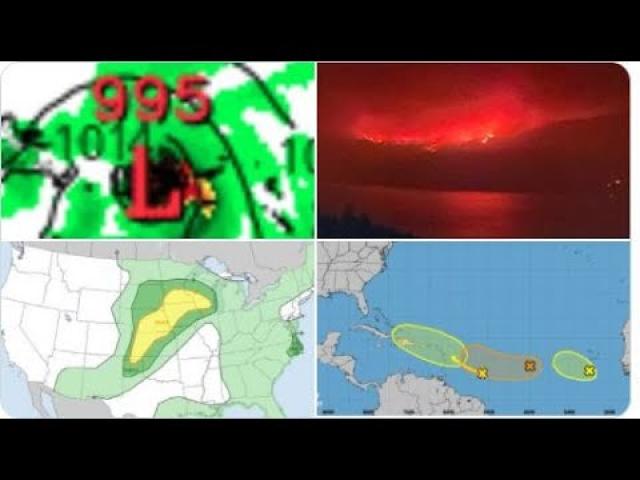
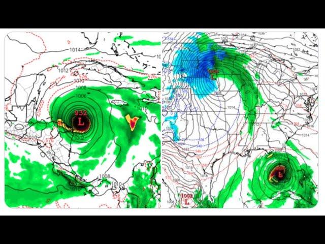
Tropical Depression Five has formed in the central Atlantic Ocean, and is forecast to reach the Lesser Antilles as a tropical storm by Tuesday.
The depression is located several hundred miles east of the Windward Islands, moving steadily west at 10 to 15 mph.
The small low-pressure center was detected Friday with a satellite-borne instrument called a scatterometer.
Just enough thunderstorms near the center prompted the National Hurricane Center to upgrade what was previous called Invest 99L to Tropical Depression Five Saturday morning.
On its predicted path, 99L would approach the Lesser Antilles by Tuesday, though exactly where the center tracks remains uncertain. There are no watches or warnings in effect, yet.
Sea surface temperatures are warm ahead of the system, and upper-level winds currently shearing the system are expected to relax. These factors favor intensification.
However, the mid-level atmosphere is moderately dry, and that may keep a brake on any rapid strengthening. If the storm can develop an inner core of moisture and keep it walled off from the dry air, more sustained intensification would be possible. Smaller systems such as this are notorious for strengthening and weakening faster than forecast.
It’s too soon to know if it will pose any threat farther west or northwest toward the Greater Antilles and/or the United States.
Check back with us at weather.com for the latest on this system.
Prime Time and a Prime Location
This system is located in the heart of the deep Atlantic tropics, also known as the Main Development Region. Tropical storms and hurricanes are most common in this region from late July into September as tropical waves move off Africa and into the Atlantic.
Such tropical waves emerging off the west coast of Africa are often referred to as Cabo Verde systems because many of them pass near the Cabo Verde Islands.
A tropical disturbance, Invest 98L, is over Florida.
This disturbance is likely to develop into a tropical depression or storm once it moves into the Atlantic.
For now, this doesn't appear to be a threat for the East Coast.
It may be a threat to parts of Atlantic Canada late in the week ahead.
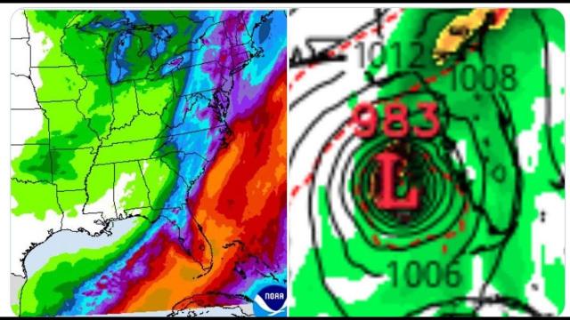
Another disturbance is producing heavy rain near the northern Gulf Coast.
A tropical disturbance over Florida is likely to develop once it moves off the Southeast coast, but is unlikely to be a threat to the East Coast in the week ahead.
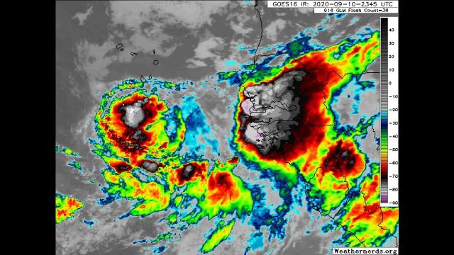
This weak, broad area of low pressure over South Florida, tagged Invest 98L by the National Hurricane Center, is producing a large area of disorganized showers over parts of Florida, the northwest Bahamas and the adjacent areas of the Atlantic Ocean.
This low-pressure area is forecast to emerge back over the Atlantic Ocean by Sunday.
Conditions are expected to be conducive for tropical development early in the week ahead off the Southeast coast. The National Hurricane Center has given it a high chance of development into a tropical depression or storm.
Hurricane Hunter reconnaissance aircraft are scheduled to fly into this disturbance once it emerges over the ocean.
For now, the large majority of forecast model guidance keeps the track of this system sufficiently far off the East Coast. You can see that in the orientation of the red potential development area from the NHC in the above map.
Changes in the forecast are always possible that may bring the track closer, but, for now, this isn't anything the East Coast should be concerned about.
Even if it tracks well offshore, this system, in combination with high pressure to its north, may eventually generate swells that could lead to rip currents and coastal flooding along parts of the Eastern Seaboard.
Late in the week, this system may end up brushing or directly impacting some part of Atlantic Canada.
Check back with us at weather.com for the latest on this potential tropical system.