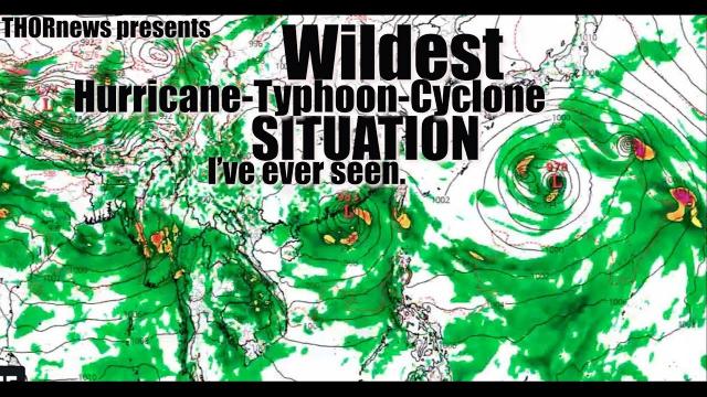
A Professional* Look at this Crazy Hurricane Peak Season Situation
Description
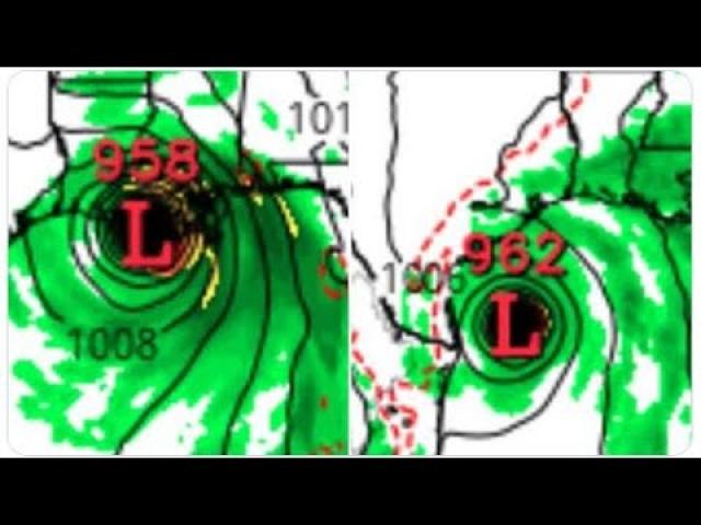
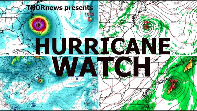
This is part 2 of our look at how wild things can get as the Pacific & Atlantic are becoming very active and waking up. The Gulf is gonna get a soaking regardless of system designation. God Bless Everyone.
Stay Cool. T
https://www.paypal.me/THORnews
Tshirts
https://hitthebuttonbaby.com/
https://www.facebook.com/thornewsgo
THORNEWS
PO BOX 35946
HOUSTON TEXAS
77235-5946
@newTHOR on Twitter
https://weather.com/storms/hurricane/news/2018-08-30-tropical-storm-hurricane-florence-east-atlantic
Tropical Depression Six Prompts Warnings For Cabo Verde Islands; Caribbean Wave to Be Monitored in Gulf Next Week
A tropical storm is forming off the west Africa coast.
This system will bring rain and wind to the Cabo Verde Islands.
It should then track into the central Atlantic Ocean next week.
A Caribbean tropical wave will move toward the Gulf of Mexico next week.
There's a very low chance that wave might develop in the Gulf next week.
Regardless, rounds of locally heavy rain are expected along the Gulf Coast.
The next tropical storm of the 2018 Atlantic hurricane season is expected to develop off the west African coast by Saturday, as a separate Caribbean tropical wave bears watching in the Gulf of Mexico next week
Tropical depression six formed south of the Cabo Verde Islands and it is expected to intensify.
Once this system becomes a tropical storm, it will be called Florence.
Tropical storm warnings are posted for the Cabo Verde Islands, an archipelago with a population of more than 500,000 just off the west coast of Africa, specifically the islands of Santiago, Fogo and Brava.
This means tropical storm-force winds - at least 39 mph sustained winds - are expected, in this case, within the next 12 to 24 hours.
This "future Florence" is expected to produce up to 8 inches of rain, which may trigger flash flooding in parts of the relatively mountainous Cabo Verde Islands, through early Saturday before moving away.
After that, this system will move into the open Atlantic Ocean into next week.
Despite eventually forecast to become a strong tropical storm, the majority of forecast model guidance suggests this system will eventually curve northwestward into the central Atlantic Ocean, not posing a threat to any other land areas, including the United States or Caribbean Sea.
This is just one of multiple tropical waves forecast to emerge off the coast of western Africa, potentially spinning up into tropical cyclones as they track westward across the tropical Atlantic Ocean, known as the Main Development Region (MDR) for Atlantic hurricanes.
Often referred to as African easterly waves, tropical waves are batches of energy and general spin in the atmosphere that develop due to temperature contrasts in northern Africa. The frequency and intensity of these waves typically peaks roughly this time of year.
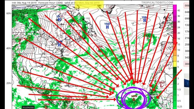
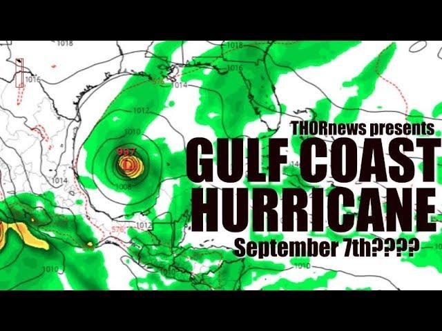
Gulf Concern Next Week?
Another tropical wave is currently gliding west-northwest through Hispañola, producing showers and storms with locally heavy rainfall.
Currently, wind shear – the change in wind direction and/or speed with height – is sufficient to prevent this tropical wave from developing the next several days.
However, steered by high pressure aloft parked over the eastern United States, this system should move into the Gulf of Mexico next week.
Once it does, it may encounter a more favorable environment for development.
There are some uncertainties in the suite of numerical forecast guidance, including how much land this tropical wave will interact with and how much wind shear may be in place over the Gulf of Mexico next week, so it is far from a certainty any tropical development will occur at all.
However, a factor favoring development is the warm water in the Gulf of Mexico, with sea-surface temperatures above average and ample heat content. If a system can get into the Gulf of Mexico, it will have a better than usual chance of development.
Partially due to the warm Gulf waters, as The Weather Channel senior meteorologist Stu Ostro noted Wednesday, the atmosphere over the Gulf of Mexico is moist and unstable, with thunderstorms already percolating.
The National Hurricane Center Thursday gave this tropical wave a low chance of developing in the Gulf of Mexico next week.
the crankywxguy blog
http://www.stormhamster.com/entry/e083118.htm
the wave master
https://dabuh.com/


Comments