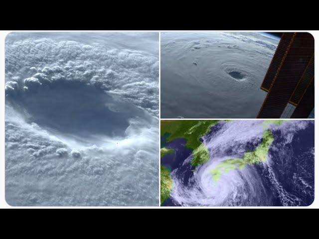
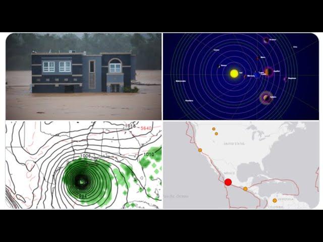
5.1 Earthquake in Puerto Rico & our Big Storm has a Beautiful Face
Description
We're at very super Asteroid Fight Club red alert until further notice.
Stay Aware & Stay cool.
God bless everyone,
T LEWISON
5430 BIRDWOOD RD. #416
HOUSTON TEXAS 77096
WWW.PAYPAL.ME/THORNEWS
www.venmo.com/TEric-Lewison
$THORnews on CashApp
https://www.patreon.com/thornews
check out the crankywxguy blog
http://www.stormhamster.com/entry2/e122819.htm
video
https://weather.com/forecast/national/news/2019-12-26-post-christmas-winter-storm-plains
Powerful Post-Christmas Winter Storm May Bring Blizzard Conditions, Ice to Plains, Upper Midwest, Northeast
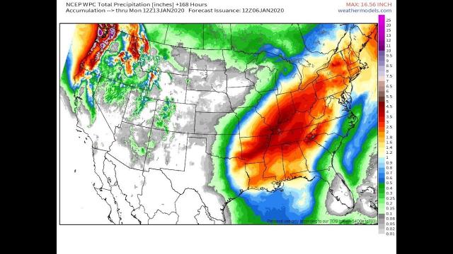
A significant winter storm is shaping up this weekend in the nation's mid-section.
Heavy snow and strong winds may produce blizzard conditions at times in the Northern Plains.
Some freezing rain may lead to icy roads, as well.
Some snow and ice will also spread to parts of New England and upstate New York.
Heavy snow has already pummeled the mountains of the Southwest.
A powerful winter storm will bring heavy snow, some ice and possible blizzard conditions to parts of the Plains this weekend, before spreading snow and ice into the Great Lakes and parts of the Northeast into early week, potentially snarling holiday travel.
This significant system has been named Winter Storm Gage
Low pressure is expected to intensify in the Plains this weekend.
The air mass ahead of the storm will remain very warm for late December, so some areas that are used to seeing snow this time of year may end up seeing predominantly rain.
However, some cold air will be pulled in behind the intensifying storm, so wind-driven snow and some freezing rain is expected in other areas from the Northern Plains to New England.
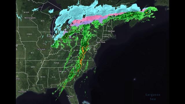
Happening Now
Snow and ice have spread into the Northern Plains and parts of the upper Mississippi Valley, as of Saturday morning. Farther south, rain and thunderstorms are moving through the Central and Southern Plains, as well as into the mid-Mississippi Valley.
A number of winter storm warnings and winter weather advisories have been issued by the National Weather Service from parts of the Four Corners region into the Upper Midwest. An ice storm warning has also been issued for portions of southwestern Minnesota where ice accumulation of up to half an inch is possible.
A winter storm watch has been issued for parts of southern New England from Sunday evening through Tuesday afternoon where ice may become a concern.
In general, the worst conditions are expected where winter storm warnings are in effect. Strong wind gusts, blowing and drifting snow and icy conditions may make travel impossible, especially in the Northern Plains.
Mixed precipitation could make roads slick from southeastern Colorado to northern Michigan, including the Twin Cities, where winter weather advisories are in effect.
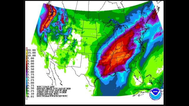
-Saturday: Low pressure will cross through the Central Plains while intensifying. Heavy snow will pound areas from the Central Plains into the Northern Plains and upper Midwest. Some freezing rain is possible in parts of northern Michigan, Minnesota, western Wisconsin and northern Iowa, though that may change to rain from south to north.
Increasing wind may lead to blizzard conditions at times from the eastern Dakotas into western Minnesota.
A few severe thunderstorms are possible from the Southern Plains into the lower Mississippi Valley late Saturday afternoon into Saturday night as a broken line of thunderstorms pushes east across the region. The highest risk of severe thunderstorms exists from northeastern Oklahoma to southwestern Missouri, including Tulsa, Oklahoma and Fort Smith, Arkansas. The primary risks include damaging winds and a couple of tornadoes.
-Sunday into Monday: Snow will linger while winds may actually increase in the Northern Plains, with precipitation eventually changing to snow across much of the upper Mississippi Valley. Areas of lingering light snow and gusty winds may last in parts of the upper Mississippi Valley and Great Lakes Monday and Tuesday.