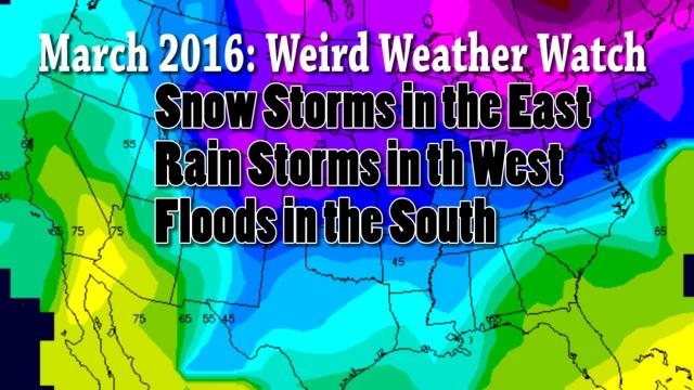
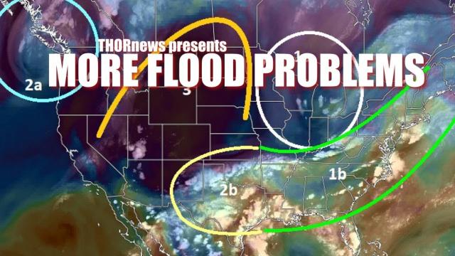
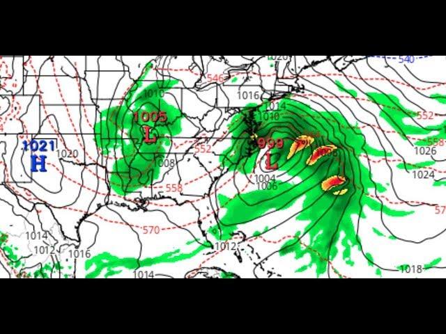
MAJOR flood problems for South East & lots of BIG STORMS in January!
Description
The weather for January looks nasty & mean. Stay Cool.
God bless everyone,
T LEWISON
5430 BIRDWOOD RD. #416
HOUSTON TEXAS 77096
WWW.PAYPAL.ME/THORNEWS www.venmo.com/TEric-Lewison
$THORnews on CashApp
https://www.patreon.com/thornews
check out the crankywxguy blog
http://www.stormhamster.com/entry2/e010320.htm
video from TWC
https://weather.com/forecast/regional/news/2020-01-03-first-storm-2020-rain-snow-east-south
First Eastern Storm of 2020 Will Wring Out More Rain Than Snow Through the Weekend
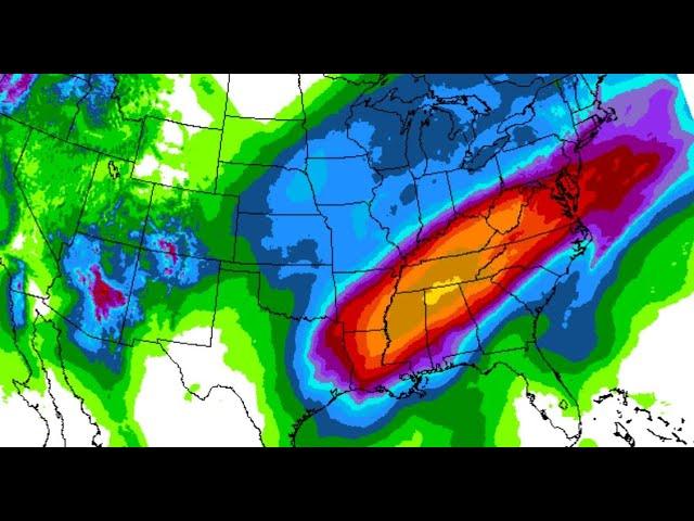
The first Eastern storm of 2020 is likely to produce more rain than snow or ice.
It has already lead to flash flooding in parts of the Deep South.
Rain will spread as far north as southern New England this weekend.
Some snow is expected from the Great Lakes to New York state and northern New England.
The first storm of 2020 to impact the eastern U.S. into this weekend will produce rain in most areas and struggle to wring out modest snow in other areas.
Torrential rain triggered flash flooding in parts of Mississippi Thursday night, particularly in the state capital city.
Over 4 inches of rain flooded streets and parking lots and stranded vehicles in Jackson. Evacuations of first-floor apartments were prompted on the city's west side as floodwater encroached from the apartment's parking lot.
Thursday was Jackson's second wettest January day on record, in which they picked up almost a month's worth of precipitation.
The Holmes Lake Dam, a small dam in southern Hinds County southwest of Jackson, failed Thursday night damaging a barn, several vehicles and a fence, according to local emergency management.
In southwest Mississippi, a flash flood warning was issued for areas near the Robbins Lake Dam in southern Adams County south of Natchez, where video indicated overtopping of the dam was occurring. According to the National Weather Service, water levels were receding late Thursday night in the dam, but additional rain still could still result in a failure of that dam.
In Natchez, Mississippi, at least five mudslides were reported along Martin Luther King Street. Flooding was also reported throughout Lowndes County, in northeast Mississippi, prompting closures of at least three roads.
Forecast Storm Timing
Friday
Widespread rain is expected throughout much of the South and East on Friday, including as far north as central New England and upstate New York.
A small area of light snow will slide from the Northern Plains to the upper Midwest during the day.
Friday night, colder air will wrap into the backside of this storm and allow some snow to develop from the upper Mississippi Valley into the southern Great Lakes and Ohio Valley.
Otherwise, rain will continue in much of the rest of the East.
Saturday
Precipitation should be primarily rain during the day Saturday as far north as southern New England.
Colder air wrapping into the storm should change rain to snow during the day from parts of the Ohio Valley and Appalachians to western, central and upstate New York and northern New England.
Saturday night, rain should diminish along most of the East Coast, while snow may linger in parts of New York state and New England, as well as the Appalachians.
Winds will also increase Saturday into Saturday night as the colder air filters in behind the cold front.
Where snow does fall, totals will be modest, generally less than 6 inches from the upper Midwest and Great Lakes into the Appalachians, New York state and northern New England.
Rainfall totals along the Interstate 95 Northeast corridor should generally be an inch or less. Parts of the Southeast may see another 1 to 2 inches of rain from the Gulf Coast to the Carolinas and Virginia. This could lead to flash flooding in localized areas.
Generally minor to moderate river flooding may persist into next week in parts of the Deep South after the recent heavy rain.
Parts of Idaho, western Montana, Wyoming, western Colorado and northern Utah picked up snow through late on New Year’s Day, including in Salt Lake City where enough snow was expected to issue winter storm warnings. Winter Storm Henry was named due to these warnings. More than a foot of snow fell in the Wasatch, including in Alta, Utah, which picked up 16 inches.
The highest snowfall totals from Henry came from southern Wyoming, to the west of the I-25 corridor. Two to four feet of snow fell from Whiskey Park to Sugar Loaf, Wyoming. Winds gusted to near 60 mph along the I-25 corridor on New Year’s Day.


Comments