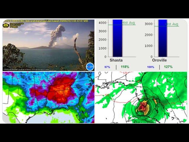
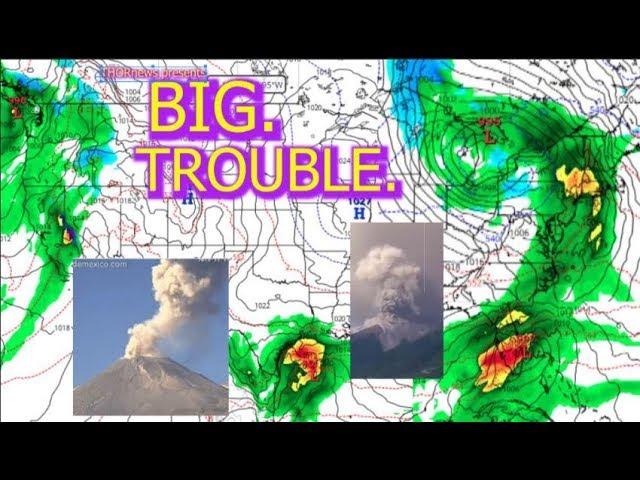
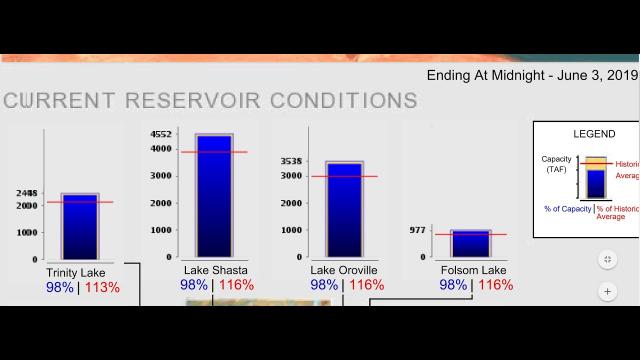
Major Alert! California has 4 dams over 90% & 3 Storms in bound for NW.
Description
2019 is one Cliffhanger after the next.
God bless everyone,
T
THORnews survives and thrives on your prayers,
good thoughts, defense and support
send love, letters and contributions to
5430 Birdwood Rd. #416
Houston, Texas
77096
article on storms
https://www.accuweather.com/en/weather-news/march-like-storm-to-blast-california-with-drenching-rain-mountain-snow-and-severe-weather/70008253
March-like storm to blast California with drenching rain, mountain snow and severe weather
After sunshine and pleasant weather grace California early this week, a powerful storm system will barrel into the state during the middle to latter part of the week.
The return of a March-like weather pattern, driven by a large dip in the jet stream, will be the culprit for driving this rare storm into the West Coast.
Rain will first move into Northern California on Wednesday before overspreading the rest of the state by Wednesday night and Thursday.
By the time the storm moves into the Four Corners region later on Friday, the foothills of the Sierra Nevada and parts of Northern and coastal California will receive between 1 to 3 inches of rain.
The hardest-hit locations may receive as much as 4 or 5 inches of rain.
Between 1 and 2 inches of rain is expected in San Francisco, with 0.50 to 1 inch of rain possible in Los Angeles. San Diego may even receive up to 0.50 of an inch of rain from this system.
Even parts of the San Joaquin Valley will have to deal with showers and thunderstorms from Wednesday night into Thursday that could produce localized heavy downpours and some incidents of small hail.
It is extremely unusual for a storm system to bring this amount of rainfall across the state this late in the spring season.
Average rainfall during the month of May ranges from just under 0.75 of an inch in Sacramento to just under 0.50 of an inch in San Francisco and Fresno. San Diego typically receives around 0.10 of an inch for the month.
These cities, as well as many other locations across the state, will receive two to three times their normal monthly rainfall in the span of only two or three days later this week.
Travel will turn slippery with numerous delays on the roadways after the recent stretch of generally dry weather. Motorists traveling on Interstates 5 and 80, as well as secondary roadways, should allow extra time to reach their destination and reduce speed to lessen the risk of hydroplaning.
Lengthy flight delays and cancellations both into and out of the major hubs along the West coast will also be likely, and some flights may have to be rerouted as gusty winds accompany the rain.
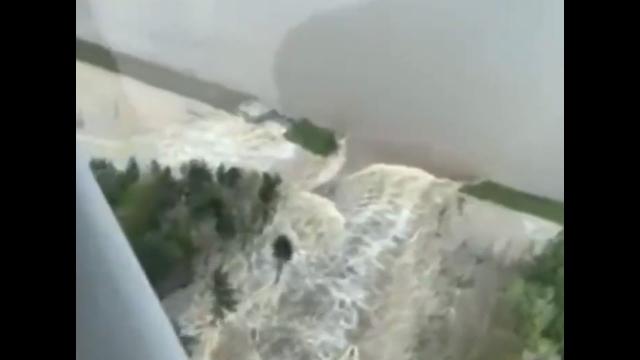
In addition, flash flooding of streets and poor drainage areas, as well as smaller streams and creeks, will be a danger to anybody living in flood-prone areas.
Abnormally chilly air will accompany the clouds and rain later this week, with high temperatures struggling to reach the middle 60s F across the Central Valley on Thursday. Normal highs during the middle of May are in the 80s.
Showers may even reach Death Valley on Thursday and keep high temperatures only in the upper 70s after they soar above the century mark early this week.
Snow levels are forecast to drop as low as 6,000-7,000 feet in the Sierra Nevada by Thursday and Thursday night, and up to a foot of snow is possible at the highest elevations.
Motorists traveling across I-80’s Donner Pass may even have to deal with snow on the roadway for a brief time if snowfall rates become high enough.
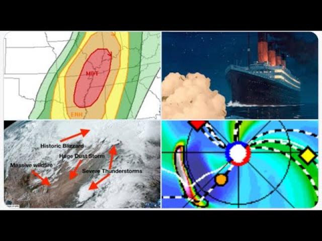
In addition to drenching rain and mountain snow, there is the potential for a few heavy, gusty and perhaps locally severe thunderstorms to be spawned, according to AccuWeather Senior Meteorologist Alex Sosnowski.
The greatest impact from the storms will be for hail and strong wind gusts. However, on occasion, severe thunderstorms can produce brief tornadoes and waterspouts.
"The potential for severe thunderstorms will extend well inland beyond California as the storm moves along to portions of Nevada, Arizona and Utah at the end of the week," Sosnowski said.


Comments