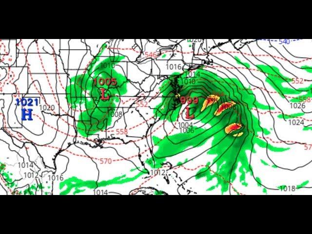
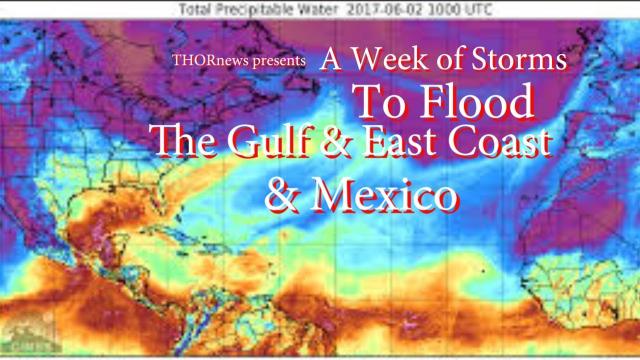
BIG Flood Problems for East Coast through Wednesday & more Rain for Texas
Description
the cranky blog
http://www.stormhamster.com/entry/e081118b.htm
it's going to get wild y'all.
stay cool.
God bless everyone,
T
https://www.paypal.me/THORnews
Tshirts
https://hitthebuttonbaby.com/
THORNEWS
PO BOX 35946
HOUSTON TEXAS
77235-5946
the crankywxguy blog
http://www.stormhamster.com/entry/e073118.htm
the wave master
https://dabuh.com/
https://www.accuweather.com/en/weather-news/risk-of-flooding-downpours-to-return-to-northeastern-us-this-weekend-early-next-week/70005743
Risk of flooding downpours to return to northeastern US this weekend, early next week
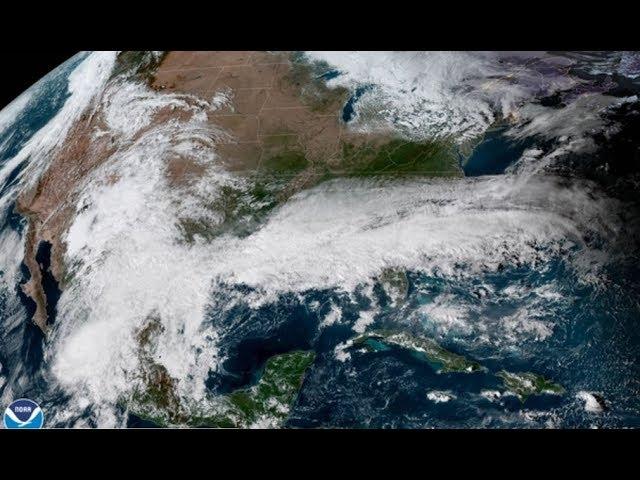
Drenching showers and thunderstorms will bring the risk of flash flooding to the central Appalachians and parts of the mid-Atlantic into early next week, while the heaviest rain may focus on parts of New England.
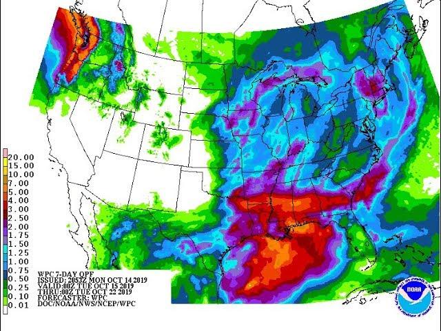
Have the umbrellas and raincoats handy again. There is the potential for the wettest swath in the Northeast to receive 5 inches of rain with locally higher amounts before the pattern breaks up.
Whether 5 inches of rain falls in as many days or an inch of rain falls in an hour, enough rain is expected to fall to lead to rising streams and possible urban and small stream flooding.
Repeating storms wasted no time in hammering parts of Ohio and southwestern Pennsylvania. More than 3 inches of rain fell on some of the suburbs of Pittsburgh in several hours on Friday afternoon.
"The greatest risk of flash flooding will be during, but not limited to, the daytime and early evening hours," according to AccuWeather Lead Long-Range Meteorologist Paul Pastelok.
For the latest on the location of downpours and the risk of flooding in your area, download the free AccuWeather app.
The rain may lead to delays and cancellations of some sporting events and could make moving into a new home, apartment or dorm quite difficult.
The swath of heaviest rain is likely to extend from parts of eastern Pennsylvania and New Jersey to southeastern New York state, including much of the Hudson Valley, and southern and southeastern New England.
A second pocket of heavy rainfall may extend from southeastern Virginia to the coastal areas of the Carolinas by early next week.
The setup is likely to have more success at bringing downpours to the mid-Atlantic and southern New England beaches when compared to July. People heading to the beach for a last summer getaway before school starts may have to dodge some showers.
Areas most likely to escape the most persistent rainfall are from central and northern Maine to northern New York state and Michigan as well as portions of southern West Virginia, southwestern Virginia and the western portions of the Carolinas.
However, most locations in the Northeast, even those outside of the most persistent rainfall, will still run the risk of a downpour that could lead to isolated urban flooding.
A number of locations experienced their wettest July on record in the mid-Atlantic states including Harrisburg, State College and Williamsport, Pennsylvania; Baltimore and Washington, D.C.


Comments