Alert! Monster Storms & Monster Floods for USA & Texas in May
Description
It's going to be another epic Mayday May.
God bless everyone,
T
THORnews survives and thrives on your prayers,
good thoughts, defense and support
send love, letters and contributions to
5430 Birdwood Rd.
Houston, Texas
77096
crankywxguy blog
http://www.stormhamster.com/entry2/e042919c.htm
video on today's situation
https://weather.com/storms/severe/news/2019-04-26-severe-thunderstorms-heavy-rain-flooding-tornadoes-hail-wind-plains
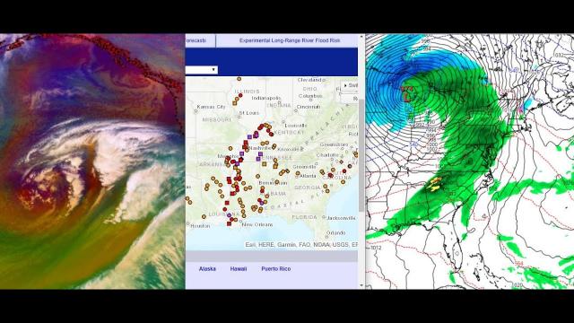
Rounds of Severe Thunderstorms and Flooding Rain Expected in the Central and Southern Plains This Week
Severe thunderstorms are expected in parts of the Plains each day through at least Wednesday.
Hail, damaging winds and tornadoes are possible.
Rounds of soaking rain may result in flooding, as the ground is already saturated in many areas.
Severe thunderstorms will flare up in parts of the Plains states through midweek with hail, high winds, tornadoes and flooding rainfall.
Showers and thunderstorms will persist in parts of the Plains through Tuesday morning and strong winds and an isolated brief tornado cannot be ruled out.
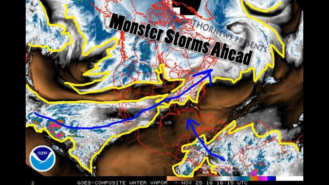
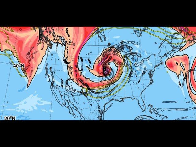
The setup this week will feature a southward dip in the jet stream, or trough, over the West and an area of high pressure, or upper-level ridge, over the Southeast. A frontal system is expected between the trough and ridge.
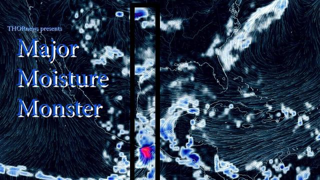
Upper-level winds are expected to be strong, and plenty of moisture will surge northward out of the Gulf of Mexico into portions of the south-central states.
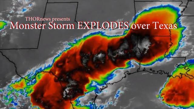
As a result, numerous thunderstorms will develop, and some of them could pack damaging winds, large hail, tornadoes and torrential rainfall.
Tuesday
The upper-level trough will begin to shift into the Plains Tuesday and will encounter moisture and instability, which will likely result in the chance for numerous severe thunderstorms.
The chance for severe storms looks highest from south-central Oklahoma into southeastern Kansas, southwestern Missouri and far northwestern Arkansas. There is the potential for very large hail, damaging wind gusts and tornadoes.
There could be multiple rounds of thunderstorms in this zone, first in the morning, then again in the afternoon, evening and overnight hours.
Heavy rain could also trigger flash flooding from far northern Texas to as far north as Lower Michigan. NOAA's Weather Prediction Center has issued a moderate risk of flash flooding in parts of eastern Oklahoma, far southeastern Kansas, southwestern Missouri and northwestern Arkansas.
On Wednesday, scattered strong to severe storms are possible from parts of Texas into the Ohio Valley, with hail and damaging winds being the primary threats, although an isolated tornado cannot be ruled out.
Once again, there could be both afternoon and evening storms and thunderstorm clusters that persist through the overnight in some areas.
Heavy rainfall could lead to flooding on Wednesday, mainly from northern Texas into southeastern Oklahoma and western Arkansas.
Flood Threat
As mentioned earlier, flash flooding will also be a significant concern in the Plains and Midwest this week.
A widespread area of 1 to 3 inches of rainfall is expected from parts of Texas into Michigan. Some areas will see locally higher amounts topping 3 inches, especially where overnight thunderstorm clusters occur.
This additional rainfall will increase the chance for flooding this week, especially in areas that receive heavy rainfall in a short period of time.
The National Weather Service has issued flood watches for parts of the Plains and mid-Mississippi Valley.
River flooding concerns may also increase late this week, as many river gauges along the Mississippi River and in the Midwest are already in at least minor flood stage.
The ground is saturated in many locations in this region. Oklahoma City has received more than 4.5 inches of rain in April, and Dallas/Fort Worth has picked up 6.74 inches so far this month, almost 4 inches above average.
Storm Reports So Far
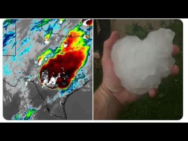
A line of severe storms roared through parts of Kansas overnight Sunday, producing hail up to baseball-size and damaging winds.
Up to 20 power poles were downed by high winds at the Eureka, Kansas, airport, and a semi was blown off U.S. Highway 169 near Greeley, Kansas, injuring the driver.


Comments