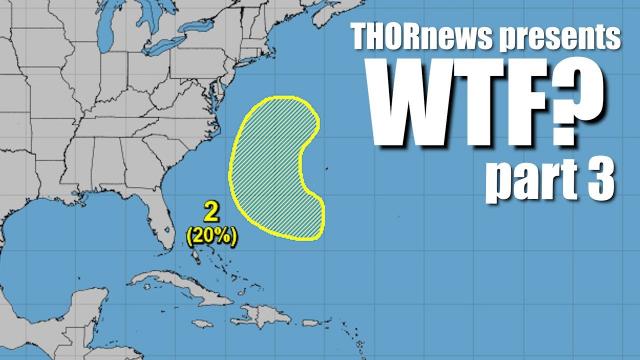
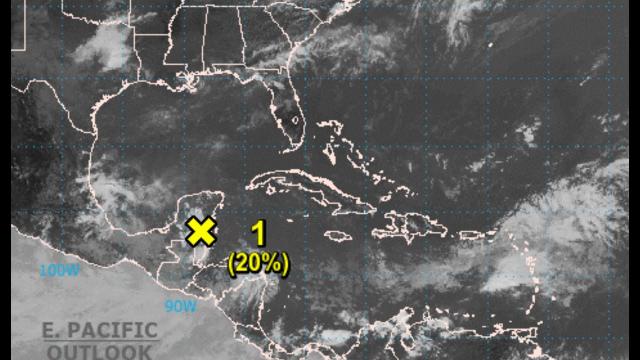
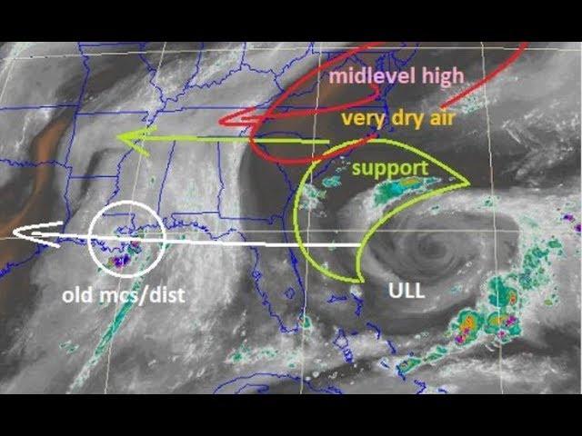
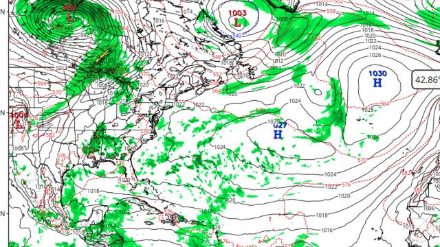
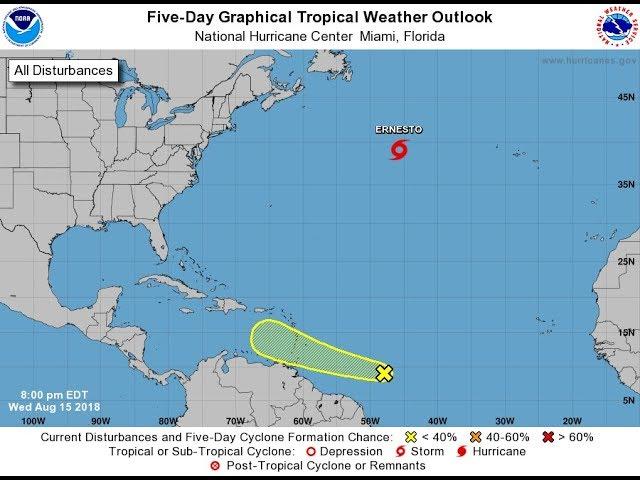
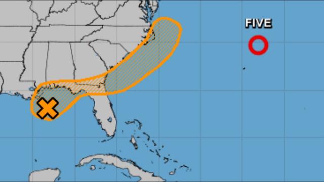
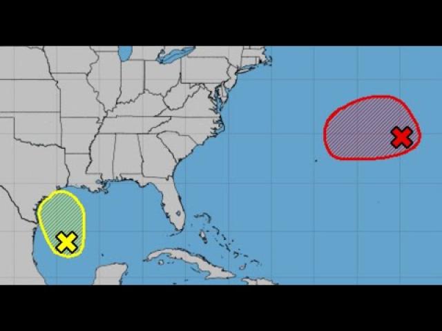
ALERT! 2 Atlantic Systems! 50% & 20% chance of Tropical Development!!!!
Description
Thank you! Y'all are incredible! Awesome! Fantastic!
Astonishers & Asteroid Fight Club RULE!
50% development over next 5 days.system 1
20% development over next 2 days system 2
God bless everyone,
T
https://www.paypal.me/THORnews
Tshirts
https://hitthebuttonbaby.com/
THORNEWS
PO BOX 35946
HOUSTON TEXAS
77235-5946
Follow on twitter
@DaDabuh
@crankywxguy
@newthor
the Dadabuh blog
http://DaBuh.com
the crankywxguy blog
http://www.stormhamster.com/entry/e070218.htm
article on weather
https://www.accuweather.com/en/weather-news/storms-to-rattle-drench-north-central-us-into-midweek/70005378
Drenching storms to rattle north-central US into midweek
Strong to locally severe thunderstorms are forecast to erupt on the rim of a large swath of hot and humid air over the northern Plains and the Upper Midwest this week.
People venturing outdoors should keep an eye out for rapidly changing weather conditions, especially during the afternoon and evening hours.
On Monday evening, storms were widely separated and extended from northern and central Minnesota to west-central Nebraska.
Into Tuesday night, strong to severe storms will occur on a more concentrated basis.
The main threat area during Tuesday night will extend from northern Minnesota to western Nebraska.
Gusts to 70 mph cannot be ruled out in the strongest storms. The risk of flash flooding will accompany the storms as well.
On Wednesday afternoon and night, the severe weather threat is likely to continue to escalate.
As a storm moves across the northern Plains, it is forecast to produce a large swath of powerful thunderstorms.
"The storms, which may last into the overnight hours, may bring damaging winds, large hail and localized urban flooding," according to AccuWeather Storm Warning Meteorologist Richard Schraeger.
"The tornado threat is low, but a few isolated spin-ups cannot be ruled out."
The threat of severe weather on Wednesday is expected to extend from northeastern Minnesota, northwestern Wisconsin and part of the Upper Peninsula of Michigan to Nebraska and northeastern Colorado.
Major cities that may be affected by the storms include Omaha, Nebraska; Sioux Falls, South Dakota; Sioux City, Iowa; Minneapolis and Eau Claire, Wisconsin.
Some parts of the Upper Midwest at risk for storms this week have been hit hard by flooding over the last two weeks.
By Thursday and Friday, much cooler air will plunge southward from Canada with the main focus from the upper Mississippi Valley on east.
Storms are forecast to erupt along the leading edge of this press of cooler and less humid air.
While rain is needed in parts of the Plains and Midwest, any persistent downpours will aggravate the flooding situation in parts of Iowa, southern Missouri, northwestern Illinois and northern Missouri.


Comments